

Reviewed September 2026 against USDA Economic Research Service, PS Market Research, and Frontiers in Agronomy.
Try it: Run your own numbers →
Precision Agriculture UAV: What the Data Actually Shows
A precision agriculture UAV is a drone carrying GNSS positioning plus a sensor payload — multispectral, thermal, or LiDAR — that turns a flight over a field into a georeferenced map accurate to centimeters rather than meters. In the United States, 27% of farms reported using some form of precision agriculture practice in 2023, and among large-scale crop farms, 70% used guidance autosteering, 68% used yield monitors and soil maps, and 45% used variable rate technology, according to USDA’s Economic Research Service (ERS) chart of note, published 2023 and cited below. UAVs are the data-collection layer underneath most of that adoption curve: they generate the imagery that feeds guidance systems, yield maps, and variable-rate prescriptions.
This article covers what a UAV actually does in a precision agriculture operation, how PPK (Post-Processed Kinematic) positioning differs from RTK, what the US and UAE markets currently spend on this technology, and where to verify updated figures yourself as adoption data refreshes. It also covers UAV applications in agriculture more broadly and where drones sit inside agriculture’s ongoing mechanization and data revolution — the same historical arc that took farming from horse-drawn plows to autosteered tractors to sensor-driven fields.

What Is a PPK UAV and Why It Matters for Precision Agriculture
A PPK UAV (Post-Processed Kinematic UAV) records raw GNSS satellite data during flight and corrects it afterward against a stationary base station, producing centimeter-level positional accuracy without needing a live radio or cellular link during the flight itself. This is the key operational difference from RTK (Real-Time Kinematic) systems, which correct position in real time but depend on an uninterrupted correction signal — a liability on large farms, in hilly terrain, or in regions with patchy rural connectivity across the US Midwest, UAE desert interior, or Gulf coastal zones.
- ✔ Primary Focus: Accurate mapping, monitoring, and analysis across agriculture, forestry, and related geospatial work.
- 📊 Data Insight: Precise geotagged imagery supports crop health, soil assessment, irrigation planning, and forest management decisions.
- ⚠ Risk: Without PPK or RTK correction, consumer-grade drone GPS carries 1-3 meter error — enough to misplace a prescription-map zone boundary by a full crop row.
Key Features of PPK UAV Technology
- GNSS Data Recording: Captures raw spatial data for post-processed accuracy.
- Sensor Payloads: Integrates multispectral, hyperspectral, LiDAR, or thermal cameras for comprehensive data collection.
- Advanced Positioning: Achieves centimeter-level accuracy, outperforming uncorrected consumer drone surveys.
- Signal Independence: Functions reliably without a stable live satellite correction link during flight.
- Efficient Operations: Reduces time and labor in data acquisition across large farms and forest tracts.
PPK overcomes the main weakness of live-correction methods: signal dependency. That makes it the more reliable choice for large-acreage US row-crop operations and for UAE farms operating away from dense cellular infrastructure.

Precision Agriculture UAV Adoption: The Numbers
Market sizing gives a clearer read on where UAV-based precision agriculture stands than adoption surveys alone, because it captures actual spend rather than stated practice. In the United States, the precision agriculture technologies market — the category that includes UAV mapping, guidance systems, and variable-rate hardware — was valued at $2.1 billion in 2024 and is projected to reach $4.3 billion by 2032, per PS Market Research, a compound growth path driven largely by large-scale row-crop operations replacing manual scouting with sensor-based field data.
In the UAE, the agriculture drones market specifically — a narrower category than the broader precision-ag market above — was valued at $41.2 million in 2025 and is projected to reach $147.4 million by 2032, also per PS Market Research. That represents roughly 3.5x growth over seven years, reflecting UAE federal and emirate-level investment in desert and greenhouse agriculture technology as part of national food-security strategy. Globally, industry analysts place the agriculture drones market between $3.9 billion and $6.23 billion for 2026, with the range reflecting differing methodologies across market-research firms on what counts as “agriculture drone” spend (hardware only vs. hardware plus software and services), per The Business Research Company.
On the yield side, a 2025 systematic review published in Frontiers in Agronomy found that variable rate technology applications combining UAV-derived field data with prescription mapping produced yield increases of up to 62% alongside fertilizer input reductions of up to 60% in the studies analyzed — though these are outer-bound figures from a range of trial conditions, not a single universal result, and the review notes results vary by crop, soil type, and baseline management intensity. For a farm-level dollar figure — net ROI per acre from adopting UAV-based precision agriculture in the US corn or soybean belt — no consolidated USDA or peer-reviewed dataset currently publishes that number; the yield-percentage and input-reduction figures above are the closest verified proxy. To build your own per-acre ROI estimate, multiply the fertilizer reduction percentage against your actual input spend and the yield increase against your local crop price, using your own farm’s baseline costs rather than a borrowed average.
How PPK UAVs Work: The Survey Workflow
Understanding the operational workflow explains why PPK UAV data is trustworthy enough to drive variable-rate decisions, rather than just producing a pretty aerial photo.
Step-by-Step Breakdown:
-
Pre-Flight Planning:
Mission parameters are set — flight altitude, speed, grid pattern, and sensor payload (LiDAR, multispectral, thermal). A base GNSS station is set up on or near the field for later corrections; physical ground control points are optional with PPK, unlike with uncorrected surveys. -
Data Collection in Flight:
The UAV performs an autonomous or semi-autonomous flight over the target area, capturing:- Raw GNSS logs for each image or scan point.
- Aerial imagery (visible, multispectral, hyperspectral).
- Point clouds and 3D models if equipped with LiDAR.
- Thermal data for soil moisture and crop stress mapping.
-
Post-Processing (The “PPK” Step):
After the flight, the UAV’s onboard GNSS log is combined with base station reference data in specialized software, producing centimeter-level georeferenced outputs — orthophotos, digital elevation models (DEMs), and vector layers with exact coordinates. -
Analysis & Application:
The processed data feeds crop health monitoring, soil assessment, irrigation planning, forest biomass estimation, and pest outbreak detection.
- Common Mistake: Failing to synchronize UAV and base station clocks causes georeferencing errors even with PPK enabled. Verify time sync at setup, every flight.
UAV Precision Agriculture Benefits in the Field
Precision agriculture UAV deployment matters most where labor, water, and input costs are rising faster than commodity prices — a pressure point for row-crop operations across the US Corn Belt and for water-constrained farms in the UAE and wider Gulf region. Here is what the data supports:
Key Benefits for Modern Agriculture:
- ✔ Targeted Input Application: UAV-derived field maps support variable rate technology, which the Frontiers in Agronomy 2025 review associated with yield increases up to 62% and fertilizer reductions up to 60% in the trials studied.
- ✔ Early Stress Detection: Multispectral and hyperspectral cameras detect crop stress from disease, nutrient deficiency, or pest pressure before visible symptoms appear.
- ✔ Soil Moisture Mapping: Thermal sensors combined with spatial data reveal soil moisture patterns in detail, supporting targeted irrigation scheduling.
- ✔ Lower Survey Overhead: Shorter survey times and fewer field personnel reduce per-acre monitoring cost relative to manual scouting.
- ✔ Reduced Chemical Drift: Precisely targeted input application lowers off-target chemical drift, a growing regulatory consideration under EPA and state-level spray-drift rules in the US.

Modern UAVs in agriculture are routinely equipped with multispectral, hyperspectral, and LiDAR sensors. Combined with AI analytics, these payloads enable:
- 🚀 Growth-stage tracking from planting to harvest.
- 🌾 Biomass estimation and planting-density optimization.
- 🦠 Disease and pest outbreak mapping, ahead of visible field symptoms.
- 🚰 Water resource management during drought or irregular rainfall — a direct application for water-scarce UAE agriculture.
- 🗺️ Digital elevation models (DEMs) and orthomosaics for field planning and yield estimation.
Crop Health Monitoring
Multispectral imagery for real-time stress and anomaly detection.
Field Mapping
Geotagged orthomosaics for precision management and machine navigation.
Irrigation Planning
High-resolution thermal data supports data-driven water scheduling.



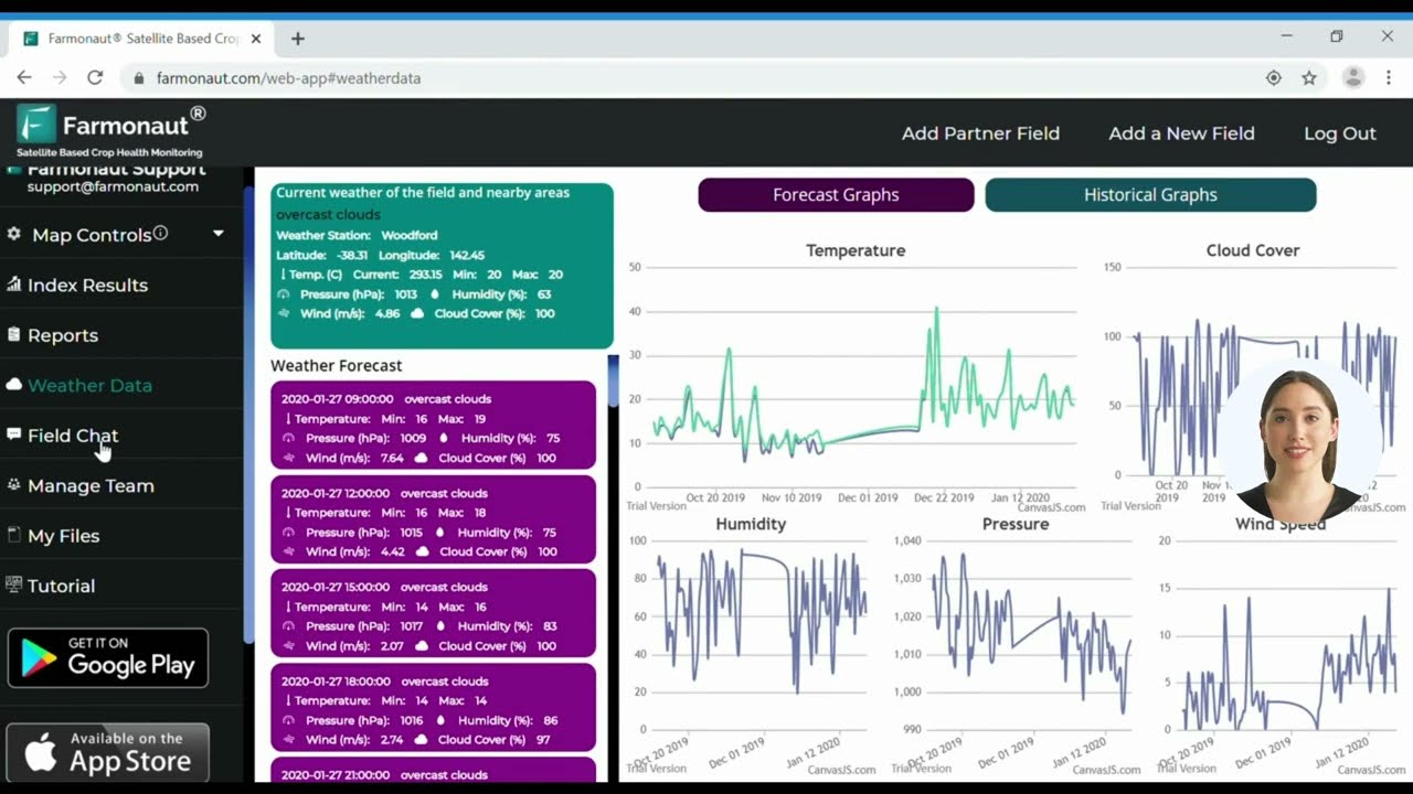
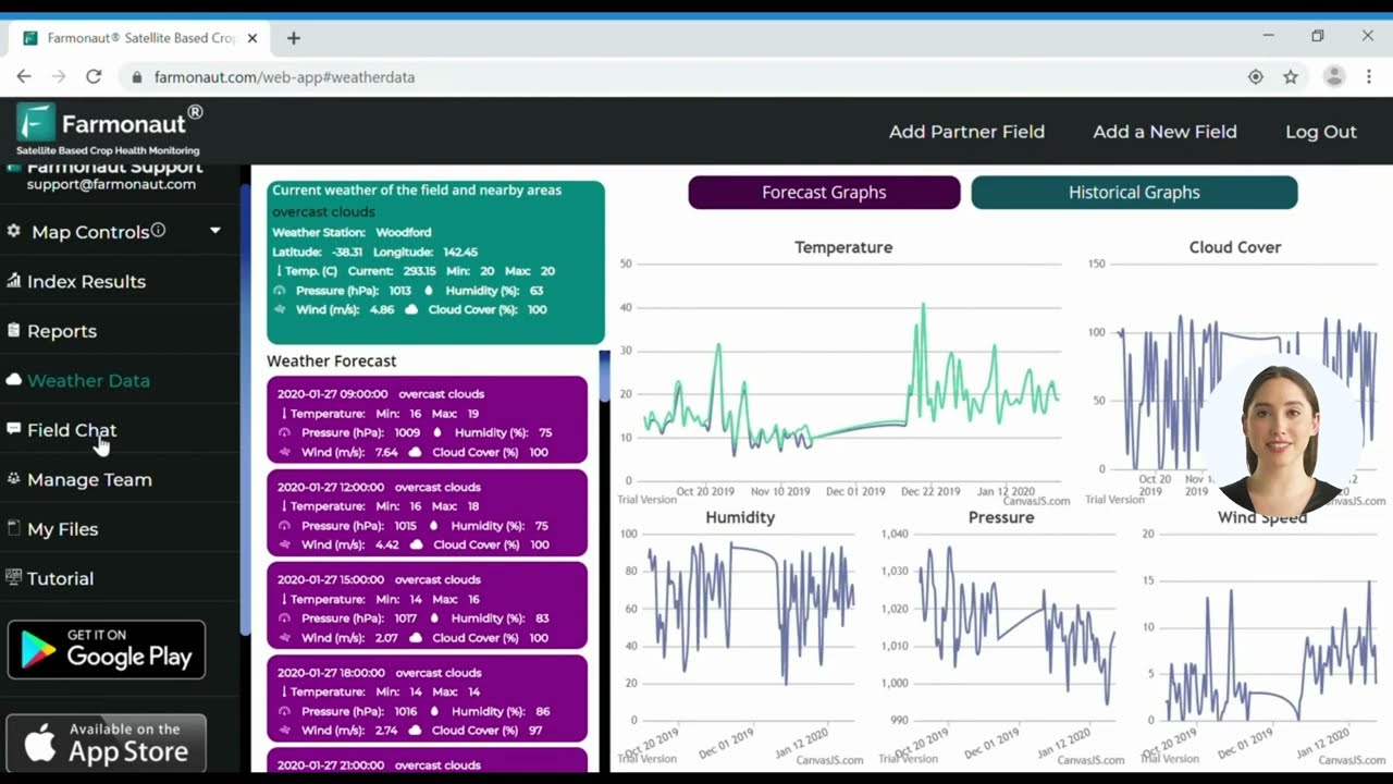
Feed UAV data directly into an AI-based management platform such as the Farmonaut satellite dashboard for near real-time field analytics alongside your drone survey data.
UAV Applications in Agriculture: A Practical Breakdown
Beyond mapping, UAV applications in agriculture span the full production cycle. The application of UAVs in agriculture generally falls into five categories, each drawing on a different sensor or flight pattern:
| Application | Sensor / Method | Primary Use |
|---|---|---|
| Field mapping & boundary survey | RGB camera + PPK GNSS | Orthomosaics, DEMs, legal boundary records |
| Crop health scouting | Multispectral / hyperspectral | NDVI stress mapping, disease detection |
| Variable rate prescription | Multispectral + AI analytics | Fertilizer, pesticide, water zoning |
| Livestock and herd monitoring | RGB / thermal | Headcount, location, heat-stress detection |
| Spray and seed application | Payload-carrying agricultural drones | Targeted spraying, aerial seeding on steep or wet ground |
On that last row: commercial UAV-based spraying is growing but not yet separately quantified in the market data cited in this article — the $2.1 billion US precision agriculture figure and the $41.2 million UAE agriculture drones figure both bundle mapping, guidance, and application hardware together rather than breaking out spray-drone volume specifically. If you need spray-drone-specific figures, check the FAA’s Part 137 agricultural aircraft operator registrations for US operators, which distinguishes UAV from manned-aircraft applicators.
Forestry & Environmental Applications
Forestry operations in the US, UK, and EU face mounting pressure from wildfire risk, invasive species, and sustainable-yield reporting requirements. PPK-equipped UAVs support this work directly:
- ✔ Forest Inventory: LiDAR-enabled PPK UAVs produce 3D models of tree density, canopy structure, and timber volume.
- ✔ Wildfire Risk Assessment: High-resolution thermal imagery and elevation models reveal fuel loads and dry zones for early-warning fire risk mapping — relevant to USGS and US Forest Service fuel-load monitoring programs.
- ✔ Change Detection: Repeatable flight paths enable temporal mapping — tracking regeneration, reforestation progress, and storm or fire damage over time.
- ✔ Pest & Disease Monitoring: Early detection of outbreak zones or tree mortality supports targeted, faster response.
- ✔ Resource Planning: Accurate geospatial data underpins sustainable logging plans and restoration-zone identification.

For organizations, smallholders, and conservation managers, UAV deployment is lowering the barrier to spatial intelligence that was previously limited to well-funded agencies and large corporations.
- Farmonaut offers advanced carbon footprinting solutions tailored for agriculture and forestry, supporting businesses that need to monitor and reduce environmental impact while maintaining productivity.
PPK UAV Payloads: Multispectral, LiDAR & Thermal
The practical value of a precision agriculture UAV comes from its payload. The four sensor types in common use:
- Multispectral Cameras:
Capture bands beyond visible light — NDVI (Normalized Difference Vegetation Index), GNDVI, and others — for plant health mapping, stress detection, and growth-stage assessment. - Hyperspectral Imagers:
Use narrow, contiguous bands to identify subtle nutrient deficiencies, disease signatures, and soil composition variation. - LiDAR Sensors:
Produce 3D point clouds for canopy structure, terrain modeling, and biomass estimation — used in both precision farming and forest density assessment. - Thermal Cameras:
Monitor soil moisture, water stress, and irrigation efficiency, and detect early pest or disease outbreaks via temperature anomalies.
Combined with high-precision GNSS logging and post-processing, these sensors deliver:
- ✔ Accurate field boundaries and management zones.
- ✔ Detailed maps for variable rate application.
- ✔ Terrain correction for automated equipment or autonomous vehicles on uneven ground.

Using only RGB cameras limits actionable insight. Pair multispectral, LiDAR, or thermal sensors with PPK positioning for full agronomic and environmental value.
Real-World Scenarios: UAVs in Action
- Corn and soybean nitrogen mapping (US Midwest): Multispectral UAV passes identify in-field nitrogen variability, letting operators apply variable-rate nitrogen instead of a flat field-wide rate — directly reflected in the 45% VRT adoption rate USDA ERS reports among large-scale US crop farms.
- Date palm and greenhouse monitoring (UAE): Thermal and multispectral UAV surveys support water-stress detection in a market projected to grow from $41.2 million to $147.4 million by 2032 (PS Market Research); crop-specific yield data for date palm or greenhouse operations is not yet published in consolidated form — check the UAE Ministry of Climate Change and Environment’s periodic agricultural technology sector reports, typically released in the second quarter of each year, for the most current figures.
- Forest restoration (US and EU): LiDAR-equipped UAVs monitor canopy health after wildfire events, directing reforestation and recovery efforts to the areas that need it most.
Forest Inventory & Modeling
Wildfire Risk Mapping
Pest & Disease Outbreaks
PPK UAV vs. Traditional Survey Methods
| Application Area | Traditional Methods | PPK UAV | Key Benefit |
|---|---|---|---|
| Field & Forest Mapping | Accuracy: ±5 m Time per 100 ha: ~8 hrs Manual surveying, satellite maps |
Accuracy: ±2 cm Time per 100 ha: ~1 hr Automated, PPK-corrected data |
Large precision gain, faster turnaround, maps refreshed on demand |
| Crop Health Monitoring | Coarse NDVI, visual checks, seasonal manual inspection | Real-time multispectral/hyperspectral, temporal analysis, early alerts | Earlier detection, data-driven treatment |
| Forest Inventory & Density | Manual plots, ±10-20% error, multi-week survey | LiDAR 3D models, ±2% estimation error, 1 day | Higher accuracy, faster turnaround |
| Irrigation & Soil Moisture Monitoring | Field probes, limited temporal coverage, risky extrapolation | Thermal & PPK imagery, spatially resolved, repeatable | Better water management, drought resilience |
| Pest/Disease Outbreak Detection | Random inspections, delayed response, often after visible symptoms | Spectral/pattern recognition, actionable at early invisible stages | Proactive protection, lower intervention cost |
Where UAVs Fit in Agriculture’s Industrial Revolution
Agriculture has gone through several distinct mechanization waves: mechanized tillage and harvesting in the late 19th and early 20th centuries, synthetic fertilizer and the mid-20th-century Green Revolution’s yield gains, and now a data-driven wave built on GPS guidance, remote sensing, and UAVs. The current phase is sometimes framed as agriculture’s fourth industrial revolution — the point where field data collection and application became automatable rather than purely manual. USDA ERS’s 2023 data on adoption (27% of US farms using precision agriculture practices generally, and 70% of large-scale farms using autosteering guidance specifically) marks a measurable point in that curve rather than its endpoint: adoption is concentrated among larger operations, meaning the shift is still working its way through mid-size and smaller farms.
UAVs specifically fill a gap that satellite remote sensing and ground-based sensors don’t: satellite imagery updates on a fixed revisit cycle and can be blocked by cloud cover, while ground sensors only measure single points. A UAV flight is on-demand and covers a whole field at sub-inch resolution, which is why it has become the connective layer between satellite-scale monitoring and machine-level variable-rate application.
AI Integration and What Comes Next
AI integration with UAV-collected geospatial data is changing how farmers, foresters, and land managers operate day to day. Autonomous flight planning, on-site analytics, and near real-time advisories are increasingly accessible to operators without a remote-sensing background.
- 🚀 Autonomous Missions: Preprogrammed UAV flights requiring minimal pilot intervention, with AI-driven route planning based on field shape, slope, and crop variability.
- 🔍 Rapid Data Processing: Cloud platforms convert geotagged imagery into actionable insight for variable rate applications or targeted forest interventions.
- 🌐 Seamless Integration: APIs such as the Farmonaut Satellite Data API allow direct ingestion of remote sensing and UAV data into farm management systems.
- 💡 AI-Driven Recommendations: From irrigation scheduling to early pest alerting, AI surfaces trends and anomalies that are hard to catch by eye.
- 📈 Scalable Analytics: Compare multiple years of imagery, track ongoing projects, and generate reports for compliance, sustainability audits, or insurance claims.
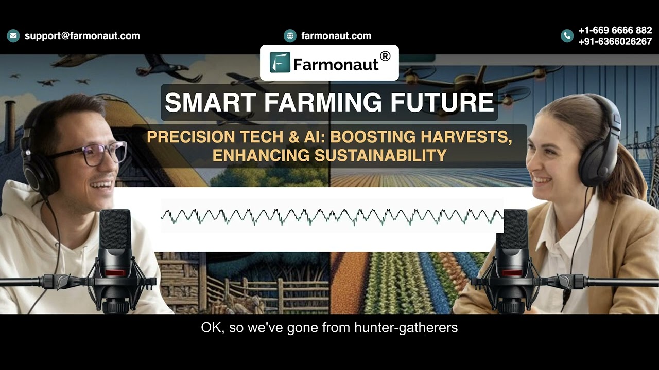
Farmonaut: Satellite + UAV Data in One Platform
Farmonaut supports stakeholders in agriculture, forestry, mining, and infrastructure with satellite-based technology alongside UAV data ingestion. Our web app, mobile apps, and API integrations are built for precision, accessibility, and affordability.
- Satellite-Based Monitoring:
Real-time multispectral imagery provides NDVI, soil condition data, and vegetation health insight. - Jeevn AI Advisory System:
Delivers data-driven recommendations for crop management, weather risk, and operational strategy. - Blockchain Traceability:
Supports transparency across agricultural and forestry supply chains. Learn more about blockchain traceability for produce certification. - Environmental Impact Monitoring:
Supports regulatory compliance and sustainable practices with automated carbon footprinting tools. - Fleet & Resource Management:
Optimize large-scale logistics, equipment deployment, and harvest operations. See our Fleet Management product. - Crop Loan and Insurance:
Reduce fraud and speed up claim processing with satellite-based verification for financing. - Large Scale Farm Management:
Our Large Scale Farm Management platform supports multi-farm operations. - Crop Plantation & Forest Advisory:
Streamline planning, reforestation, and monitoring in one place. Explore Farmonaut’s advisory tools.

Calculator: Estimate Your UAV Survey Cost per Acre
Use your own field size, flight speed, and coverage width to estimate flight time and per-acre survey cost — plug in your equipment’s real specs rather than a generic estimate.
Run your own numbers
Assumptions: constant flight speed with no turn-time or battery-swap overhead added; swath width should reflect your sensor’s real ground coverage at your planned altitude, not the drone’s maximum range. Excludes post-processing time, base-station rental, and data-storage costs. Use it as a first-pass planning estimate, not a quote.
Deployment Checklist & Common Mistakes
Set up your GNSS base station log as close as possible to your field or forest project. The closer and more representative the base/reference environment, the more accurate your post-processed results.
US precision agriculture technology spend is projected to roughly double from $2.1 billion (2024) to $4.3 billion by 2032, per PS Market Research — a compound growth rate that makes UAV data collection a fixed cost worth planning into a multi-year equipment budget rather than a one-off purchase.
Combining UAV data with an AI analysis platform, such as Farmonaut’s, enables proactive alerts — from early pest-pressure signals to forecasted irrigation deficits — instead of reactive, after-the-fact field checks.
Uploading imagery with poorly maintained timestamps or missing raw GNSS logs undermines PPK correction entirely. Verify log integrity before and after every flight.
Frequent, accurate UAV monitoring is foundational for carbon accounting and biodiversity tracking in managed landscapes — increasingly relevant as US and EU carbon-market reporting requirements tighten.
FAQ: Precision Agriculture UAV
What is the main advantage of a PPK UAV over a standard consumer drone in agriculture?
Centimeter-level positional accuracy without requiring a live ground control point network or constant satellite correction link. That precision ensures crop health maps, soil zones, and field boundaries are exact — improving every downstream variable-rate decision.
How widely is precision agriculture UAV technology actually adopted in the US?
USDA ERS reported 27% of US farms using some precision agriculture practice in 2023, with adoption concentrated among large-scale operations: 70% used autosteering guidance, 68% used yield monitors and soil maps, and 45% used variable rate technology that year. Check the USDA ERS chart of note directly for the current release, since this data is updated periodically.
Can small and mid-size farms afford UAV-based precision agriculture?
Adoption is currently concentrated in large-scale operations per USDA ERS 2023 data, but falling hardware costs and lower per-acre survey costs (see the calculator above) are narrowing that gap. Community co-op ownership and contracted UAV survey services are two ways smaller operations access this data without buying the hardware outright.
How much can UAV-driven variable rate technology actually improve yield?
A 2025 systematic review in Frontiers in Agronomy found yield increases up to 62% alongside fertilizer reductions up to 60% in the trials analyzed. These are outer-bound results from a range of trial conditions, not a guaranteed outcome — actual results depend on crop, soil, and starting management intensity. Read the full review for methodology and per-study breakdowns.
How does the UAE agriculture drone market compare to the US market?
The UAE agriculture drones market was valued at $41.2 million in 2025, projected to reach $147.4 million by 2032 — a narrower category than the $2.1 billion (2024) US precision agriculture technologies market, which includes guidance and variable-rate hardware beyond drones alone. Both figures come from PS Market Research.
How frequently should UAV flights be conducted over a field?
Bi-weekly to monthly flights during the growing season work for most row crops. Forest and restoration projects benefit from quarterly or post-event (fire, storm) surveys. Repeat flights are what make trend detection — not just single-point snapshots — possible.
What other sectors use PPK UAV technology besides agriculture and forestry?
Mining, infrastructure, and environmental monitoring use PPK UAVs for volumetric analysis, change detection, and compliance reporting. Farmonaut supports satellite and AI-powered monitoring across these sectors as well.







Conclusion: How to Verify These Numbers Yourself
Precision agriculture UAV adoption is measurable, growing, and increasingly documented by government and market-research sources rather than anecdote. The durable takeaway is not any single figure in this article — it’s the method for checking whether it still holds. USDA ERS republishes farm technology adoption charts periodically; PS Market Research updates its US and UAE market-size reports on its own release cycle; and the Frontiers in Agronomy review can be cross-checked against newer systematic reviews as they publish. Before acting on any number here, pull the current version from the source link rather than assuming last year’s figure still applies.
- ✔ Verify before you plan: Adoption and market-size figures update annually or on a multi-year cycle — check the source link, not just this page, before budgeting.
- ✔ Match sensor to purpose: Multispectral for crop stress, LiDAR for structure and volume, thermal for moisture — don’t default to RGB-only.
- ✔ PPK over RTK for large or remote acreage: Signal independence matters more than live correction convenience once you’re covering hundreds of acres.
- ✔ Use the calculator above with your own equipment specs — a borrowed per-acre cost figure from another operation’s swath width and speed will mislead your budget.
Ready to combine UAV survey data with satellite-based monitoring? Explore Farmonaut’s platform to bring both data sources into one dashboard.

 TVS Electronics
 BW Pipelines
 WICO
WICO Gen Chayat
 Chimera Innovation
 Hiteshi Infotech
 SkyHarvest
 Polaris Digitech
 Teledarbas
 Wild Oak Farm
 SFX
SFX BACF Africa
 Doodlakine
 Exurbia Geospatial
 FieldZero
 Indico Company
