

Reviewed September 2026 against USDA’s Economic Research Service, the Association of Equipment Manufacturers, and Ken Research.
Try it: Run your own numbers →
IoT applications in agriculture are the sensors, connected devices, and cloud analytics that monitor soil, water, and crop conditions in real time; UAVs (drones) add an aerial layer on top, capturing multispectral and thermal imagery that ground sensors can’t see. Together they form what USDA’s Economic Research Service (ERS) tracks as “precision agriculture” — and as of 2023, 27% of US farms report using at least one precision agriculture practice, according to USDA ERS. That number is the honest starting point for anyone deciding whether these tools are worth the investment on their own operation, and it’s higher than most people searching for this topic expect.
This page answers four related questions in one place: what IoT applications in agriculture actually look like on a working farm, what UAV solutions exist for small-scale farmers specifically (not just large operations), where UAVs fit as agritech tools more broadly, and how the two categories compare on cost and payback. If you searched for any variant of “IoT applications in agriculture” or “UAV solutions for small scale farmers,” the answer is below — with USDA, ERS, and industry-report figures attached, not projections.

Access Satellite-Powered Insights for Smart Agriculture on Web App
Table of Contents
- Who Actually Uses This: The Adoption Numbers
- IoT Applications in Agriculture: The Core Uses
- UAV Applications in Agriculture, Including Small Farms
- Comparison Table: IoT vs. UAV Applications
- Payback Calculator: Is Precision Ag Worth It on Your Acres?
- Where Farmonaut Fits
- Barriers to Adoption and How They’re Changing
- Frequently Asked Questions
- Conclusion
- Try it: Run your own numbers
Who Actually Uses This: The Adoption Numbers
Before covering individual applications, it’s worth being precise about who has adopted these systems, because adoption is heavily skewed by farm size. USDA’s National Agricultural Statistics Service (NASS), summarized by USDA ERS, found that in 2023, 70% of large-scale US crop farms used guidance autosteering systems, compared with 52% of midsize crop farms. For yield monitors and soil mapping — the ground-truth data layer that IoT platforms and UAV imagery both feed into — 68% of large-scale farms had adopted the technology.
That 27% economy-wide adoption figure from ERS’s separate 2023 dataset covers all precision agriculture practices combined, so it sits below the size-specific autosteer and yield-monitor numbers above — smaller operations pull the average down. The gap between “large-scale” and “all farms” is the clearest evidence that cost and scale, not the technology’s usefulness, are what’s limiting adoption. That gap is also exactly what a UAV-based or satellite-based system — no owned hardware, priced per acre — is built to close, which is why “UAV solutions for small scale farmers” is a distinct question from “UAV applications in agriculture” generally: the equipment economics are different at each scale.
What Adoption Is Worth in Dollars
The Association of Equipment Manufacturers (AEM) published a 2024 study quantifying what current adoption levels are actually delivering. Per AEM’s 2024 findings, current precision agriculture adoption is boosting annual US crop production by 5%, with a further 6 percentage points of potential gain identified if adoption increased. AEM converts that into a concrete revenue figure: a 5% yield increase is worth an additional $66,000 in annual revenue per 1,000 acres. The same study credits precision agriculture efficiency with sparing 11.4 million acres of US cropland from being brought into production at all — land that stayed in conservation, pasture, or unfarmed status because existing acres produced more per acre.
IoT Applications in Agriculture: The Core Uses
“IoT applications in agriculture” refers to networks of distributed sensors, connected field devices, and cloud analytics platforms that continuously monitor soil moisture, temperature, humidity, nutrient levels, and water usage, then feed that data into automated alerts or irrigation and fertigation systems. The applications that show up most often in US adoption data and in practice are:
- ✔ Soil and field condition monitoring: continuous sensor readings replacing manual soil sampling, feeding the same yield-monitor and soil-mapping systems that 68% of large-scale US farms already run, per USDA ERS.
- ✔ Automated alerts for irrigation timing, pest pressure, and nutrient deficiency, triggered by sensor thresholds rather than a fixed calendar.
- ✔ Guidance and autosteer integration: the single most widely adopted precision technology in the US, at 70% of large-scale farms and 52% of midsize farms (USDA ERS, 2023).
- ✔ Data collection for forecasting: multi-season sensor logs feeding machine-learning yield and input models.
- ✔ Integration with variable-rate irrigation and fertigation systems, so a moisture reading below threshold in one zone triggers targeted water or nutrient delivery in that zone only, not the whole field.
When IoT applications in agriculture connect directly with aerial imagery, the result is a closed feedback loop: ground sensors flag a problem, aerial data confirms its extent, and the response is targeted rather than field-wide.
68% of large-scale US crop farms already use yield monitors and soil maps (USDA ERS, 2023). If you’re not in that group, the gap isn’t a technology problem — it’s an access-to-data-infrastructure problem, and it’s exactly what per-acre satellite and IoT subscriptions are designed to close without requiring you to buy hardware.

UAV Applications in Agriculture, Including Small Farms
UAVs (unmanned aerial vehicles, i.e. drones) capture multispectral, hyperspectral, and thermal imagery to detect plant stress, nutrient deficiency, and pest pressure before it’s visible from the ground. The North America agricultural drone market was valued at $1.14 billion in 2024, according to Ken Research, and the FAA had issued more than 10,000 licenses for agricultural drone operations as of 2024 — a proxy for how mainstream commercial agricultural drone use has become in the US, since each license represents an authorized commercial operator, not a hobbyist.
UAV Agritech Solutions: Where the Market Actually Sits
Ken Research’s 2024 data shows large-scale farms captured 69.4% of the US agricultural drone market. That’s a size skew similar to the IoT adoption pattern above, and for the same underlying reason: owning and maintaining UAV hardware, plus the FAA Part 107 licensing and data-processing pipeline behind it, carries fixed costs that are easier to absorb across a large acreage base.
UAV Solutions for Small-Scale Farmers
This is the harder question, and it deserves a direct answer rather than a marketing one: government agencies have not published US data breaking out drone adoption specifically among small farms (the gap is confirmed — ERS and Ken Research report by “large-scale” vs. midsize/small aggregates, not a small-farm-only drone figure). What we can say with confidence, based on the 69.4% large-farm share above, is that small operations are the minority of current UAV agritech adopters. Two paths close that gap without requiring UAV ownership:
- ✔ Hire a licensed operator per pass — many regional ag-service providers now offer per-acre spraying or imaging flights, avoiding the FAA Part 107 licensing and hardware cost entirely.
- ✔ Use satellite imagery instead of owned UAV hardware for the recurring monitoring use case (NDVI, moisture stress, field-wide health), reserving a contracted drone flight for the specific tasks — targeted spraying, high-resolution mapping — where satellite resolution isn’t sufficient.
A peer-reviewed review of UAV payload applications in agriculture, indexed on NCBI/PubMed Central, covers the sensor and payload side of this in more technical depth if you’re evaluating specific hardware.
- ✔ Aerial surveys for mapping and monitoring large or irregularly shaped fields
- ✔ Targeted spraying of fertilizer and pesticide to cut chemical volume and cost
- ✔ Early disease and pest identification via NDVI and other vegetation indices
- ✔ Yield estimation ahead of harvest for logistics and marketing planning


Monitor Your Fields on Android
The Rest of the Stack: Variable-Rate, Irrigation, Traceability, Fleet
Beyond core imaging and sensing, four more applications round out how UAV and IoT data get used operationally:
-
Variable-rate application (VRA) uses combined aerial imagery and soil-sensor data to apply fertilizer, pesticide, and water only where a zone needs it, rather than uniformly across a field.

-
Precision irrigation management uses soil-moisture sensors and aerial surveys to identify exact water needs per zone.
-
Automated field mapping and planting uses UAV-derived high-resolution maps for field division, planting layout, and yield estimation.
Discover Large-scale Farm Management Solutions for digitized field intelligence →
-
Supply chain traceability pairs IoT tracking during harvest and logistics with blockchain record-keeping for certification and fraud reduction.
Two more applications complete the picture: predictive yield estimation for market-supply planning (Yield Analytics API / Developer Docs), and fleet/resource management tied to loan and insurance verification (Loan & Insurance, Fleet Management).

Comparison Table: IoT vs. UAV Applications in Agriculture
This table separates what’s independently verified US adoption or market data from what is directionally reasonable but not government-published — a distinction most comparison pages skip.
| Application | Technology | US Adoption / Market Data | Source | Best Fit |
|---|---|---|---|---|
| Autosteer guidance | IoT | 70% large farms, 52% midsize farms (2023) | USDA ERS/NASS | Row crops, all farm sizes |
| Yield monitors & soil mapping | IoT | 68% of large-scale farms (2023) | USDA ERS/NASS | Corn, soybean, wheat |
| Any precision ag practice | Both | 27% of all US farms (2023) | USDA ERS | Economy-wide baseline |
| UAV crop imaging/spraying | UAV | $1.14B North America market; 69.4% large-farm share (2024) | Ken Research | Large operations own hardware; small farms hire operators |
| Variable-rate application | Both | Not separately published by USDA | See Gaps note below | All row crops |
| Precision irrigation | IoT | Not separately published by USDA | See Gaps note below | Row & specialty crops, water-scarce regions |
| Traceability & fleet management | IoT | Not a USDA-tracked adoption metric | — | Commodity supply chains, equipment-heavy operations |
On the gaps: USDA has not published separate adoption figures for variable-rate application, precision irrigation, or individual IoT sensor types (soil moisture vs. weather stations) as distinct line items — they’re folded into the broader “precision agriculture practices” 27% figure. If your operation needs a number specific to one of those, the USDA NASS Census of Agriculture and ERS’s periodic Agricultural Resource Management Survey (ARMS) are the primary sources to check for newer breakouts; ERS updates its charts-of-note series periodically as new NASS survey waves are processed.
Treating UAV imagery and ground IoT sensor data as substitutes for each other instead of complements. A UAV flight tells you where a problem is; a soil sensor tells you why. Combine both before deciding on an input change.

Payback Calculator: Is Precision Ag Worth It on Your Acres?
AEM’s 2024 study puts the added revenue from a 5% yield increase at $66,000 per 1,000 acres annually. Enter your own acreage, yield lift assumption, and per-acre crop revenue below to see what that scales to on your operation, and compare it against what you’d expect to pay in annual subscription or service costs.
Run your own numbers
Assumes a linear relationship between yield increase and revenue at your entered per-acre revenue figure, following the methodology AEM used to calculate its $66,000-per-1,000-acres benchmark (AEM, 2024). Excludes financing costs, multi-year ramp-up, and input-cost changes; treat the result as a planning estimate, not a guarantee. The default $1,320/acre and $8,000 annual cost are illustrative placeholders — replace them with your own crop revenue and quoted subscription/service pricing.
Where Farmonaut Fits
Farmonaut’s approach to closing the adoption gap described above is to deliver the satellite, AI, and blockchain layers of this stack without requiring farmers to buy UAV hardware or install ground sensor networks first.
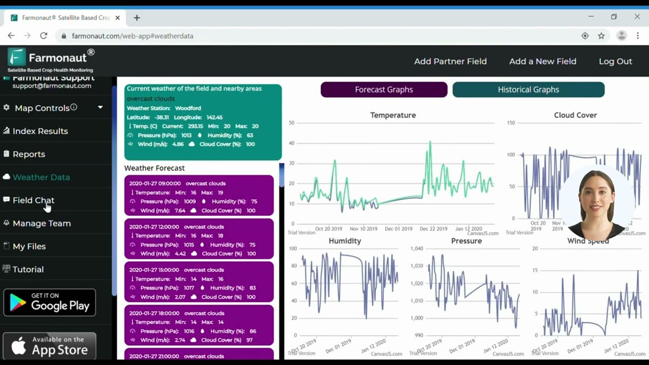
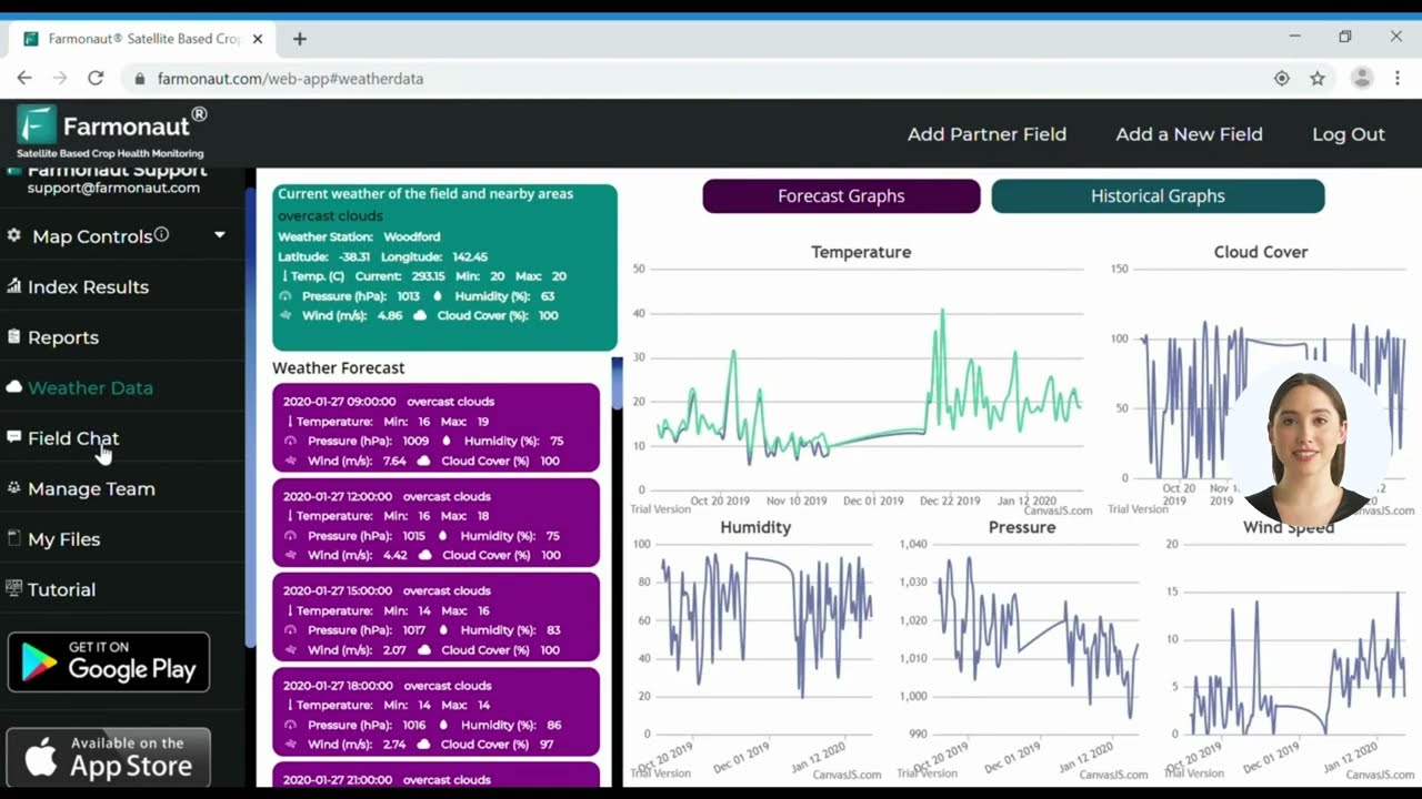
- ✔ Satellite-based monitoring: real-time NDVI, soil condition, and crop stress data via web and mobile apps, addressing the same use case as a UAV imaging flight without the flight.
- ✔ AI-powered advisory: JEEVN AI generates recommendations from multispectral and weather data.
- ✔ Blockchain traceability: tamper-proof product history for supply-chain verification.
- ✔ Carbon footprint tracking for regenerative and sustainability reporting.
- ✔ Fleet and resource management with satellite-driven oversight.

Barriers to Adoption and How They’re Changing
The size skew in the adoption data above — 70% of large farms vs. 27% economy-wide — traces to five specific barriers, and each has a specific mitigation path rather than a generic “costs are falling” claim:
- ⚠ Upfront hardware cost: UAV airframes, sensors, and multispectral payloads require capital that a per-acre satellite or IoT subscription avoids. Check current equipment pricing directly with vendors, since no government agency publishes a standard cost table for this category (a confirmed data gap — see the source list below).
- ⚠ FAA Part 107 licensing: commercial drone operation in the US requires a Part 107 remote pilot certificate; this is the compliance step behind the 10,000+ license count from Ken Research’s 2024 data. Check faa.gov/uas for the current certification process and any updates to licensing requirements.
- ⚠ Data integration complexity: combining UAV, satellite, and IoT sensor feeds into one decision layer requires cloud analytics; platforms built for this (rather than raw data dumps) reduce the integration burden.
- ⚠ Digital literacy and training: adoption at midsize and small operations tracks access to intuitive interfaces, not just access to the underlying technology.
- ⚠ Rural connectivity: IoT sensor networks and cloud-synced UAV data both depend on rural broadband or cellular coverage, which remains uneven across the US; the FCC’s broadband deployment reports are the reference point for checking coverage in a specific county.
On method, not just numbers: if you want to verify whether any of the adoption or market figures above have moved, the durable path is (1) search USDA ERS’s “charts of note” series for the most recent precision agriculture entry, (2) check whether NASS has released a newer Census of Agriculture or ARMS survey wave, and (3) check Ken Research or Mordor Intelligence for an updated North America agricultural drone market report, which both publishers refresh on roughly an annual cycle. That three-step check works regardless of what the numbers say next year.
Access Satellite Crop Monitoring on iOS
Frequently Asked Questions
1. What are the main IoT applications in agriculture?
The core applications are soil and field condition monitoring, automated irrigation and pest alerts, guidance/autosteer systems, yield monitoring and soil mapping, and data collection feeding forecasting models. In the US, autosteer guidance is the most widely adopted at 70% of large-scale farms and 52% of midsize farms (USDA ERS, 2023).
2. Are there UAV solutions for small-scale farmers, or is this only for large operations?
Large farms hold 69.4% of the North America agricultural drone market (Ken Research, 2024), so adoption skews large. Small-scale farmers have two practical paths: hire a licensed drone operator per flight instead of buying hardware, or use satellite-based monitoring for the recurring imaging use case and reserve a contracted drone flight for tasks that need higher resolution.
3. What’s the difference between UAV applications and IoT applications in agriculture?
IoT applications are ground-based: ambient sensors continuously reporting soil moisture, temperature, and nutrient data. UAV applications are aerial and episodic: a drone flight captures a snapshot of field-wide crop health, stress, or pest pressure at a point in time. The two are complementary, not competing — a 2023 USDA ERS data point shows 68% of large farms already combine yield monitors/soil maps (ground) with other precision tools.
4. How much does precision agriculture actually improve yield and revenue?
AEM’s 2024 study found current precision agriculture adoption is boosting annual US crop production by 5%, worth an additional $66,000 in revenue per 1,000 acres, with 6 more percentage points of potential gain identified if adoption increased further. The study also credits precision agriculture with sparing 11.4 million acres of cropland from being brought into production.
5. What is a UAV agritech solution in practical terms?
A UAV agritech solution pairs a drone (fitted with multispectral, hyperspectral, or thermal sensors) with the cloud software that turns raw imagery into NDVI maps, stress alerts, or variable-rate application instructions. The FAA’s 10,000+ agricultural drone operator licenses (2024) reflect how many US operations now run this as commercial infrastructure rather than a one-off pilot project.
6. Where can I access Farmonaut’s satellite and AI tools?
Visit the Web App, or download Android and iOS versions. Developers can integrate directly via the API and Developer Docs.







Conclusion
IoT applications in agriculture and UAV applications in agriculture are two complementary technology layers, not competing categories: ground sensors give continuous field-level data, aerial imagery gives a periodic wide-angle view, and the value of combining them is measurable rather than theoretical — USDA ERS’s 68% large-farm adoption of yield monitors and soil maps, and AEM’s $66,000-per-1,000-acres revenue benchmark, are both 2023–2024 data points, not marketing claims. The adoption gap between large and midsize/small farms (70% vs. 52% for autosteer alone) is the clearest signal of where the opportunity remains, and it’s a gap that per-acre satellite subscriptions and contracted drone flights are specifically built to close without requiring hardware ownership.
To keep this page useful past its review date: recheck USDA ERS’s charts-of-note series and the NASS Census of Agriculture for newer adoption figures, and check Ken Research or Mordor Intelligence for the current North America agricultural drone market size, since both refresh roughly annually. The method for evaluating any new number stays the same regardless of what it says: compare it against your own acreage and revenue in the calculator above before deciding whether the investment pencils out.
Experience the Next Wave of Precision Agriculture

 LatConnect 60
 Disease Free Life
 WebsEdge
 Blickwinkel
 Agricultural Credit Policy Council
 BayWa
BayWa MCSOD
MCSOD Marei Nursery
 eKGIS
eKGIS Mostas Tech
 Native Seeds
 Andex
Andex FCF India
 Unifrutti Gulf
 Deluxe Conseil
 WICO
WICO Chimera Innovation
