

Reviewed September 2026 against USDA Economic Research Service, USDA Agricultural Research Service, and USDA National Agricultural Statistics Service data.
Try it: Run your own numbers →
GPS RTK Agriculture: Accuracy, Costs, and 7 Real Uses
GPS RTK agriculture pairs a satellite GNSS signal with a fixed base station’s real-time correction stream to cut positioning error from several meters down to 1-3 centimeters, per USDA Agricultural Research Service (ARS) specifications for planting and herbicide application. That level of precision is what lets autosteer tractors hold a line within a couple of centimeters pass after pass, and it is why USDA’s Economic Research Service found guidance autosteer systems on 52% of midsize U.S. farms and 70% of large-scale crop farms as of 2023. This article covers what RTK GPS actually does in the field, what it costs to install and run, how it compares with plain GPS, and how to decide whether it pays back on your acreage.
“USDA Agricultural Research Service documents RTK GPS accuracy of 1-3 centimeters for planting and herbicide application — versus 1-5 meters for uncorrected GPS.”
“70% of large-scale U.S. crop farms were running guidance autosteer systems by 2023, according to USDA’s precision agriculture study.”
Table of Contents
- 1. What Is GPS RTK Agriculture?
- 2. How RTK Guidance Systems Work
- 3. Who Is Actually Using RTK: USDA Adoption Data
- 4. 7 Ways RTK GPS Agriculture Pays Off in the Field
- 5. RTK vs. Standard GPS: Accuracy and Impact Table
- 6. What an RTK Guidance System Actually Costs
- 7. RTK Payback Calculator
- 8. Trimble, Topcon, and Choosing a Correction Source
- 9. Base Station Setup & Signal Integrity Checklist
- 10. Where Satellite Monitoring Fits Alongside RTK
- 11. RTK Agriculture FAQ
- 12. Conclusion
- Try it: Run your own numbers
What Is GPS RTK Agriculture?
GPS RTK agriculture refers to using Real-Time Kinematic (RTK) correction on top of standard GNSS positioning so that field equipment knows its location to within 1-3 centimeters instead of the 1-5 meter error typical of uncorrected consumer GPS, per USDA ARS. That gap — meters versus centimeters — is the entire reason RTK guidance systems exist: it is the difference between a planter that drifts a few inches between passes and one that repeats the exact same line every time, season after season.
RTK agricultural systems are now a standard fixture on commercial-scale U.S. row-crop operations. USDA’s Agricultural Resource Management Survey found 40% of U.S. farm and ranch acreage was already using some form of GPS for on-farm production in 2019, and by 2023 USDA reported autosteer guidance — the application layer that RTK precision enables — on 52% of midsize farms and 70% of large-scale crop farms. Cotton, a crop with tight row-spacing tolerances, led adoption at 86% of U.S. cotton farms using precision agriculture equipment in 2023.




How RTK Guidance Systems Work in Agriculture
An RTK GPS agriculture setup has three parts: a GNSS constellation overhead, a mobile receiver (“rover”) mounted on the tractor, sprayer, or harvester, and a fixed reference point known as the base station. The base station sits at a precisely surveyed location and continuously broadcasts correction data — via radio or cellular link — to every rover in range. Those corrections account for atmospheric delay, satellite clock drift, and multipath reflection, the three main error sources that keep uncorrected GPS at meter-level accuracy.
- ✔ Precise Positioning: The rover applies the base station’s corrections in real time, cutting positioning error to the 1-3 cm range USDA ARS documents for planting and spraying, versus 1-5 meters for standard GPS.
- ✔ Consistent Guidance for RTK Seed and Fertilization Control: Machinery holds pre-set lines for planting, fertilizing, and harvesting, which is what USDA ARS credits with a 20% reduction in overlapping fertilizer applications and a 20% improvement in field efficiency from GPS-guided tractor systems.
- ✔ Data Synchronization: Centimeter-accurate location data feeds directly into farm management software, turning every pass into a georeferenced data point rather than a rough estimate.
A base station can be a farm’s own fixed GNSS receiver or a subscription to a networked correction service covering a region — the tradeoff between the two is covered in the cost section below. Either way, RTK agricultural systems remain reliable under the atmospheric conditions that degrade plain GPS, which is why USDA ARS treats RTK as the accuracy benchmark for input-application technology rather than an optional upgrade.

Who Is Actually Using RTK: USDA Adoption Data
Adoption of GPS and RTK agricultural systems is not uniform across U.S. agriculture — it tracks farm size and crop type closely. USDA’s Economic Research Service put overall GPS use on-farm at 40% of acreage in its 2019 Agricultural Resource Management Survey; by the time USDA’s follow-up precision agriculture study reported in 2023, adoption of guidance autosteer alone had reached 52% of midsize farms and 70% of large-scale crop farms. Corn and soybean growers show a related pattern in yield-monitoring technology, a companion system usually installed alongside RTK guidance: USDA’s National Agricultural Statistics Service (NASS) reports 60% of U.S. corn and soybean producers using yield monitoring systems as of 2023, while USDA’s Economic Research Service separately puts yield monitors, yield maps, or soil maps on 68% of large-scale crop farms.
| Segment | Adoption Rate | Year | Source |
|---|---|---|---|
| All U.S. farm/ranch acreage using GPS | 40% | 2019 | USDA ERS Agricultural Resource Management Survey |
| Midsize U.S. farms using autosteer guidance | 52% | 2023 | USDA |
| Large-scale U.S. crop farms using autosteer guidance | 70% | 2023 | USDA |
| U.S. cotton farms using precision ag equipment | 86% | 2023 | USDA |
| All U.S. farms/ranches using any precision practice | 27% | 2023 | USDA |
| Corn/soybean producers using yield monitors | 60% | 2023 | USDA NASS |
| Large-scale crop farms with yield monitors/maps | 68% | 2023 | USDA ERS |
These figures come from USDA’s periodic farm technology surveys, which are not run on a fixed annual cycle — the 2023 precision agriculture numbers are the most recent USDA has published as of this review. For a current read on adoption by state and commodity, USDA’s Quick Stats database is updated monthly and lets you filter by crop, year, and geography directly rather than relying on a secondhand summary. Regional detail — Corn Belt versus Great Plains versus the South, for instance — is not broken out in USDA’s published national tables, so a state-level Quick Stats query is the only way to get that granularity.
7 Ways RTK GPS Agriculture Pays Off in the Field
From planting through harvest and compliance reporting, RTK precision changes how every pass across a field is executed:
-
Enhanced Field Guidance & Autosteer
RTK-guided tractors, sprayers, and harvesters repeat the same line to within 1-3 cm, per USDA ARS. USDA ARS attributes a 20% improvement in field efficiency directly to GPS-guided tractor systems, mainly from eliminated overlap and skips. -
RTK Seed Fertilization Control (Variable Rate Technology)
RTK-referenced machinery applies seed, fertilizer, and crop protection product according to soil-variability maps rather than a flat rate across the field. USDA ARS documents a 20% reduction in overlapping fertilizer applications from tractor guidance systems alone. -
Terracing, Leveling & Drainage Management
Elevation data captured at RTK precision (2-3 cm vertical) supports land leveling, contouring, and drainage design that would be impossible to verify with meter-level GPS. Better drainage layout reduces runoff and improves irrigation efficiency across low-lying zones. -
Automated Section Control for Spraying and Fertilizing
Section control uses RTK-level accuracy to shut off individual boom or row sections automatically at headlands, point rows, and previously treated ground, directly cutting chemical and fertilizer overlap. -
Yield Mapping and Multi-Year Data Integration
Georeferenced yield maps built on RTK positioning are precise enough to compare the same few square meters of a field year over year — the basis for the yield-monitoring adoption USDA NASS puts at 60% of U.S. corn and soybean growers. -
Replanting & Perennial Crop Management
In orchards and vineyards, RTK keeps new plantings, pruning equipment, and harvest machinery aligned to the original planting grid across multiple seasons — critical where row spacing is fixed for the life of the planting. -
Regulatory Compliance & Traceability
Centimeter-level geotagging creates an application record precise enough for audit and certification purposes, including where blockchain-based agricultural product traceability is used downstream.
Combined, USDA’s research compilation on precision agriculture attributes 20-30% yield improvement to the full stack of GPS guidance, drone imagery, and IoT sensors working together — RTK positioning is the accuracy layer that the other pieces depend on.

Measure and manage your agriculture operation’s carbon emissions using Farmonaut’s satellite-powered tools. Track emission hotspots, improve sustainability, and comply with industry standards.
RTK vs. Standard GPS: Accuracy and Impact Table
| Operation | Standard GPS Accuracy | RTK GPS Accuracy | Documented Impact |
|---|---|---|---|
| Planting / herbicide application | 1-5 meters | 1-3 cm | USDA ARS accuracy specification |
| Tractor guidance / field passes | Meter-level, overlap-prone | 1-3 cm repeatable | 20% field efficiency gain (USDA ARS) |
| Fertilizer application overlap | Uncontrolled overlap common | Section-controlled | 20% reduction in overlapping applications (USDA ARS) |
| Land leveling / drainage design | Not verifiable at meter-level | 2-3 cm vertical | Supports precision drainage planning |
| Combined precision practices (GPS + imagery + IoT) | N/A | N/A | 20-30% yield improvement (USDA research compilation) |
The economic case shows up at the whole-farm level too: the Association of Equipment Manufacturers (AEM) estimates $118 per acre in annual economic value generated per 1,000 acres of row crops using precision agriculture, a figure that spans the input savings and efficiency gains cataloged above rather than any single practice in isolation.
Utilize satellite-driven insights and real-time tracking with Farmonaut to optimize machinery usage, reduce costs, and maximize field operation efficiency.
What an RTK Guidance System Actually Costs
Cost is usually the first question growers ask about RTK agricultural systems, and it has a wide answer because “RTK system” covers several different purchases. According to a 2026 industry survey, complete RTK guidance systems for agricultural equipment run $10,000 to $50,000 depending on the receiver tier, display, and steering-system integration. Within that, the core hardware — the GNSS receiver and antenna alone, budget to high-end — runs $3,000 to $15,000 per 2026 industry sourcing. On top of hardware, most operations without their own base station pay a correction-service subscription: Point One Nav’s 2026 pricing analysis puts RTK correction subscriptions at $42 to $125 per month, per tractor, depending on coverage area and network provider.
A farm’s own fixed base station avoids the recurring subscription but adds an upfront survey and installation cost that varies by site and is not separately broken out in the sources above — get a quote from your equipment dealer for your specific terrain and existing hardware before comparing it against a subscription network. Neither USDA nor NRCS currently publishes a federal grant or cost-share program specifically for RTK equipment; check your state’s NRCS Environmental Quality Incentives Program (EQIP) office directly, since precision agriculture cost-share eligibility is set at the state and fiscal-year level and changes annually.
Labor savings from RTK are real in practice — less fatigue, longer safe operating hours, fewer overlap corrections — but USDA has not published a separate dollar figure isolating labor cost reduction from RTK alone; the $118/acre AEM figure cited above bundles labor, input, and efficiency gains together rather than breaking labor out on its own.
RTK Payback Calculator
Enter your acreage and system cost to estimate the payback period using the AEM per-acre value figure and the published hardware and subscription cost ranges above.
Run your own numbers
Assumptions: uses the AEM $118/acre-per-1,000-acres annual value estimate scaled linearly to your acreage, and treats hardware cost as a one-time expense against net annual value after subscription cost. It excludes financing costs, base-station installation, maintenance, operator training time, and any state cost-share funding you may qualify for. It is a planning estimate, not a quote.
Trimble, Topcon, and Choosing a Correction Source
Trimble GPS Agriculture
Trimble GPS agriculture systems are widely deployed across large-scale U.S. row-crop and specialty operations, offering networked RTK correction services, autosteer hardware, and integrated yield-mapping software.
- ✔ Reliability in variable field and terrain conditions
- ✔ Multi-year data integration for yield mapping and farm management software
- ✔ Scalable infrastructure — from a single on-farm base station to regional correction networks
Topcon GPS Agriculture
Topcon GPS agriculture systems provide RTK and GNSS positioning with 2D/3D guidance, networked corrections, and automated implement control across a range of farm sizes.
- ✔ Accurate pathways for planting and spraying operations
- ✔ Web-based data management for fleet-wide guidance records
- ✔ Automated section control reducing labor and overlap
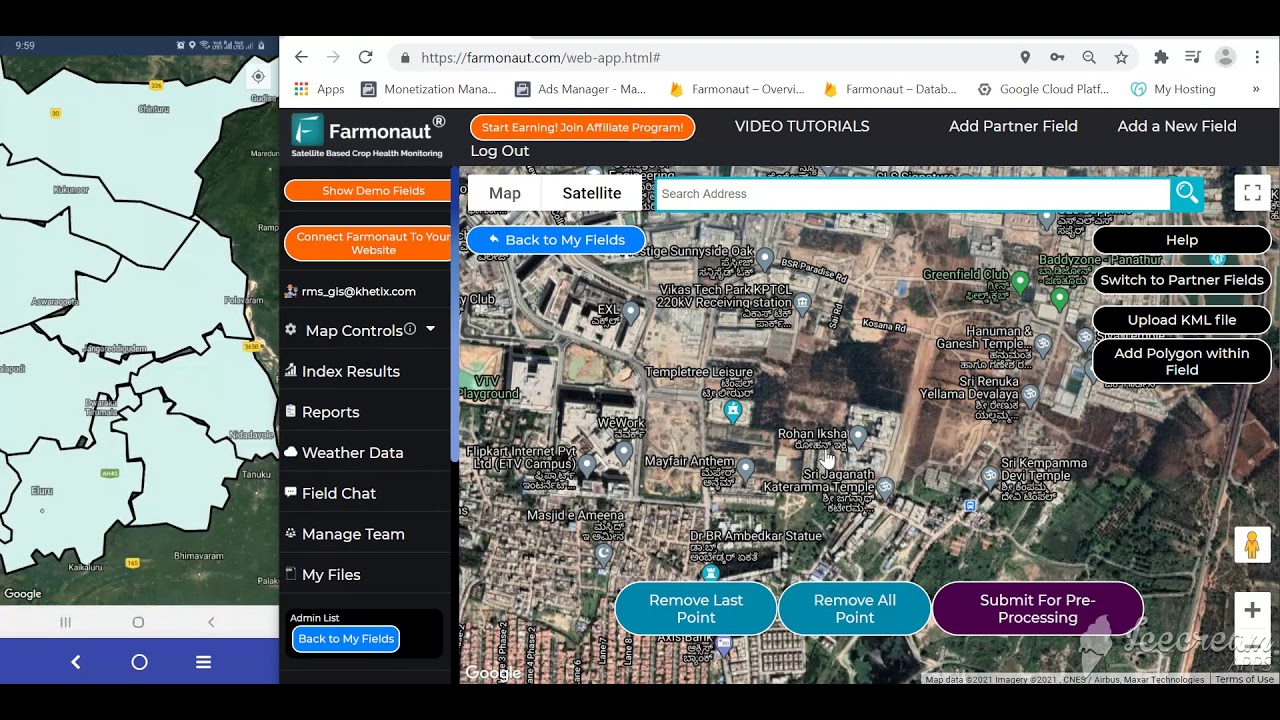
Unlock next-level resource management with the Farmonaut Agro Admin App. Remotely monitor diversified farm assets, analyze field health, and coordinate logistics for efficient, scalable operations.

📊 Vendor Selection Checklist for RTK Guidance Systems
- 🟢 Required accuracy: Does the operation need 1-3 cm (planting, section control) or is sub-meter WAAS-level correction sufficient?
- 🟢 Correction source: On-farm base station versus a networked/CORS subscription — compare the $42-$125/month subscription range against base station installation cost for your acreage.
- 🟢 Hardware compatibility: Will the receiver integrate with existing implements and displays?
- 🟢 Software integration: Does yield and mapping data export into your farm management information system (FMIS)?
- 🟢 Support and maintenance: Does the dealer provide calibration support and training?
Base Station Setup & Signal Integrity Checklist
Getting the accuracy USDA ARS documents for RTK — 1-3 cm — depends on correct deployment, not just hardware purchase:
- ✔ Base Station Placement: A well-surveyed, fixed base station is essential for reliable corrections. Choose either an on-site GNSS base or a subscription to a regional CORS (Continuously Operating Reference Station) network.
- ✔ Signal Integrity: Minimize multipath and obstruction-related errors with quality antennas placed clear of large metal structures and dense tree cover.
- ✔ Maintenance & Calibration: Routine checks on cables, receivers, and section-control calibration prevent drift and costly application errors.
- ✔ Operator Training: Field staff need working knowledge of guidance software and mapping tools to actually capture the overlap and input savings documented above.
Looking to ensure food safety and full regulatory traceability for your farm outputs? Farmonaut’s blockchain traceability platform brings transparency and trust to modern agriculture supply chains.

🌍 RTK Agricultural Systems Across Cropping Types
- 🌾 Row Crops: Consistent row spacing for corn, soybeans, wheat, and cotton — the segment with the highest documented adoption at 86% (USDA, 2023)
- 🍇 Vineyards: Yield mapping, pruning, and harvest planning tied to a fixed planting grid
- 🍑 Orchards: Centimeter-accurate perennial layout held across multiple seasons
- 🌻 Vegetable and Specialty Farms: Variable rate input application with minimal chemical waste
- 🧑🌾 Custom Operators: Repeatable guidance across multiple client fields and base stations
Placing a base station near large metal structures or dense tree lines introduces multipath error that RTK correction cannot fully cancel out. Survey the site for reflective surfaces before fixing the base station location.
Where Satellite Monitoring Fits Alongside RTK
RTK positioning tells equipment exactly where it is in a field; satellite monitoring tells growers what condition that field is in. The two are complementary rather than competing layers of a precision operation. Farmonaut provides the satellite side of that stack:
- ✔ Satellite-Based Monitoring: Crop health, soil status, and resource alerts via multispectral analysis, which can be overlaid on RTK-derived field boundaries
- ✔ AI-Powered Advisory: Jeevn AI delivers crop strategies, yield forecasts, and weather insights that pair with RTK-collected yield map data
- ✔ Blockchain Traceability: Transparent, immutable records for agriculture and mining supply chains (learn more)
- ✔ Resource & Fleet Management: Track vehicles and assets to complement RTK-guided field operations
- ✔ Environmental Impact Tracking: Monitor and reduce emissions with carbon footprinting tools
- ✔ Access via Apps, API, & Web: Manage field data through Farmonaut’s Android, iOS, and web apps, or connect programmatically via the API and Developer Docs
Get actionable advice and instant analytics for field, plantation, and forest management. Make every seed and every acre count with Farmonaut’s real-time, AI-powered platform.
RTK Agriculture: Frequently Asked Questions
What accuracy does GPS RTK achieve in agriculture?
USDA Agricultural Research Service documents RTK GPS accuracy of 1-3 centimeters for planting and herbicide application, compared with 1-5 meters for uncorrected standard GPS.
How much does an RTK guidance system cost for a farm?
Complete RTK guidance systems run $10,000 to $50,000 per a 2026 industry survey, with core GNSS hardware alone ranging $3,000 to $15,000. Correction subscriptions for growers without their own base station run $42 to $125 per month per tractor, per Point One Nav’s 2026 pricing data.
How widely is RTK GPS used in U.S. agriculture?
USDA reported guidance autosteer systems on 52% of midsize U.S. farms and 70% of large-scale crop farms in 2023, with cotton farms leading at 86% precision equipment adoption. Check USDA’s Quick Stats database for the most current figures by crop and state.
How does RTK seed and fertilization control reduce input waste?
RTK-referenced section control automatically shuts off individual boom or planter sections on overlap areas and headlands. USDA ARS documents a 20% reduction in overlapping fertilizer applications from tractor guidance systems.
What equipment is needed to implement RTK guidance on a farm?
At minimum, an RTK-capable GNSS receiver on the equipment plus a correction source — either a farm’s own fixed base station or a networked subscription service. A guidance display and compatible farm management software are recommended to capture the full efficiency gains.
How does Farmonaut complement RTK GPS practices?
Farmonaut provides satellite-driven field monitoring, AI advisory, blockchain traceability, and fleet management that layer on top of RTK-guided field operations, turning precise machine location into crop health context, sustainability benchmarks, and compliance records.







Further reading:
Conclusion: RTK Is the Accuracy Layer Under Every Other Precision Ag Investment
RTK GPS agriculture is not a single product but a measurable jump in positioning accuracy — from meters to 1-3 centimeters, per USDA ARS — that makes autosteer, section control, variable rate application, and yield mapping trustworthy at the sub-row level. USDA’s adoption figures show this is no longer a frontier technology: 70% of large-scale U.S. crop farms and 52% of midsize farms were running autosteer guidance by 2023, with cotton growers leading at 86% precision equipment use.
The durable way to evaluate an RTK investment does not change as prices or adoption numbers shift year to year: check USDA’s Quick Stats database for current adoption in your state and crop, get a hardware quote in the $3,000-$50,000 range depending on system tier, compare a $42-$125/month correction subscription against your own base station’s installation cost, and run the payback math against the AEM $118-per-acre-per-1,000-acres value estimate for your actual acreage using the calculator above.
For growers layering satellite crop monitoring on top of RTK-guided field operations, Farmonaut connects satellite-driven insights, AI advisory, blockchain traceability, and fleet tracking into the same operational picture.
For developer integrations, visit the Farmonaut Satellite API or the Developer Docs. For authoritative adoption and accuracy figures cited throughout this article, see the USDA Economic Research Service report, the USDA Agricultural Research Service precision agriculture page, and USDA NASS agricultural yield survey guide.
Discussion
Questions, corrections or field experience? Share them below. First-time comments are reviewed before they appear, and your email is never published.
No comments yet. Be the first to add a question or your experience.

 IRE Soil
 Blickwinkel
 Agricultural Credit Policy Council
 BayWa
BayWa MCSOD
MCSOD Marei Nursery
 eKGIS
eKGIS Mostas Tech
 Native Seeds
 Andex
Andex FCF India
 Unifrutti Gulf
 Deluxe Conseil
 TVS Electronics
 WICO
WICO Chimera Innovation
