

Canadian Malartic, Quebec · Mine profile
Malartic Gold Mine: Output, Costs and Reserves in Quebec
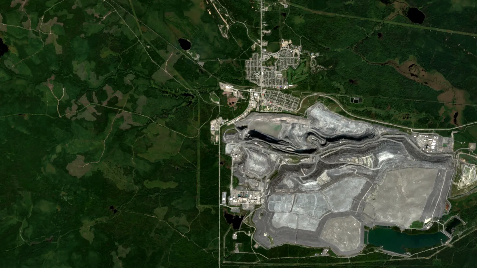
The Malartic gold mine is in Quebec, Canada, not Malaysia. Agnico Eagle’s Canadian Malartic produced 642,612 ounces in 2025 at a total cash cost of $946 an ounce. Output, reserves, costs and the 2026 pit-wall setback are below.
Key takeaways
- Canadian Malartic is in the town of Malartic, Quebec, 100% owned by Agnico Eagle since 31 March 2023 (Agnico Eagle, 2025 annual report).
- It produced 642,612 oz of gold in 2025 from 20.1 million tonnes of ore at 1.08 g/t, at a total cash cost of $946 an ounce (Agnico Eagle, 2025 annual report).
- A rock mass moved on the Barnat pit north wall on 1 July 2026; Agnico Eagle expects 60,000 to 80,000 oz less in the second half of 2026 and up to 150,000 oz less in each of 2027 and 2028 (Agnico Eagle, second-quarter 2026 report).
- Reserves were about 9.1 million oz at the end of 2025, 6.0 million oz of them at the underground Odyssey mine; the complex is expected to run through 2042 under current plans (Agnico Eagle, 2025 annual report).
- Malaysia is a much smaller gold producer: USGS estimated 1.8 tonnes for 2022, against about 20 tonnes from Canadian Malartic alone in 2025.
In this article
- Where the mine is and who owns it
- Malartic gold mine output, grade and cost per ounce
- What the Barnat pit wall movement means for output
- How ore becomes gold at Canadian Malartic
- What the Odyssey mine adds
- How the deposit was found and what explorers can learn
- What the mine reports on dust, noise and water
- Gold mining in Malaysia: how it compares
- Frequently asked questions
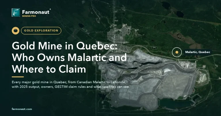
The Malartic gold mine is in the town of Malartic in Quebec, Canada, about 25 kilometres west of Val-d’Or. It is not in Malaysia. Its full name is Canadian Malartic, and Agnico Eagle owns all of it (Agnico Eagle, 2025 annual report). In 2025 it produced 642,612 ounces of gold at a total cash cost of $946 an ounce (same report). The web address of this page still says Malaysia because of an error in an older version of the article; every fact below is about the Quebec mine.
This page covers the mine’s output and cost per ounce, the pit-wall movement that cut its 2026 outlook, how the ore is processed, the underground Odyssey mine, how the deposit was found, what the operator reports on dust, noise and water, and how a single Quebec mine compares with gold mining in Malaysia. A mill output calculator is included.
Where the mine is and who owns it
Malartic lies in the Abitibi region of north-western Quebec, roughly 80 kilometres east of Rouyn-Noranda (Agnico Eagle, 2025 annual report). Geologically it sits in the southern Abitibi greenstone belt. A greenstone belt is a strip of very old volcanic and sedimentary rock that often hosts gold. This belt has produced more than 100 million ounces of gold since the 1920s, according to the geologists who developed the mine (Wares and Burzynski, Osisko Mining). Our guides to the Abitibi greenstone belt and to Canada’s gold deposits by province show the wider setting.
Osisko Mining built the open pit and reached commercial production in May 2011 at 60% of capacity (Wares and Burzynski). Agnico Eagle and Yamana Gold later held it 50/50. On 31 March 2023 Agnico Eagle closed a deal with Pan American Silver and Yamana and took the 50% it did not already own (Agnico Eagle, 2025 annual report). Trade press called it Canada’s largest open pit gold mine at that point (MINING.COM, 3 April 2023). Agnico Eagle says the complex poured its eight millionth ounce in December 2024 (Canadian Malartic mine site). Natural Resources Canada put Quebec’s gold output at 55.5 tonnes in 2024, 28% of the Canadian total (NRCan, gold facts, preliminary data). Canadian Malartic’s 655,654 ounces in 2024 equal about 20.4 tonnes, so by our arithmetic this one mine made roughly 37% of the province’s gold.
The complex now has two mining fronts. The original Canadian Malartic pit was depleted in 2023, and open pit mining continues in the neighbouring Barnat pit. The Odyssey mine is an underground operation that feeds the same mill (Agnico Eagle, 2025 annual report). Agnico Eagle runs nine other gold mines; our ranking of Agnico Eagle mines by gold output and cost puts Canadian Malartic next to them.
Malartic gold mine output, grade and cost per ounce
Three terms help here. Grade is grams of gold in each tonne of ore (g/t). An ounce means a troy ounce, which is 31.1035 grams. Total cash cost per ounce is the operating cost of producing an ounce, expressed in US dollars. It is a non-GAAP measure, so it is defined by the company and leaves out most capital spending and income tax.
Chart
Total cash cost per ounce at Canadian Malartic
US dollars per ounce, selected periods; 2026 outlook is the company’s expectation
| Period | Ore milled (000 tonnes) | Grade (g/t) | Gold produced (oz) | Total cash cost (US$/oz) |
|---|---|---|---|---|
| Full year 2024 | 20,317 | 1.09 | 655,654 | 930 |
| Full year 2025 | 20,123 | 1.08 | 642,612 | 946 |
| First half 2025 | 9,828 | 1.14 | 332,304 | 900 |
| First half 2026 | 9,094 | 1.13 | 301,459 | 1,082 |
| Second quarter 2026 | 4,387 | 1.06 | 135,243 | 1,185 |
The full-year rows come from the 2025 annual report; the half-year and quarter rows come from the second-quarter 2026 report. We left out 2023 because Agnico Eagle counted only 50% of the mine until 30 March 2023, so that year is not comparable.
Output fell by 2.0% in 2025 because less ore went through the mill, grades were slightly lower, and recovery dropped as more ore came from low-grade stockpiles (annual report). In the first half of 2026 output fell by 9.3% on lower throughput. In the second quarter it fell by 21.6% because of an unplanned shutdown in April and lower grades (second-quarter report). The cost of an ounce rose from $876 in the second quarter of 2025 to $1,185 a year later. Agnico Eagle now expects about $1,260 an ounce for the full year 2026, up from earlier guidance of $1,187.
The ore is low in grade. At about 1.1 g/t, a tonne of rock holds roughly one gram of gold, which is why the mine depends on scale: about 55,000 tonnes a day through the plant in 2025 (Canadian Malartic mine site). For context, Agnico Eagle’s average realized gold price across all its mines was $4,483 an ounce in the second quarter of 2026 (second-quarter report), well above the cash cost shown above. The price moves daily, so use a current quote when you do your own sums. Industry-wide, the World Gold Council put the global average all-in sustaining cost at US$1,785 an ounce in the first quarter of 2026 (World Gold Council). That measure also includes sustaining capital, so it is higher than a cash cost and the two should not be compared directly.
What the Barnat pit wall movement means for output
On 1 July 2026 a rock mass moved along the north wall of the Barnat pit. Nobody was hurt and no equipment or environment was affected. As a precaution, Agnico Eagle stopped mining in the pit. It expects repairs to finish in the third quarter of 2026 and mining to restart in the fourth (second-quarter report). While the pit is shut, the mill is fed from low-grade stockpiles instead of planned Barnat ore.
Chart
Annual gold output at Canadian Malartic: guidance and the largest disclosed cut
Thousand ounces; left dot is guidance midpoint minus the largest cut, right dot is the February 2026 guidance midpoint
The company expects the event to cut output at Canadian Malartic by 60,000 to 80,000 ounces in the second half of 2026 and by up to 150,000 ounces in each of 2027 and 2028 (second-quarter report). It also says the movement does not change the development or production outlook for Odyssey (second-quarter 2026 news release). The chart below applies the largest cut to the February 2026 guidance midpoints. It is simple subtraction to show the scale, not a company forecast, and the company may revise its numbers.
Separately, Agnico Eagle reported a fatal accident at Canadian Malartic in April 2026 and ran a safety reset across all its operations afterwards (second-quarter 2026 news release).
How ore becomes gold at Canadian Malartic
The original Canadian Malartic pit was about 1.8 kilometres long, 1 kilometre wide and 360 metres deep when mining there ended on 5 May 2023. The Barnat pit is planned to finish at 1.7 kilometres by 750 metres and 380 metres deep (Canadian Malartic mine site). Proven and probable open pit reserves at the mine, which are mined from the Barnat pit, were 58.6 million tonnes at 0.77 g/t, or 1.4 million ounces, at the end of 2025. Reserves are the part of a deposit that a company has shown can be mined at a profit. Agnico Eagle used a cut-off grade of 0.35 g/t for them (annual report). A cut-off grade is the lowest grade the mine will still treat as ore.
▶ Follows a gold nugget from rock to ring through drilling, crushing, leaching and refining. · 5:27
The plant crushes and grinds the rock, then dissolves the gold and silver in a leach circuit. Activated carbon catches the dissolved metal before it is poured into bars. The mine reports average gold recovery of about 91.6% in 2025, meaning it captured that share of the gold that entered the mill.
A rough check shows how the numbers fit together: 20.1 million tonnes at 1.08 g/t holds about 700,000 ounces, and 91.6% recovery gives about 640,000 ounces, close to the 642,612 reported. The calculator below does the same sum with your own inputs.
Calculator
How much gold does a mill produce in a year?
Enter your own throughput, grade, recovery and price.
- Ore milled per year (tonnes): 19,250,000
- Gold produced (kilograms): 19,044
- Revenue per year: $2,449,067,147
- Margin over cash cost per year: $1,775,573,681
Example values only, not a forecast. The defaults are close to Canadian Malartic’s 2025 figures: about 55,000 tonnes a day, 1.08 g/t and 91.6% recovery (Agnico Eagle, 2025 annual report and mine site). Price and cost are inputs: use today’s price and your own cost. The margin ignores capital, royalties and tax.
What the Odyssey mine adds
Odyssey is the underground part of the complex and the main reason Agnico Eagle expects the mine to outlive the open pits. Its proven and probable reserves were 6.0 million ounces at 3.14 g/t at the end of 2025, much richer than the open pit ore (annual report). Of that, 5.7 million ounces sit in the East Gouldie deposit. In total the Canadian Malartic complex held about 9.1 million ounces of reserves, including 1.6 million ounces at the planned Marban pit, which is not yet permitted or mined, and under current mine plans it is expected to run through 2042 (annual report).
Chart
Gold reserves behind the Malartic mill
Million ounces, proven and probable reserves at 31 December 2025; Wasamac (1.4) is a separate project and is not part of the 9.1 Moz at the Malartic complex; Marban is not yet mined
In July 2026 the first phase of shaft sinking reached 1,586 metres, and first production through the shaft is on schedule for the second quarter of 2027 (second-quarter 2026 news release). The ramp, which is the sloping tunnel used by trucks, was at 1,190 metres. Planned shaft bottom is 1,870 metres in 2030.
Agnico Eagle also has a plan it calls “fill the mill”. When the Barnat pit is mined out in 2029, the plant will have about 40,000 tonnes a day of spare capacity. The company is studying a second Odyssey shaft, a satellite open pit at Marban about 12 kilometres from the mill, and the Wasamac underground project about 100 kilometres away. Together they could lift output toward one million ounces a year from 2033 (Agnico Eagle, Q4 2025 results). The company says these evaluations are preliminary and include inferred resources, which are the least certain category, so treat the one-million-ounce figure as a goal, not a result. Marban is envisioned at 120,000 to 150,000 ounces a year over about 12 years, and Wasamac at about 90,000 ounces a year (same release).
How the deposit was found and what explorers can learn
Canadian Malartic is a rediscovery. An older underground mine on the site produced about one million ounces between 1935 and 1965. Osisko bought the claims from a bankruptcy trustee in October 2004, when most companies saw the site as an exhausted camp that needed clean-up (Wares and Burzynski). The company reasoned that the old mine sat on a much larger, lower-grade deposit that could be mined from the surface. It built that case from public data in the Quebec government’s online geoscience database, plus the logs of more than 4,500 old drill holes. More than 750,000 metres of drilling followed, a positive feasibility study came in November 2008, and government approval in August 2009 (same paper).
The deposit lies just south of the Cadillac–Larder Lake fault zone. About 70% of the gold is in altered sediments of the Pontiac Group, with the other 30% in the upper part of a porphyry intrusion beneath them. The gold is mostly fine grains inside disseminated pyrite, with an average grain size near 15 microns (Wares and Burzynski). In plain terms, the gold is fine-grained and spread through a very large volume of rock, so it pays only at large scale. When the geologists wrote their paper, reserves stood at 10.7 million ounces at 0.97 g/t, calculated at a gold price of US$1,200 an ounce (same paper).
The lesson for explorers is that old camps can be worth re-examining with a new model and public data. Satellite imagery can help with this early screening. Farmonaut’s satellite-based mineral detection uses multispectral imagery to rank targets inside a licence area before drilling is planned. The results are exploration targets that sit ahead of any resource estimate. If you hold ground in a similar greenstone belt, you can request a quote for your area or contact the team.

▶ Explains what satellites can and cannot show when screening ground for gold. · 4:25
What the mine reports on dust, noise and water
An open pit next to a town draws scrutiny, and the operator publishes its own figures. The mine says it met Quebec standards for air quality, water quality and noise in 2025, and that compliance with blasting standards was 99.8%. It also says equipment was stopped for more than 7,200 hours in 2025 when dust or noise approached the permitted limits (Canadian Malartic mine site). These are company statements, not an independent audit.
The Barnat extension needed a roughly 4-kilometre deviation of Route 117 east of the town, which opened to traffic in the fall of 2019 (same page). At closure the company plans to revegetate the tailings pond and waste rock pile and let the pits fill with groundwater. The flooded pit will cover the waste rock and tailings stored in the Canadian Malartic pit. A “Good Neighbour Guide” written at Canadian Malartic in 2016 later became a model for Agnico Eagle’s LaRonde and Goldex mines (Agnico Eagle, 2025 sustainability report).
▶ Explains the seven main environmental impacts of mining in plain words. · 2:31
Gold mining in Malaysia: how it compares
Many searches for Malartic come from people who expect a Malaysian mine, so here is the comparison. Malaysia’s main gold district is the Central Gold Belt, a structural zone up to 30 kilometres wide and 450 kilometres long, where the Penjom and Raub mines have each produced more than one million ounces (Monument Mining, Selinsing exploration page). Monument Mining operates the Selinsing mine in the same belt, in Pahang state (Mining Technology, Selinsing project profile).
The scale is very different. The US Geological Survey estimated Malaysia’s gold output at 1,800 kilograms (1.8 tonnes) in 2022 (USGS Minerals Yearbook, gold, 2022). Canada produced an estimated 200 tonnes in 2025 (USGS Mineral Commodity Summaries 2026, gold). Canadian Malartic’s 642,612 ounces is about 20 tonnes. That is roughly 10% of Canada’s estimate and about eleven times the Malaysian estimate. The years differ, so read it as a sense of scale, not an exact ratio.
For a closer look at a related question, see our guide: Freeport-McMoRan vs Southern Copper: Reserves and Costs.
If this topic matters to you, read Endeavour Mining Gold Mines: Output, Reserves, Costs next.
Frequently asked questions
Where is the Malartic gold mine?
It is in the town of Malartic in the Abitibi region of north-western Quebec, Canada, about 25 kilometres west of Val-d’Or and 80 kilometres east of Rouyn-Noranda (Agnico Eagle, 2025 annual report).
Is the Malartic gold mine in Malaysia?
No. It is in Quebec, Canada. Malaysia has its own gold mines, such as Penjom, Raub and Selinsing, but none is called Malartic.
Who owns Canadian Malartic?
Agnico Eagle owns 100%. It bought the half it did not own from Yamana Gold and Pan American Silver in a deal that closed on 31 March 2023 (Agnico Eagle, 2025 annual report).
How much gold does Canadian Malartic produce?
It produced 642,612 ounces in 2025 and 655,654 ounces in 2024, including Odyssey. Output in the first half of 2026 was 301,459 ounces, down 9.3% from a year earlier (Agnico Eagle annual report and second-quarter 2026 report).
How big is the Canadian Malartic pit?
The original pit, where mining ended in May 2023, was about 1.8 kilometres long, 1 kilometre wide and 360 metres deep. The Barnat pit is planned to end at 1.7 kilometres by 750 metres and 380 metres deep (Canadian Malartic mine site).
How long will the mine keep operating?
Open pit mining at Barnat was planned to run to 2029. Under current mine plans, the complex as a whole, including Odyssey, is expected to be in production through 2042 (Agnico Eagle, 2025 annual report). The July 2026 pit wall movement may change the open pit schedule.
What grade is the ore?
The mill processed ore averaging 1.08 g/t in 2025. Open pit reserves average 0.77 g/t, while the Odyssey reserves average 3.14 g/t (annual report).
What is the Odyssey mine?
Odyssey is the underground mine at the complex. It has 6.0 million ounces of reserves, including the East Gouldie deposit. A shaft is being sunk, and first production through it is scheduled for the second quarter of 2027 (second-quarter 2026 report).
What happened at the Barnat pit in July?
A rock mass moved along the north wall on 1 July 2026. There were no injuries. Mining was suspended while repairs are made, and in its 29 July 2026 report Agnico Eagle said it expected to restart in the fourth quarter of 2026.
How is gold recovered at Canadian Malartic?
The plant crushes and grinds the ore, dissolves the gold and silver in a leach circuit, captures them on activated carbon and pours bars. Average gold recovery was about 91.6% in 2025 (Canadian Malartic mine site).
This page is for information only. It is not investment advice. It gives no price targets and does not consider your goals or risk tolerance. Company results and guidance change, so check Agnico Eagle’s latest filings before you rely on any figure.
Farmonaut mining
Get a quote to screen your licence area from space
Send your polygon or KML and we will quote a satellite screen that ranks exploration targets ahead of any resource estimate.

Mining Pro sample view, synthetic data
Keep reading
Sources
- Agnico Eagle, 2025 annual report: s205.q4cdn.com
- Agnico Eagle, second quarter 2026 report (MD&A): s205.q4cdn.com
- Agnico Eagle, fourth quarter and full year 2025 results: s205.q4cdn.com
- Agnico Eagle, 2025 sustainability report: s205.q4cdn.com
- Agnico Eagle, Canadian Malartic mine site: malartic.agnicoeagle.com
- Wares and Burzynski (Osisko Mining), The Canadian Malartic Mine: discovery and development of an Archean bulk-tonnage gold deposit: tgdg.net
- USGS, Mineral Commodity Summaries 2026: gold: pubs.usgs.gov
- USGS, Minerals Yearbook 2022: gold: pubs.usgs.gov
- Monument Mining, Selinsing exploration and regional geology: monumentmining.com
- Mining Technology, Selinsing gold mine project profile: mining-technology.com
- MINING.COM, Agnico Eagle becomes sole owner of Canadian Malartic (3 April 2023): mining.com
- Natural Resources Canada, Gold facts (preliminary 2024 data): natural-resources.canada.ca
- World Gold Council, Record gold prices outpace rising mining costs in Q1’26: gold.org
- Agnico Eagle, second quarter 2026 results news release: s205.q4cdn.com
Discussion
Questions, corrections or field experience? Share them below. First-time comments are reviewed before they appear, and your email is never published.
No comments yet. Be the first to add a question or your experience.

 Qader Group
 Ileys General Trading
 SG Gold Mining LLC
 VRV Global Pte Ltd
 Omsri International FZE
 G.I.T.T.
 Jaunita Erss Ltd
 Almosi SARL
 SRK Consulting
 Berks Gold Limited
 Mwerezi Minerals Company Limited
 Mining SARL
 SenGold Invest SAS
 Sean Mining Limited
 NTS Group (Pty) Ltd
 Mine4Africa
 Lithspo Minerals Limited
 Tintina Mining Group
 Licence holder · Nigeria · Gold + lithium










