

Agricultural Drone Images & Price Range Guide 2026: Future-Proofing Precision Farming
“By 2026, over 70% of large farms are projected to use multi-sensor agricultural drone images for crop monitoring.”
“The agricultural drone market’s price range is expected to reach $2,000–$25,000 per unit by 2026.”
Introduction: Drones & Precision in Agriculture
In 2026, the agricultural landscape is being reshaped by rapid advancements in drone technology. Agricultural drone images, coupled with advanced sensors and robust data analytics, have become indispensable for modern farming worldwide. The way farmers monitor, manage, and optimize crops is fundamentally different from just a few years ago.
As precision agriculture moves into the mainstream, stakeholders increasingly rely on technological, data-driven practices for improved accuracy, efficiency, and sustainability. This comprehensive article explores the significance of agricultural drone images, technological advancements, and presents an in-depth agricultural drone price range guide for 2026—helping stakeholders understand, evaluate, and invest wisely for the decade ahead.

- ✔ Precision farming is a reality due to drone-led data insights
- 📊 High-resolution images let farms detect stress and optimize inputs
- ⚠ Initial investment can vary, but technology drives long-term gains
- ✔ AI-enhanced drones enable rapid, repetitive field monitoring
- 📊 Agricultural drone price range broadens accessibility for various farm sizes
Significance of Agricultural Drone Images: Revolutionizing Farm Monitoring
Agricultural drone images provide a groundbreaking approach to monitoring crop health, analyzing field conditions, and making data-driven agricultural decisions. Unlike traditional field scouting methods, drones offer:
- ✔ Rapid and Accurate Assessments: Cover hundreds of hectares within minutes, ensuring no area goes unchecked.
- 📊 Detailed Multi-layered Data: RGB, multispectral, and thermal image layers provide comprehensive views of crop vitality, water stress, and pest presence.
- ✔ Repetitive and Consistent Monitoring: Automated flight scheduling allows for regular, season-long monitoring for trend analysis and early warning signals.
- ✔ Precision Insights: Agricultural drone images support variable rate application of fertilizers, pesticides, and water by identifying stressed zones.
- ⚠ Common Mistake: Relying solely on RGB images without leveraging multispectral or thermal sensors can limit early detection of underlying crop stress.
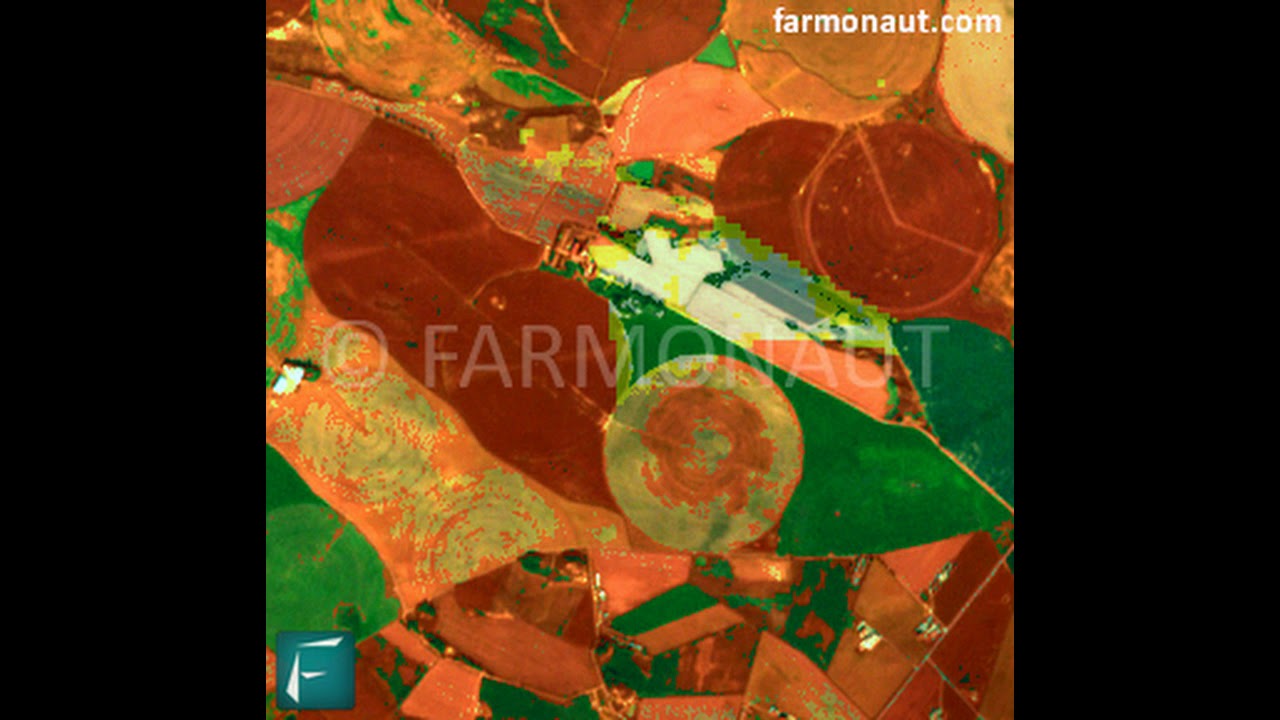
The evolution of agricultural drone imaging, particularly the integration of NDVI (Normalized Difference Vegetation Index) maps and AI-driven analytics, means farmers can now detect, analyze, and respond to pest infestations, nutrient deficiencies, and irrigation needs with unprecedented accuracy in 2026.

Advanced Sensors & Imaging in Agricultural Drones: A Deep Dive
Modern agricultural drones come equipped with a suite of advanced sensors:
- RGB Cameras: Offer high-resolution visual imagery, ideal for plant vigor mapping and physical damage assessment.
- Multispectral Sensors: Capture different wavelengths, providing NDVI and other indices to assess photosynthetic activity, plant stress, and soil moisture.
- Thermal Sensors: Measure temperature variations across large tracts of land, identifying areas of water stress, irrigation issues, or disease outbreaks earlier than visible symptoms appear.
- Hyperspectral Sensors: Advanced models from 2026 are expected to use these for detailed biochemical and nutrient profiling.
These sensors generate aerial images that are processed by powerful algorithms and cloud-based analytics platforms. The insights obtained help optimize fertilizer application, irrigation, and pest management, transforming agricultural practices into data-rich, precision-driven ecosystems.

Key Features of Modern Agricultural Drone Imaging (2026)
- ✔ Automated Flight Planning & Mapping: Intuitive software enables precise and repeatable coverage, reducing missed areas.
- ✔ Edge & Cloud Computing: Real-time, AI-powered analysis delivers immediate data layers for farm managers on-site or remotely.
- ✔ Enhanced Autonomy & Battery Life: Drones now operate for up to 60 minutes per flight, covering more hectares than ever before.
- ✔ Greater Payload Capacity: Allows for additional sensors or input tanks for spraying pesticides or fertilizers.
- ✔ Seamless Integration with Agri-Platforms: Upload flight data to cloud-based farm management systems for one-click reporting and data storage.
Integrated Workflows: Drone Data for Farm Management
The integration of agricultural drone images with holistic farm management software streamlines workflows and empowers rapid, data-supported decisions. Farmers can:
- ✔ Combine Aerial & Ground Data: Cross-reference aerial images with IoT soil sensors for robust, multi-source analysis.
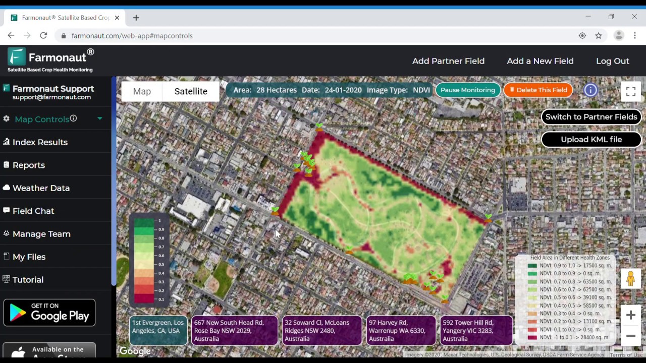
- ✔ Implement Variable Rate Applications: Use NDVI maps to direct site-specific application of inputs, reducing cost and waste.
- 📊 Build Historical Field Profiles: Track crop health and productivity across multiple seasons for informed rotation and input choices.
- ✔ Monitor Compliance & Traceability: Support digital record-keeping for regulatory or certification programs.

🔍 Visual Impact: Modern Drone Imaging Empowers Agriculture
- 🌱
Precision Crop Scouting - 💧
Optimal Water Usage - 📈
Data-Driven Decisions - 🪲
Early Pest Detection - 🍃
Reduced Chemical Runoff
Top Technological Advancements in Agricultural Drones for 2026
2026 agricultural drones deliver far more than simple overviews. This new era features breakthroughs that fundamentally change how crops are monitored, protected, and optimized:
- AI & Machine Learning Integration: Real-time analysis of drone images with anomaly detection for diseases, pests, or safety risks.
- Bigger Battery & Enhanced Autonomy: New battery tech means single flights lasting up to an hour with full autonomy.
- Greater Payload Options: From seed dispersal to precision pesticide spraying, payloads are more adaptive and specialized.
- Cloud Platform Synergy: Flights upload imagery and insights instantly to web and mobile farm management systems.
- Automated Flight Planning Software: Reduces human error, managing complex field shapes with seamless path optimization.
- Edge AI Analysis: On-board computation for immediate actionable insights—no need to wait for uploads & downloads.
🎛️ Key Technologies in 2026’s Agricultural Drones
- 🛰️
Satellite-Guided Navigation - 🧠
AI-Powered Analysis - 🖼️
High-Resolution Imaging - ⚡
Extended Battery Life - 🌾
Precision Input Spraying
“By 2026, over 70% of large farms are projected to use multi-sensor agricultural drone images for crop monitoring.”
Comparison Table of Agricultural Drones for 2026
To help farmers and stakeholders make informed decisions, here’s a comparison of leading agricultural drone models projected for 2026. This table highlights sensor technology, estimated price ranges, flight capabilities, and sample applications:
| Drone Model | Image/Sensor Technology | Est. Price Range (USD/INR) | Flight Time (min) | Coverage (ha/hr) | Sample Use Case |
|---|---|---|---|---|---|
| AgriEagle X12 | Multispectral + RGB + Thermal | $22,000–$25,000 / ₹18–21L | 60 | 130 | Advanced crop health monitoring, large-area mapping, irrigation optimization |
| CropPilot M7 | RGB + Multispectral | $10,000–$14,000 / ₹8.5–12L | 45 | 85 | NDVI analysis, targeted fertilizer spraying, pest detection |
| SkySentry BioScan | Hyperspectral + RGB | $18,000–$22,000 / ₹15–18L | 50 | 110 | Crop nutrition analysis, stress mapping |
| AeroScout Lite | RGB | $3,500–$5,000 / ₹3–4L | 30 | 35 | Entry-level crop scouting, basic mapping |
| SprayMaster Pro | Thermal + Multispectral + Spraying System | $12,000–$18,000 / ₹10–15L | 50 | 70 + 10 (input spraying) | Variable rate pesticide/fertilizer application, water stress detection |
| EcoAgri Scout | Multispectral + NDVI | $7,000–$9,000 / ₹6–7.5L | 35 | 55 | Sustainable farming monitoring, field scouting |
Note: These models reflect the projected capabilities and pricing structures for 2026. Check with approved vendors or consultants for specifications suiting your region and regulatory needs.
Agricultural Drone Price Range Guide 2026
The agricultural drone price range continues to broaden, offering greater accessibility and options tailored for different farming scales and budgets. Here’s a breakdown of what farmers can expect in 2026:
- ✔ Entry-Level Models ($2,000–$5,000/₹1.5–4L):
- Basic RGB cameras
- Suitable for crop scouting and small farms
- Flight times: 20–35 mins
- Benefit: Cost-effective introduction to drone-driven field mapping
- ✔ Mid-Range Drones ($6,000–$14,000/₹5–12L):
- Multispectral/NDVI sensors
- Photo and video mapping
- Ideal for medium-sized farms or specialized applications (irrigation, pest monitoring)
- Flight times: 30–50 mins
- ✔ High-End & Commercial Drones ($15,000–$25,000+/₹12–21L+):
- Integrated thermal, hyperspectral, and multispectral sensors
- Automated flight planning, heavy payload options for spraying, seeding
- Best for large farms, agri-service providers, research institutions
- Flight times: 45–60 mins
The drone price range is greatly influenced by sensor technology, flight autonomy, payload compatibility, and the sophistication of AI analysis or integration platforms. Budget planning should include not only the initial purchase but also after-sales support, maintenance, and any required software subscriptions.
ROI, Investment, and What the Future Holds
Return on investment (ROI) with agricultural drones can be substantial when factoring in:
- ✔ Reduced Input Costs: Minimize fertilizer and pesticide use via targeted spraying and data-driven application rates.
- ✔ Higher Yields: Early detection of crop issues allows timely intervention, improving productivity.
- ✔ Less Labor, More Efficiency: Automated monitoring and precision farming free up valuable workforce hours.
- ✔ Sustainability & Compliance: Drones help minimize chemical runoff and optimize water use, supporting sustainable certification and regulatory needs.
- ✔ Dynamic Decision-Making: Real-time or near-real-time data supports adaptive farm management and disaster risk mitigation.
The future of agriculture is a hybrid landscape—drones will work alongside satellite imagery, IoT sensors, and machine learning platforms for holistic resource management. Platforms like large scale farm management apps can import drone data, merge it with satellite and ground-sensor feeds, and empower smarter operational decisions.
For those seeking sustainability and regulatory alignment, advances in real-time carbon footprinting—using satellite and drone data—help monitor and minimize agricultural emissions, critical for both market competitiveness and climate resilience going forward.

Instant satellite & crop analysis in your browser

Monitor farms anywhere, anytime with Android

Get satellite crop health alerts on iPhone/iPad
Farmonaut: Satellite Technology Empowering Modern Farming
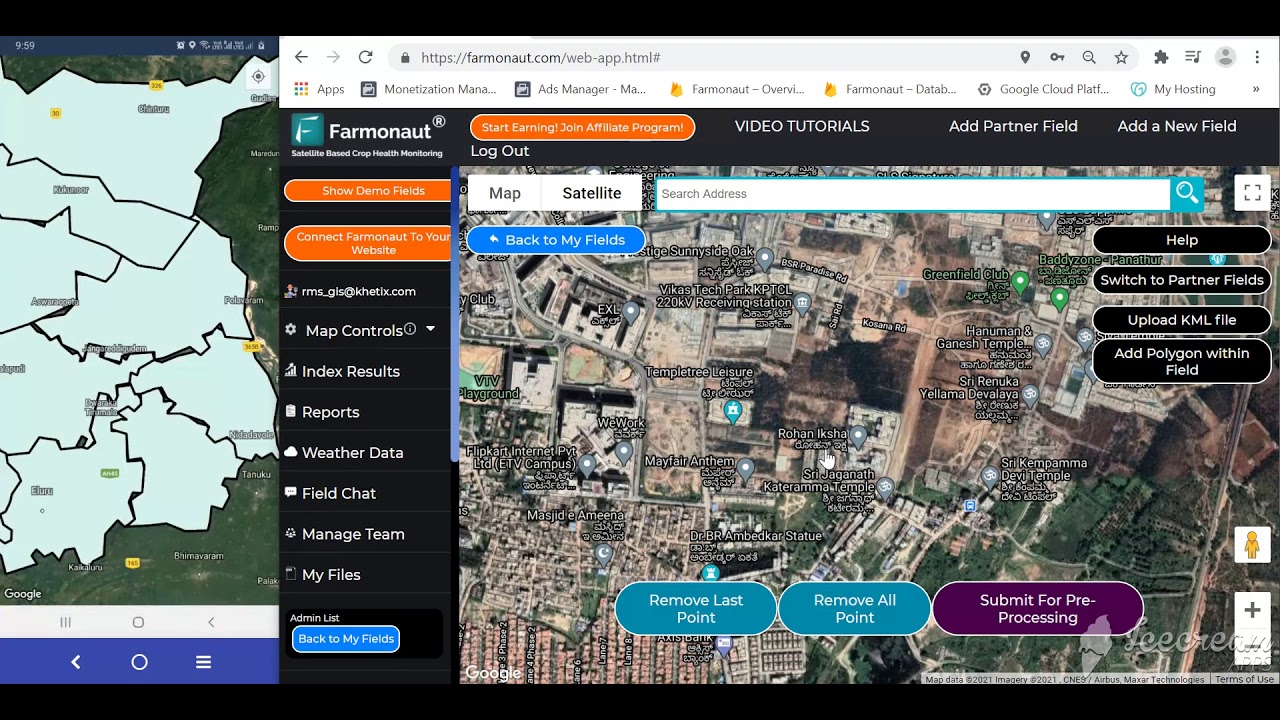
As a pioneering satellite technology company, we at Farmonaut provide satellite-driven insights for agriculture that complement agricultural drone images. Our platform, available on web, Android, and iOS, delivers real-time crop monitoring, AI-based advisory, blockchain traceability, and resource management solutions for users—including individual farmers, businesses, and governments globally.
Our satellite-based services are especially powerful when combined with drone imagery, providing both broad, frequent overviews and granular, highly localized field data. We help our clients make critical decisions in crop health, soil management, water use, and sustainable farming practices, at a fraction of the cost of traditional monitoring systems.
For developers and agri-tech businesses, we offer robust API access, enabling easy integration of our satellite and weather data into third-party applications. Detailed guidance can be found in our API Developer Documentation.
Those with larger operations or government-scale projects rely on our Large Scale Farm Management tools for seamless oversight of extensive tracts, and our blockchain-based traceability platform to guarantee supply chain transparency. Partnerships with financial institutions allow us to support satellite-based crop loan verification and insurance, reducing fraud and opening new opportunities for farmers.
To drive sustainable practices, our environmental impact monitoring solutions assist users in tracking carbon emissions and planning interventions that lower total environmental impact.
At Farmonaut, we are committed to making satellite and advanced imagery accessible, affordable, and impactful—empowering businesses, users, and governments to thrive in the data-driven era of agriculture.
Frequently Asked Questions (FAQs) on Agricultural Drone Images & Price Range 2026
-
What types of imaging are most effective for monitoring crop health?
The most effective types are multispectral and thermal sensors. RGB cameras offer visual imagery, but multispectral and thermal imaging detects invisible stress factors—such as water deficiency, pests, or disease—before they manifest visually.
-
How does the agricultural drone price range compare in 2026 versus previous years?
Prices have become more accessible in 2026, with entry-level models around $2,000, mid-range around $6,000–$14,000, and high-end models between $15,000–$25,000+. Enhanced technology now comes at a lower cost per feature, making drones viable for smaller farms as well.
-
Can drone images be integrated with satellite and sensor networks?
Absolutely. Modern farm management platforms (like Farmonaut) allow seamless integration—drone images, satellite data, and IoT soil/weather sensors can all be viewed and analyzed together in one dashboard.
-
What about legal and environmental considerations when using drones?
Operators should comply with aviation and agricultural regulations for drone use, spraying, and data privacy in their locales. Most countries require registration of drones above specific weights and adherence to no-fly zones near sensitive areas.
-
Do I need additional training to operate agricultural drones equipped with advanced sensors?
While user-friendly software has lowered technical barriers, responsible use of advanced drones—including for spraying—often requires operator training or certification as per national guidelines.
-
Can I access Farmonaut insights via API?
Yes! You can integrate Farmonaut’s satellite data into custom apps or analytics pipelines via our API and Developer Docs.
Conclusion: Choosing the Right Agricultural Drone Solution
Agricultural drone images, advanced sensors, and AI-powered data platforms are revolutionizing farm management and precision agriculture in 2026. As the range of models, use cases, and price points expands, stakeholders must focus on choosing solutions that match their operational scale, data needs, and integration preferences. By understanding sensor technology, flight autonomy, and cost factors, farms can maximize returns and drive efficiency, sustainability, and resilience into the next decade.
We at Farmonaut remain dedicated to providing accessible, affordable, and cutting-edge satellite solutions that empower users at every step of the agri-value chain—complementary to aerial drone imagery and poised to deliver the next generation of agricultural intelligence globally.

 Godrej Agrovet
 Hayleys Agriculture
 Linx Agritech
 Adinet
 Save Your Soils
 GalaxEye Space
 Grandstream Algérie
 XOS Realty
 Geospatial Lab Africa
 Agro La Gándara
 HIPSAC
 ZOL Zimbabwe
 Juligerm
 AdBio
AdBio MISE Maroc
 NWNS
NWNS Red August Group
 Farm Inc
 WeMe Global
 Agrotoken
 Blue BearX
 Insignito
 DnCubed
 Indosistim Teknologi
 Liquify Digital
 CU Foods
 BeyondTech Global
 Rouge VC
 AgroRisk
 Oath Inc
 Esri North East Africa
 MDCV UK
 Etech Consulting Madagascar
 Vestlandsforsking
 WB Dev
 Sama Premium
 Tres Valles
 Blickwinkel
 Agricultural Credit Policy Council
 eKGIS
eKGIS Mostas Tech
 Andex
Andex Deluxe Conseil
 WICO
WICO Chimera Innovation
 SkyHarvest
 Teledarbas
 Exurbia Geospatial
 FieldZero
