

Amazon Deforestation Map: 2026 Update & Key Solutions
Amazon Deforestation in 2026: A Pressing Environmental Challenge
The Amazon rainforest, often referred to as the “lungs of the Earth“, plays a critical role in regulating global climate, supporting biodiversity, and sustaining numerous indigenous and local communities. However, deforestation in the Amazon remains a pressing challenge as we move into 2026, with profound implications for agriculture, forestry, minerals extraction, and infrastructure development.
Primarily driven by human activities such as logging, mining, cattle ranching, and agricultural expansion, deforestation continues to cause irreversible damage to one of the world’s most vital ecosystems. The rapid loss of forest areas poses significant environmental and social upheavals across Brazil, Peru, Bolivia, and beyond.
Despite increased global awareness, the rate of Amazon deforestation continues to accelerate in 2025 and is projected to rise in 2026. Modern satellite monitoring and AI-driven mapping offer powerful new tools to understand and combat this loss.
- Biodiversity at Risk: The Amazon harbors over 10% of the world’s known species, but deforestation significantly reduces habitat and fragments vital ecosystems.
- Greenhouse Gas Emissions: Forest clearing increases emissions, accelerating global climate change.
- Socio-Environmental Disruption: Indigenous and local communities, whose livelihoods depend on the forest, face increasing marginalization.
Why the Amazon Matters Globally
- Carbon Sink: The Amazon stores more than 120 billion tons of carbon, regulating the Earth’s climate.
- Ecosystem Services: It maintains water cycles vital for agriculture even beyond South America.
- Medicinal Diversity: Many pharmaceuticals originate from the biodiversity of the rainforest.
Amazon Deforestation Map 2026: The Power of Satellite Mapping
Understanding the scope and patterns of deforestation requires detailed, up-to-date maps. The map of deforestation in the Amazon for 2025 and the projected 2026 update are now generated using advanced remote sensing technology, AI analysis, and a network of ground-level observations.
Satellite imagery and AI mapping solutions enable the visualization of hotspots like deforestation frontiers in Brazil’s Mato Grosso and Pará, Peru’s Madre de Dios, and critical zones in Bolivia.
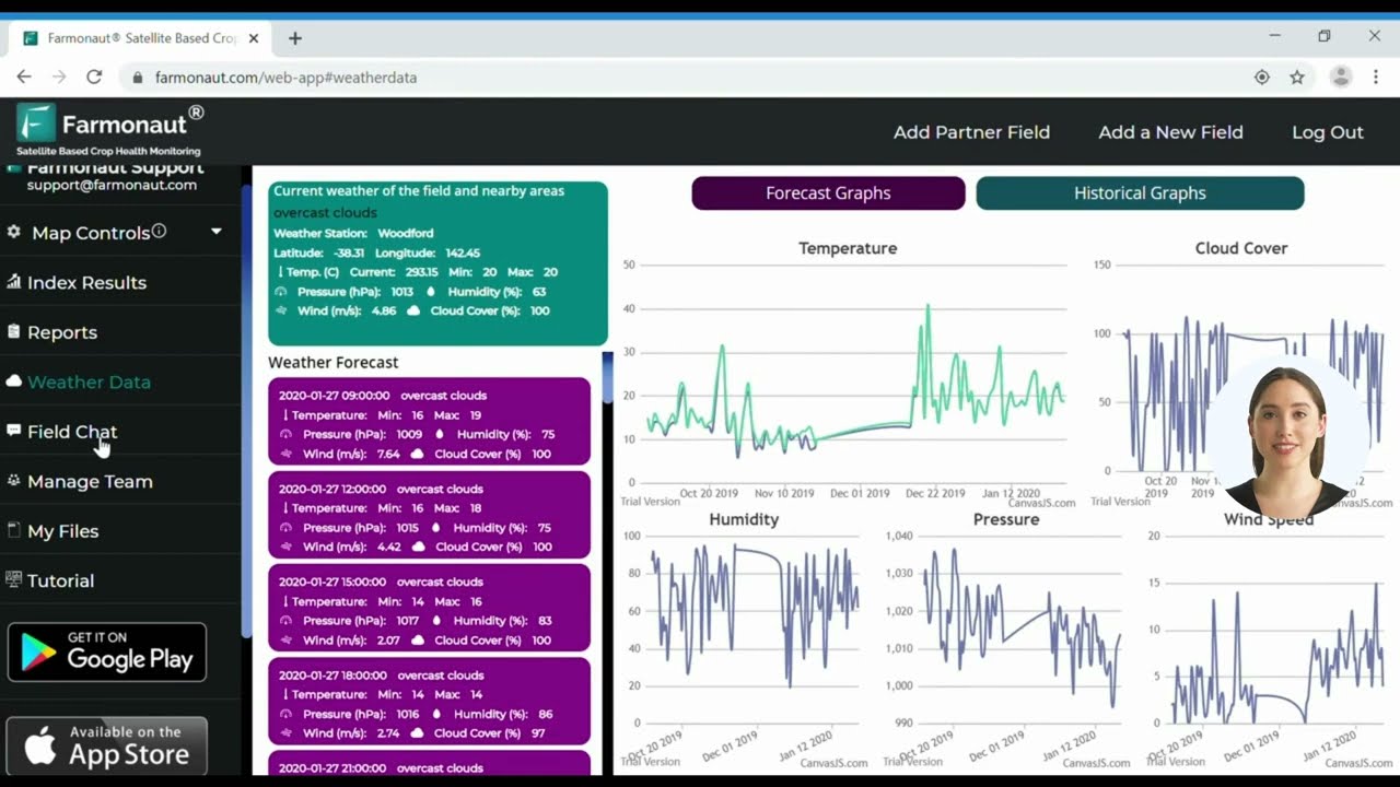
How Deforestation Maps are Created in 2025–2026
- Data Acquisition: Multispectral satellite images capture changes in forest cover at high resolution.
- AI Analysis: Algorithms classify land cover and identify deforested patches, even detecting illegal activities early.
- Trend Visualization: Mapping tools display deforestation hotspots, expansion fronts, and help prioritize conservation efforts.
- Real-Time Updates: Frequent data cycles provide up-to-date visualizations, enabling fast policy intervention.
When analyzing deforestation maps, always cross-reference satellite data with local field reports or trusted databases for higher accuracy and actionable insights.
Key Drivers of Amazon Deforestation: 2026 Landscape
The relentless expansion of deforestation in the Amazon is primarily fueled by a set of human-driven activities. Knowing these allows for more focused and effective conservation strategies.
1. Agriculture & Cattle Ranching (Including Soybean Cultivation)
- Agricultural expansion is a major driver, especially soybean plantations promoted for export markets.
- Cattle ranching requires extensive land, resulting in massive forest loss and altering soil composition, increasing greenhouse gas emissions, and disrupting water cycles.
2. Logging: Legal & Illegal Timber Extraction
- Timber extraction (both legal and illegal) is a key contributor, often unmanaged, causing habitat fragmentation.
- Demand for valuable hardwoods like mahogany drives illegal logging that fuels challenges for forest governance.
3. Mining & Extraction of Minerals
- Mining operations, especially for gold and rare minerals, often result in clearing vast tracts of the Amazon, contaminating waterways with mercury, and causing significant soil erosion.
- Socio-environmental impacts include disruption of indigenous communities and local ecological balance.
4. Infrastructure Development
- Road construction and hydroelectric dam projects increase forest accessibility, often leading to illegal logging, further land clearing, and floods that disrupt river ecosystems.
- Infrastructure expansion exacerbates deforestation by opening new frontiers for settlement and economic activity.
Mining and infrastructure projects in the Amazon carry high reputational and regulatory risks. Investors should prioritize environmentally sound practices and demand robust monitoring systems to minimize long-term liabilities.
Yearly Amazon Deforestation & Drivers Breakdown Table (2022–2026)
The following table summarizes recent and projected Amazon deforestation trends, its main drivers, and key monitoring solutions—all essential for understanding and mitigating forest loss in 2026 and beyond.
| Year | Estimated Deforested Area (sq km) | Primary Driver | % Contribution (Logging, Mining, Agriculture, Infrastructure) |
Key Solution/ Monitoring Action Implemented |
|---|---|---|---|---|
| 2022 | 9,100 | Agriculture (Soybean, Cattle) |
Agriculture: 61% Logging: 21% Mining: 11% Infrastructure: 7% |
Initiated stricter anti-illegal-logging enforcement, early AI satellite mapping rollouts |
| 2023 | 9,400 | Agriculture, Logging |
Agriculture: 59% Logging: 23% Mining: 13% Infrastructure: 5% |
Expanded community-based surveillance, REDD+ incentive scaling |
| 2024 | 10,000 | Agriculture, Mining |
Agriculture: 58% Logging: 19% Mining: 15% Infrastructure: 8% |
Rollout of stricter mining regulations, adoption of satellite-driven carbon footprint monitoring (learn more) |
| 2025 | 10,200 | Agriculture, Logging, Mining |
Agriculture: 56% Logging: 21% Mining: 17% Infrastructure: 6% |
Advanced blockchain traceability in supply chains (what’s new?), real-time AI-based satellite surveillance |
| 2026* | 10,500† | Agriculture, Mining, Infrastructure |
Agriculture: 53% Logging: 20% Mining: 19% Infrastructure: 8% |
Expanded regulatory enforcement, AI-driven hydrocarbon monitoring, collaborative mapping tools, scaled-up conservation investment |
* Estimated/projection | † Based on trends and satellite data through early 2026
Many analyses underestimate secondary impacts of deforestation, such as increased soil erosion and altered water cycles, by focusing only on primary causes.
Environmental Impacts of Deforestation: Biodiversity, Climate and Community Effects
The environmental consequences of Amazon deforestation reach far beyond lost trees. They trigger a sequence of direct and indirect implications on biodiversity, climate regulation, indigenous communities, and the global economy.
Loss of Biodiversity & Ecosystem Services
- Habitat fragmentation: Deforestation divides once continuous landscapes, threatening unique species and increasing extinction risk.
- Disrupted water cycles: Forest loss alters evaporation, rainfall and river flows—impacting agriculture and human health.
Impact on Climate & Greenhouse Gas Emissions
- Carbon emissions: Each year, Amazon deforestation contributes hundreds of millions of tons of CO2 released to the atmosphere.
- Reduced carbon sink capacity: Shrinking forests mean less carbon absorption, amplifying global warming.

Threats to Indigenous and Local Communities
- Many indigenous groups rely on intact forests for food, shelter, medicine, and cultural identity. Encroachment disrupts their traditional ways of life.
- Deforestation increases land conflicts, exposes communities to health risks from pollutants, and leads to social marginalization.
The Amazon’s diverse ecosystems are responsible for stabilizing half of South America’s rainfall—underpinning global food security.
Key Solutions for Monitoring & Protecting the Amazon (2026 Update)
The fight against Amazon deforestation is multi-layered, demanding science-based strategies and robust policy tools. Sustainable agriculture, regulating forestry and mining, smart infrastructure planning, and community engagement are all central to success.
Sustainable Agriculture and Agroforestry
- Agroforestry: Combining tree crops with annual food production (integrated systems) helps maintain soil composition and increases biodiversity.
- Carbon farming: Incentivizing carbon-sequestering practices through monitored carbon footprint solutions (see Farmonaut Carbon Footprinting).

Forestry Regulations & Traceability
- Blockchain-based traceability: Monitoring legal wood and agricultural supply chains to reduce illegal activities. Explore Traceability solutions by Farmonaut.
- Community-based forest management: Empowering indigenous and local communities with digital tools for surveillance and rapid reporting.
Mining Oversight & Rehabilitation
- Regulating mining operations: Technology-driven solutions (satellite monitoring, AI assessment) to monitor active extraction sites.
- Site rehabilitation: Restoration of abandoned mining zones with native vegetation and reestablishment of hydrological balance.

Infrastructure Planning & Environmental Assessment
- Strategic Environmental Assessments (SEAs): High-level planning to reduce forest loss from road and hydroelectric expansions
- Improved monitoring of hydropower impacts: Integration of fleet management tools by Farmonaut for better logistics and emission tracking.
The Transformative Role of Satellite Monitoring & AI in Amazon Conservation
Modern technology now sits at the heart of Amazon rainforest conservation. Satellite-based monitoring solutions—leveraging multispectral imagery, AI-driven analytics, and blockchain for transparency—offer reliable, scalable tools for detection, enforcement, and public engagement.
- ✔ Real-time alerts: Early warning systems for illegal deforestation, mining, or road building activities
- ✔ Data democratization: Apps and APIs enable governments, local stakeholders, and NGOs to take part in conservation efforts
- ✔ Carbon monitoring integration: Satellite measurement of forest carbon stocks for carbon credits and REDD+ schemes
- ✔ Supply chain verification: Blockchain systems support transparency for customers and regulatory agencies

Visual List: Top Amazon Conservation Tools Used in 2025–2026
- 🌍 Multispectral Satellite Mapping (NDVI, NIR, Red-Edge) for vegetation and soil monitoring
- 🤖 AI-driven Analytics for change detection and illegal activity flagging
- 🔗 Blockchain-based Traceability for transparent supply chains
- 🚦 Automated Alerts for regulatory authorities and local communities
- 📡 Mobile/ Web Apps to enable real-time user engagement
Farmonaut provides advanced satellite monitoring tools for agriculture, mining, and infrastructure in the Amazon Basin. Our AI and blockchain-powered solutions empower effective conservation and regulatory compliance.



Access Farmonaut’s Amazon Deforestation API for real-time integration and insights.
Developer Documentation for Farmonaut API
Future Trends for Amazon Deforestation Monitoring: 2026 and Beyond
- AI-Powered Decision Making: Increasingly, policymakers and NGOs turn to AI-generated deforestation maps for designing interventions.
- International Transparency: Global pressure, public dashboards, and satellite data sharing are likely to boost accountability.
- Indigenous Leadership: Indigenous-managed protected areas will gain importance—technology tools and partnerships will enhance their impact.
- Expansion of REDD+ and Carbon Credits: Payment-for-preservation models (like REDD+) reward communities for protecting forest carbon stocks.
- Smart Financing: Financial institutions are expected to rely on satellite-based verification for crop loans and insurance (more details here).
- Always use up-to-date Amazon deforestation maps for strategic planning.
- Cross-verify satellite data with independent audits for mining and logging permits.
- Implement blockchain-based traceability for all forest product chains.
- Regularly update policy tools to account for shifting deforestation hotspots.

Farmonaut’s Satellite Solutions for Amazon Deforestation Monitoring
As a pioneering satellite technology company, Farmonaut delivers cost-effective, scalable monitoring solutions across agriculture, mining, and infrastructure. Our mission is to make satellite insights accessible and actionable for government agencies, businesses, and individual land stewards.
- ✔ Satellite-Based Monitoring: Frequent imagery and NDVI analysis for detecting forest and crop changes
- ✔ Jeevn AI Advisory System: Real-time advisories for mining and agricultural sites based on environmental and operational data
- ✔ Blockchain-Based Traceability: Secure supply chain tracking in agriculture and mining
- ✔ Fleet & Resource Management: Tools for coordinating logistics, reducing emissions, and optimizing asset usage
- ✔ Environment Impact Monitoring: Real-time carbon and environmental footprint calculations (explore now)
Our platform is available as a web and mobile app—accessible anywhere, anytime—with a simple subscription model:
Key benefits:
- ✔ Affordable access to satellite and AI technology
- ✔ Improved monitoring of deforestation and mining activities
- ✔ Enhanced transparency for resource and supply chain management
- ✔ Reliable compliance support for regulatory and financial applications

Farmonaut’s Tech Portfolio at a Glance
- 🛰️ Satellite Image Analytics
- 🌱 Crop, Plantation, and Forest Monitoring Advisory (see how it works)
- 🔄 Supply Chain Traceability
- 🚜 Large-Scale Farm Management (for big operators)
- ⛽ Fleet Management (learn more)
Frequently Asked Questions (FAQ) on Amazon Deforestation and Mapping
Agricultural expansion—especially soybean cultivation and cattle ranching—remains the leading cause, though mining, logging (including illegal activities), and infrastructure growth are increasingly significant contributors.
Maps generated from satellite and AI provide real-time, location-specific data on forest loss, supporting targeted policy action, enforcement, and community engagement.
Advanced satellite-based monitoring apps, blockchain systems for traceability, and AI advisory platforms offer comprehensive insights into deforestation activities and their impacts.
Blockchain traceability solutions (as offered by Farmonaut) can ensure wood and agricultural products are sourced legally, supporting sustainable markets and reducing financial incentives for illegal clearing.
Yes. Farmonaut provides cost-effective, scalable platforms—including mobile and API options—making satellite-driven monitoring accessible to everyone.
Conclusion: Protecting the Amazon for the Future
The Amazon rainforest is vital for Earth’s climate stability, supporting rich biodiversity, and sustaining millions of people. Amazon deforestation—driven by agriculture, logging, mining, and infrastructure—remains a major environmental challenge in 2026. However, the evolution of satellite mapping, AI analytics, and blockchain traceability marks a turning point.
- ✔ Stricter regulations and conservation investment are now guided by real-time data and precise maps.
- ✔ Sustainable agricultural practices like agroforestry are gaining traction to balance productivity with conservation.
- ✔ Transparent supply chains backed by blockchain protect forests and markets.
- ✔ Farmonaut’s suite of solutions equips government, businesses, and individuals for effective forest management, compliance, and climate action.
As 2026 and beyond bring even greater data-driven capabilities, sustained collaboration and the responsible use of technology will be central to protecting the Amazon for future generations, stabilizing the global climate, and supporting thriving local communities.
Ready to monitor, analyze, and act for Amazon conservation? Explore our apps and API, or subscribe for real-time satellite solutions today.

 Raketla
 Polaris Digitech
 Teledarbas
 Wild Oak Farm
 SFX
SFX BACF Africa
 Doodlakine
 Exurbia Geospatial
 FieldZero
 Indico Company
 Kubota
 FFBS
FFBS Jontra
 Tucor
Tucor
