

Forests · Brazil evidence guide
Solutions to Deforestation in the Amazon: 7 With Evidence
Brazil’s Legal Amazon lost 5,731 km² of forest from August 2024 to July 2025, 12% less than a year earlier (INPE PRODES). Measures with evidence from Brazil: satellite alerts with fines, more cattle per hectare, clean soy and beef chains, the Forest Code, land rights and forest finance.
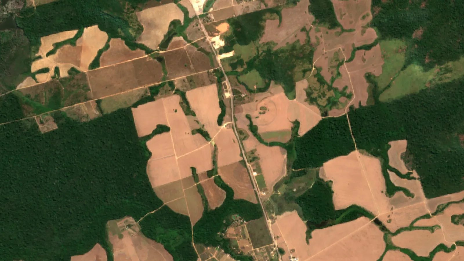
Key takeaways
- PRODES clearing in the Legal Amazon fell from 9,064 km² (Aug 2022-Jul 2023) to 6,518 km² (2024 rate) and 5,731 km² for Aug 2024-Jul 2025 (INPE consolidated rates).
- DETER alerts covered 2,874 km² from August 2025 to July 2026, 36% less than a year earlier and the lowest in the series that began in 2016 (Ministry of the Environment, 2026).
- Pasture was the first use of more than 90% of cleared Amazon land in each year from 1987 to 2020 (MapBiomas), so more cattle per hectare on existing pasture is a key lever.
- Tools with measured results: satellite-led enforcement (AEJ, 2023), the Soy Moratorium while it ran, which cut soy expansion via forest from 30% to about 1% in 2006-2014 (Science, 2015), and full Indigenous land rights (PNAS, 2020).
- Risks remain: the main soy traders left the moratorium in 2026, and Mato Grosso’s clearing rose 27% in 2025 (INPE).
In this article
- Solutions to deforestation in the Amazon at a glance
- How fast is Brazil losing Amazon forest?
- What drives Amazon deforestation in Brazil
- 1. Satellite alerts tied to fast enforcement
- 2. Raise cattle output on land already cleared
- 3. Integrated crop-livestock-forest systems and agroforestry
- 4. Make soy and beef supply chains deforestation-free
- 5. Enforce the Forest Code and the rural land registry
- 6. Secure Indigenous lands and designate public forest
- 7. Pay to keep the forest standing
- How to choose the right mix of solutions
- What farmers and ranchers can do
- Where Amazon clearing is concentrated
- Limits and open risks
Brazil cut clearing in its Legal Amazon to 5,731 km² in the year from August 2024 to July 2025, 12% less than the year before, according to the INPE note on the consolidated PRODES 2025 rate. The main solutions to deforestation in the Amazon are well known, and several have measured results in Brazil: satellite alerts tied to fines, more cattle on land already cleared, buyer rules for soy and beef, the Forest Code, secure Indigenous land and money that rewards standing forest.
This guide explains seven of them with dated numbers from Brazil’s official monitoring systems and peer-reviewed studies. It shows where clearing still happens, state by state, and gives ranchers a calculator to test how much pasture a higher stocking rate could free up. For a wider, non-Amazon view, see our guide to deforestation prevention methods.
Solutions to deforestation in the Amazon at a glance
The table sums up the seven solutions. Each has its own section below with the source behind it.
| Solution | Driver it tackles | Evidence from Brazil | Who acts |
|---|---|---|---|
| 1. Satellite alerts | Illegal clearing that goes unseen | DETER-led enforcement curbed clearing (AEJ, 2023) | INPE, IBAMA, states |
| 2. More cattle per hectare | Pasture expansion | Pasture productivity at 32-34% of potential (Strassburg et al., 2014) | Ranchers, lenders |
| 3. Crop-livestock-forest | Low-value, degraded land | About 17 million ha of integrated systems, 2020/21 (Embrapa) | Farmers, Embrapa |
| 4. Clean supply chains | Soy and beef from cleared land | Soy expansion via forest fell from 30% to about 1% while the soy moratorium ran (Science, 2015); traders left it in 2026 | Traders, meatpackers, importers |
| 5. Forest Code and CAR | Clearing inside private farms | 80% legal reserve on forest land (Law 12,651 of 2012) | Landowners, states |
| 6. Land rights | Land grabbing on public land | About 75% less clearing at the edge of homologated territories (PNAS, 2020) | Federal government |
| 7. Pay for forest | Low value of standing forest | Average Amazon Fund approvals up from about R$300 million to R$1.3 billion a year, inflation-adjusted (MMA, 2026) | Funders, BNDES |
How fast is Brazil losing Amazon forest?
Brazil measures clearing in two ways. PRODES gives the official yearly rate for the nine states of the Legal Amazon. Its year runs from 1 August to 31 July, so “PRODES 2025” means August 2024 to July 2025. It counts clear-cuts larger than 6.25 hectares so the series stays comparable back to 1988. DETER is a faster alert system that flags new clearing for the enforcement teams.
The latest official figures show a steady fall. The PRODES 2024 consolidated rate was 6,518 km², 28% lower than the 9,064 km² of 2023, according to the INPE technical note on the consolidated 2024 rate. The consolidated rate for 2025, published in February 2026, is 5,731 km², 12% lower again and about 1% below INPE’s first estimate of 5,796 km² from October 2025. For comparison, INPE reported 10,851 km² for PRODES 2020.
The longer story matters too. Brazil’s federal action plan says the rate fell by 83% between 2004 and 2012, reaching about 4,500 km² in 2012, the lowest on record, before rising again in the late 2010s. That earlier fall came from the same tools this guide covers: monitoring, enforcement and pressure on buyers.
DETER alerts for the following year point the same way. Alerts in the Amazon covered 2,874 km² from August 2025 to July 2026, 36% less than the year before and the lowest since the DETER series began in 2016, according to the Ministry of the Environment’s DETER release of August 2026. Alerts are not the official rate; the PRODES figure for that year is due later.
Independent tree-cover data agree. In the WRI Global Forest Review (2026), Brazil’s primary forest loss fell 42% in 2025, and loss not caused by fire was the lowest on record. Brazil still lost more tropical primary forest than any other country, because its forest is so large.
Chart
PRODES clearing rate in the Legal Amazon
km² per PRODES year (August to July), consolidated rates for selected years; 2021 and 2022 not shown
What drives Amazon deforestation in Brazil
Cattle pasture is the main end use of cleared land. MapBiomas found that pasture was the first use of more than 90% of the area cleared in the Amazon biome in each year from 1987 to 2020. Pasture area grew by 46.3 million hectares, or 363%, between 1985 and 2023, and covered 14% of the biome in 2023 (MapBiomas Collection 9 Amazon factsheet, 2024).
Global Forest Watch data tell the same story for primary forest. Permanent agriculture, mainly soy and cattle, caused 73% of Brazil’s primary forest loss from 2002 to 2025, according to WRI.
Land grabbing adds a second motive. Brazil’s action plan, PPCDAm, notes that the Amazon has 101 million hectares of undesignated public land and that 32.5% of the 2022 clearing happened on it. In these areas, clearing forest and placing cattle on it is often used to claim the land. The plan also lists roads as a driver: the clearing front moved along highways such as BR-163, BR-230, BR-319 and BR-364.
Fire and drought are a growing third factor. Fires set to clear land can escape into standing forest, and the dry years of the last decade have made forests easier to burn.
1. Satellite alerts tied to fast enforcement
Best for: governments and agencies that need to stop illegal clearing quickly.
Chart
DETER deforestation alerts by state
km² under alert, August 2025 to July 2026, the six states with most alert area
DETER turns satellite images into near-real-time alerts and sends them to the federal environment agency, IBAMA, and other teams. The result is a field visit, a fine or an embargo on the cleared area while the clearing is still fresh. Enforcement became much more targeted once alerts arrived within days instead of a year later.
The effect has been measured. A study in the American Economic Journal (2023) by Assunção, Gandour and Rocha used cloud cover, which blocks DETER, as a natural experiment and found that monitoring and enforcement curbed deforestation. The working paper version estimated that cutting enforcement in half would raise clearing in a municipality by about 44%.
Enforcement has stepped up again since 2023. WRI reports that IBAMA issued 81% more violation notices and 63% more fines in 2023-2025 than in 2020-2022, after the government relaunched the PPCDAm plan, which coordinates 19 federal agencies.
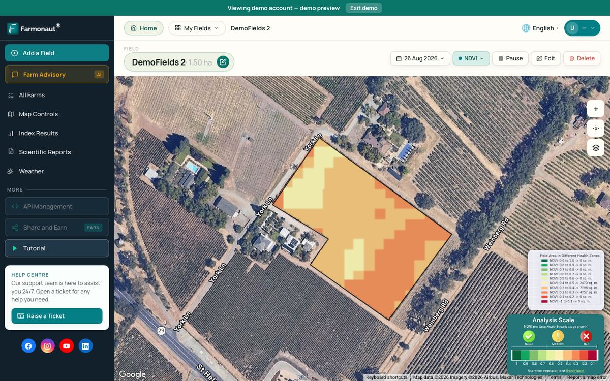
Satellites show where the forest changed, not who cleared it or why. That is why alerts work only when they are linked to land records, field teams and courts. Governments, companies and large landholders that need large-scale monitoring of many sites use the same kind of satellite change maps.

▶ How satellite NDVI maps show changes in plant cover, here used to spot crop stress across a large farm. · 4:09
2. Raise cattle output on land already cleared
Best for: ranchers, lenders and states with large areas of low-yield or degraded pasture.
Because most cleared land ends up as pasture, the biggest farm-level lever is to produce more beef on the pasture Brazil already has. A study in Global Environmental Change by Strassburg and colleagues (2014) found that Brazil’s cultivated pastures were producing at 32-34% of their potential. Raising that to 49-52% would meet demand for meat, crops, wood and biofuels until at least 2040 without clearing more natural land.
There is plenty of room. The PPCDAm plan cites Embrapa estimates of about 15 million hectares of degraded pasture in the Amazon that could be recovered. Practical steps include soil testing and liming, better forage grasses, rotational grazing, fencing, water points and herd records.
Higher output does not spare forest on its own. If beef becomes more profitable, some ranchers may clear more. Intensification works best when credit and buyer contracts are linked to a no-clearing rule and to the Forest Code.
Use the calculator below with your own herd and stocking rates. It also checks how much of your property you may legally use under the Forest Code reserve rule.
Try the numbers for your own farm below.
Calculator
How much pasture could a higher stocking rate free up?
Enter your own herd, stocking rates and property size.
- Pasture needed at current rate: 500 ha
- Pasture needed at target rate: 333 ha
- Most area you may use outside the reserve: 400 ha
- Usable area left at target rate: 67 ha
Example values only, not a benchmark or a forecast; every number is your input. A negative ‘usable area left’ means the herd at your target rate needs more pasture than the law lets you use outside the reserve. The legal reserve share is an input: the Forest Code (Law 12,651 of 2012) sets 80% for properties in forest areas of the Legal Amazon, 35% in cerrado areas and 20% in general fields. The ‘usable area’ line ignores riverbank and other protected areas, so the real figure is lower. A higher stocking rate needs better pasture, feed and water.
3. Integrated crop-livestock-forest systems and agroforestry
Best for: farms with degraded pasture that want more income per hectare and more trees.
Integrated systems combine crops, livestock and trees on the same land, either at the same time or in rotation. In Brazil they are called ILPF. Soy or maize can be grown for a season to pay for pasture renovation, and rows of eucalyptus or native trees give shade, timber and carbon.
Embrapa estimates that integrated systems covered about 17 million hectares in Brazil in the 2020/2021 season and could expand to 48 million hectares, largely on degraded pasture. Agroforestry with cocoa, açaí or Brazil nut trees is another route that keeps tree cover on smaller farms.
These systems need more skill, labour and planning than a single crop or open pasture. They pay off when the farm has advice, markets for each product and access to credit.

▶ The benefits and costs of mixing crops and livestock on one farm, the basis of integrated crop-livestock systems. · 2:55
4. Make soy and beef supply chains deforestation-free
Best for: traders, meatpackers, supermarkets and importers.
Chart
Share of new Amazon soy area that came from forest
Percent of soy expansion in the Amazon biome through deforestation, before and after the 2006 moratorium
The Amazon Soy Moratorium is the best-known example, although it no longer binds traders (see below). From 2006, major traders agreed not to buy soy grown on Amazon land cleared after a cut-off date. A study led by Holly Gibbs and published in Science (2015), covering 2006 to 2014, found that before the moratorium about 30% of soy expansion in the Amazon came through deforestation; afterwards only about 1% did. Soy area still grew by 1.3 million hectares, on land that was already cleared, as the UW-Madison summary of the study explains.
The same study found weak points. Many farmers who respected the moratorium still broke the Forest Code by clearing for other uses, and only 2% of the soy farmers studied kept their full legal reserve.
Beef is harder to trace. Calves are often born on one ranch, raised on another and fattened on a third before slaughter. Brazil’s action plan estimates that about 12% of cattle sold directly to meatpackers in Mato Grosso and Pará came from properties with evidence of illegal clearing, and the share is higher once indirect suppliers are counted. Animal-transport records linked to farm maps and supply-chain traceability tools can close part of this gap.
The moratorium has now ended in practice. WRI reports that Rondônia, Maranhão and Mato Grosso removed tax incentives for companies in the agreement, and that in early 2026 major soy traders announced plans to withdraw. They did: Abiove, which represents Cargill, ADM, Bunge, Louis Dreyfus and COFCO, left in January 2026, Amaggi and Glencore also left, and by July 2026 no company was listed as a signatory, according to Mongabay (2026). Its 2006-2014 record shows what a buyer rule can do, but it no longer binds traders. The levers that still apply to soy are the Forest Code, checks against the rural land registry (CAR) and rules in importing markets, such as the EU deforestation regulation, which ask buyers to show that products do not come from recently deforested land.
5. Enforce the Forest Code and the rural land registry
Best for: landowners, state environment agencies and banks that check borrowers.
The Forest Code (Law 12,651 of 2012) requires every rural property in the Legal Amazon to keep native vegetation as a legal reserve, with some exceptions set in the law: 80% of the property in forest areas, 35% in cerrado areas and 20% in general fields. Owners must also protect riverbanks, springs and steep slopes.
Each property must be mapped in the Rural Environmental Registry, called CAR. The registry makes farm boundaries public, so satellite alerts can be matched to a property. Registration alone is not enough. The PPCDAm plan reports that about half of the clearing PRODES recorded in 2022 happened inside properties listed in CAR. The registry needs checking, and owners with a reserve deficit need a clear path to restore it.
For a farmer, compliance comes down to three steps: map the property, check the reserve and riverbank areas against the law, and restore or compensate any shortfall under the state programme.
6. Secure Indigenous lands and designate public forest
Best for: federal and state governments.
Secure land rights reduce clearing. A study in PNAS by Baragwanath and Bayi (2020) looked at Indigenous territories in the Brazilian Amazon from 1982 to 2016. Once a territory was homologated, the final legal step that grants full property rights, clearing near its border dropped by about 2 percentage points, roughly a 75% fall from a baseline of around 3%. Territories without full rights showed no such effect.
The same logic applies to undesignated public forest. Turning it into protected areas, Indigenous territories or sustainable-use reserves removes the incentive to clear in order to claim the land. Community forest management and non-timber products such as açaí and Brazil nuts give local people income from standing forest.
7. Pay to keep the forest standing
Best for: national governments, donors and investors.
The Amazon Fund, managed by Brazil’s development bank BNDES, pays for projects that prevent clearing, support enforcement and restore land. A Ministry of the Environment presentation from August 2026 says average yearly project approvals rose from about R$300 million in 2009-2018 to about R$1.3 billion in 2023-2026 (inflation-adjusted, with 2026 counted to August). It lists R$450 million from the fund for restoration in the “Arc of Restoration” programme, which recovers degraded land in protected areas and Indigenous lands, and legal reserves in settlements and on small farms.
Other tools pay landholders directly. Brazil’s Bolsa Verde programme pays low-income families in protected areas and settlements to conserve, and Brazil launched the Tropical Forest Forever Facility at COP30 as a proposed fund to reward tropical countries for keeping their forests. Carbon projects can add income where emission cuts are measured; tools for carbon footprinting help farms track their own emissions.
How to choose the right mix of solutions
No single solution stopped clearing in the Amazon. The fall from 2004 to 2012 came from several tools at once, and the fall since 2023 again combines enforcement, finance and policy. Use these questions to pick the right mix for a place or a business:
- Who is clearing, and on what land? On undesignated public land, land designation and enforcement come first. On private farms, the Forest Code, CAR checks and buyer rules matter most.
- What is the land used for after clearing? Where it becomes pasture, pasture productivity and cattle traceability are key. Where it becomes soy, the trader moratorium cut clearing from 2006 to 2014 but ended in 2026, so Forest Code and CAR checks and import rules such as the EU deforestation regulation now carry the load.
- Can clearing be seen and acted on quickly? Alerts are useful only when a team can reach the site or block the land remotely.
- Does the farmer gain from keeping forest? Credit, price premiums and payments help when the rules are also enforced.
What farmers and ranchers can do
Most solutions to deforestation in the Amazon depend on public action, but individual farms can do a lot:
- Map your property and check it against your CAR record, the legal reserve and the protected riverbanks.
- Measure stocking rate and pasture condition each season, and recover the weakest paddocks before opening new land.
- Keep animal-movement and purchase records so buyers can see that calves did not come from cleared land.
- Plant trees where the law requires restoration, and consider integrated systems on worn-out pasture.
- Watch your own fields and forest edges by satellite so you notice changes, fires or encroachment early.
Farmonaut’s satellite crop and pasture monitoring is available on the web and in the mobile app, and developers can add the same data to their own systems through the Farmonaut API and its developer documentation.

▶ Six plain steps to start precision farming, from field maps to satellite monitoring. · 4:18
Where Amazon clearing is concentrated
Clearing is not spread evenly. In the consolidated PRODES 2025 rate, Pará, Mato Grosso and Amazonas made up about 81% of the total. Eight of the nine states cut clearing compared with 2024. Mato Grosso was the only state where it rose, by 27%.
Chart
Clearing by state: 2024 vs 2025 rate
km² per PRODES year (August to July), the seven states with most clearing
Pará remains the largest source, with 2,064 km² in PRODES 2025, down 14% from 2024. Since the BR-163 highway was paved, the clearing front has moved from northern Mato Grosso into southern Pará, according to the PPCDAm plan.
Mato Grosso is a major soy and cattle state. Its rise in PRODES 2025 and its move against moratorium tax benefits make it the state to watch.
Amazonas, Acre and Rondônia meet in the AMACRO region, a newer frontier. MapBiomas reports that 13% of the Amazon’s net loss of native vegetation since 1985 happened there. The planned paving of BR-319 is linked to new clearing in southern Amazonas.
Limits and open risks
The recent gains could be reversed. The soy moratorium has lost its signatories since January 2026. Some Amazon states have passed laws that loosen state-level protection, according to WRI. Fire remains a threat in dry years, and degradation from logging and fire is not counted in the PRODES clear-cut rate. Enforcement budgets and political priorities can also change: after 2012, the federal plan lost its central place on the government agenda and clearing later rose.
The federal plan aims for zero deforestation by 2030. Reaching it will need the gains from enforcement to be matched by better incomes for farmers who keep their forest.
How we checked the numbers
We used INPE’s PRODES technical notes for the official annual rates and kept their August to July years. Estimates and consolidated figures are labelled. DETER alert totals come from the Ministry of the Environment and are not mixed with PRODES rates. Land-use shares come from MapBiomas, tree-cover loss from Global Forest Watch data published by WRI, and policy rules from the law itself and the PPCDAm plan. Study results are described for the period and area each study covered. Each source is listed at the end of the article.
For a closer look at a related question, see our guide: Argentina Silver Mines: Producers and Projects Compared.
FAQ
What are the main solutions to deforestation in the Amazon?
The measures with the strongest evidence in Brazil are satellite alerts linked to fines and embargoes, more cattle per hectare on existing pasture, soy and beef supply-chain rules, enforcing the Forest Code and the CAR registry, secure Indigenous land and designated public forest, and funds that pay to keep forest standing.
Is Amazon deforestation going down?
Yes, in recent years. The PRODES rate fell from 9,064 km² in 2023 to 6,518 km² in 2024, and to 5,731 km² in 2025. DETER alerts for August 2025 to July 2026 were the lowest since the series began in 2016. Fire and weaker state laws are risks.
What is the main cause of deforestation in the Brazilian Amazon?
Cattle ranching. MapBiomas found that more than 90% of cleared land was first used as pasture. Soy, land grabbing on public land, roads, fire and illegal mining add to it.
How do satellites help stop deforestation?
INPE’s DETER system spots new clearing within days and sends alerts to enforcement teams. A peer-reviewed study found that this monitoring, together with fines, curbed clearing. Satellites cannot say who cleared the land, so they work best with land records and field teams.
What can farmers do to help?
Keep the legal reserve, recover degraded pasture before opening new land, keep cattle records for buyers, plant trees where restoration is required, and monitor forest edges and fields regularly.
Does the Soy Moratorium still apply?
Not in practice. After Mato Grosso and other states removed tax incentives for its members, the traders’ association Abiove left in January 2026, and by July 2026 no company was listed as a signatory. The Forest Code and import rules such as the EU deforestation regulation still apply.
Farmonaut crop monitoring
See your own fields from space
Draw your fields and pasture once and Farmonaut shows satellite vegetation maps for them through the season, on web, Android or iOS.



Keep reading
Sources
- INPE, A taxa consolidada de desmatamento para os nove estados da Amazônia Legal para 2025 é de 5.731 km² (PRODES technical note, February 2026): data.inpe.br
- INPE, Taxa consolidada de desmatamento PRODES 2024 (technical note, 2025): data.inpe.br
- INPE, Estimativa PRODES 2021 technical note (includes the 2020 rate, 2021): gov.br
- Brazil Ministry of the Environment, Action Plan for the Prevention and Control of Deforestation in the Legal Amazon (PPCDAm), fifth phase 2023-2027: dados.mma.gov.br
- Brazil Ministry of the Environment, DETER data show lower deforestation alerts in the Amazon and Cerrado, 2025-2026 (August 2026): gov.br
- Brazil Ministry of the Environment, DETER annual data press presentation (August 2026): gov.br
- WRI Global Forest Review, Tropical rainforest loss slowed in 2025 (2026): gfr.wri.org
- MapBiomas, Amazon biome land cover and use factsheet 1985-2023, Collection 9 (2024): brasil.mapbiomas.org
- Assunção, Gandour and Rocha, DETER-ing Deforestation in the Amazon, American Economic Journal: Applied Economics (2023): aeaweb.org
- Climate Policy Initiative, DETERring Deforestation in the Amazon, Working Paper 003 (2019): climatepolicyinitiative.org
- Strassburg et al., When enough should be enough, Global Environmental Change (2014): ueaeprints.uea.ac.uk
- Embrapa, Integrated crop-livestock-forest (ICLF) portfolio: embrapa.br
- University of Wisconsin-Madison, Study shows Brazil’s Soy Moratorium still needed to preserve Amazon (2015): news.wisc.edu
- Mongabay, End of Brazil’s Soy Moratorium risks millions of hectares of Amazon rainforest: Study (28 July 2026): news.mongabay.com
- Brazil, Law 12,651 of 25 May 2012 (Forest Code): planalto.gov.br
- Baragwanath and Bayi, Collective property rights reduce deforestation in the Brazilian Amazon, PNAS (2020): pmc.ncbi.nlm.nih.gov
Discussion
Questions, corrections or field experience? Share them below. First-time comments are reviewed before they appear, and your email is never published.
No comments yet. Be the first to add a question or your experience.

 Delicio
 Payagri
 WB Dev
 Sama Premium
 Prochecker
 Tres Valles
 LACOS Geoinformation
 Pulsar Supernova
 Magrifly
 LatConnect 60
 WebsEdge
 Blickwinkel
 Agricultural Credit Policy Council
 MCSOD
MCSOD Marei Nursery
 eKGIS
eKGIS Mostas Tech
 Andex
Andex FCF India
 Unifrutti Gulf
 Deluxe Conseil
 Licence holder · Niger · Gold
 Licence holder · Nigeria · Gold + lithium










