

Topography Definition in Agriculture: Meaning & Key Factors
“Over 70% of soil erosion in agriculture is influenced by topography, especially slope and landform variations.”
- Topography Definition in Agriculture: Introduction
- Understanding Topography in Farming Systems
- Topography Factors and Their Impact on Sustainable Agriculture
- Topography, Drainage, and Soil Health
- Slope, Aspect & Elevation: Determining Crop Suitability
- Sediment, Erosion Risk & Topography Management
- Topography’s Role in Pest and Disease Control
- Agricultural Land Definition and Planning
- Techniques for Studying Topography in Agriculture
- How Farmonaut Enables Topography-Based Agriculture
- Strategies for Efficient & Sustainable Farming Based on Topography
- FAQs on Topography in Agriculture
- Conclusion
Topography Definition in Agriculture: Introduction
In the world of agriculture, understanding topography is fundamental to sustainable land management and successful farming. The topography definition in agriculture refers to the study and mapping of terrain—including both natural and man-made features on the land surface—which directly influence farming systems, crop choices, and resource management. These features encompass slope, shape, elevation, aspect, drainage patterns, soils, vegetation distribution, and relief, all of which interact to determine the suitability and productivity of agricultural operations.
Topography isn’t just about hills and valleys; it is a foundational concept for designing efficient, sustainable, and resilient farming practices. It defines where fields should be located, how water and nutrients move through a system, and sets the stage for soil conservation, drainage solutions, irrigation strategies, crop selection, and pest management.
Every farm is unique, shaped by its topography. No single solution exists for all terrains. By understanding local slopes, drainage patterns, and landscape relief, farmers can unlock increased soil fertility, productivity, and sustainability.

Understanding Topography in Farming Systems
The topography meaning in agriculture integrates not only relief (the physical highs and lows of the terrain), but also the intricate interactions between terrain, climate, soils, water, and human activities. When we start with relief, we look at valleys, plateaus, gentle slopes, and steep hills, and ask:
- How will water flow or stagnate across the land?
- Where will runoff increase erosion risk?
- How does aspect (slope direction) affect temperature, sunlight exposure, and microclimates within the farm?
- How does topography shape vegetation patterns and the suitability of crops?
- How should fields be designed for efficient water management and nutrient cycling?
“Proper land topography management can reduce water runoff by up to 50%, enhancing sustainable farming and soil conservation.”
Historically, topography guided the earliest farming settlements. Today, with advanced geo-mapping and satellite solutions, we have greater precision than ever before. Modern farmers and land managers incorporate topographic data into every aspect of their operation, from field layout to carbon footprint monitoring for environmental stewardship.

Topography Definition in Agriculture: Key Factors & Their Impact
Why do we emphasize topography definition agriculture so much? Because the detailed understanding of land shape, slope, aspect, elevation, and drainage patterns directly controls both risk and opportunity within crop production systems. Below is a comparison table breaking down how each factor interacts with critical domains of agricultural management. This knowledge forms the core of sustainable, efficient operation decisions on any farm.
Visual List 1: ✔ Positive Impacts of Proper Topography Management
- ✔ Reduces Erosion: Stable slopes conserve more soil.
- ✔ Enhances Water Efficiency: Proper drainage minimizes waste runoff.
- ✔ Boosts Crop Suitability: Aligning aspect/slope with crop needs increases yield.
- ✔ Improves Pest & Disease Control: Managing low-lying wet zones reduces risk.
- ✔ Promotes Biodiversity: Mixed relief supports varied vegetation and beneficial organisms.
Topography, Drainage, and Soil Health
Topography definition agriculture underlines that soil health and drainage are inherently tied to each other. Proper drainage is crucial—it prevents waterlogging, salinization, and nutrient leaching. The topography of the land helps farmers anticipate where water will accumulate, flow, or stagnate and which areas require intervention.
- 💧 Waterlogging Risk: Low-lying or poorly drained areas may become saturated, especially after rainfall or irrigation, limiting root oxygen and increasing disease risk.
- 🔄 Runoff Management: Steep slopes increase runoff and erosion, leading to topsoil loss and reduced soil fertility.
- 🌱 Nutrient Retention: Water movement patterned by topography impacts how nutrients and amendments move or are retained within productive root zones.
- ⚠ Common Mistake: Ignoring microtopography (minute surface undulations) can result in irregular growth patterns and patchy yields—even within the same field.

Use satellite-driven soil health monitoring to identify waterlogged, saline, or drought-prone zones. Targeted solutions for each microzone maximize farm-wide efficiency.
Visual List 2: 📉 Negative Impacts if Topography is Ignored
- 📊 Patchy Crop Emergence: Irregular moisture or soil depth.
- ⚠ Runoff & Water Loss: Increased fertiliser and chemical waste into waterways.
- 🦠 Pest and Disease Concentration: Unmanaged wet spots can harbor insects or pathogens.
- 🚜 Inefficient Machinery Use: More wear and fuel costs due to unpredictable land relief.
- 🔻 Yield Decline: Lower overall productivity and profitability.

Slope, Aspect & Elevation: Determining Crop Suitability
Slope, aspect, and elevation are the triad that defines microclimates within a farm. Here’s why each matters:
- Slope: The angle of the land surface. Gentle slopes allow for traditional row crops and efficient mechanization. Steep or irregular terrain may require terracing or agroforestry to minimize erosion and maximize stability.
- Aspect: The compass direction a slope faces. South-facing slopes (in the Northern Hemisphere) receive more sunlight, making them warmer and drier; North-facing slopes retain moisture and experience reduced evaporation. This shapes crop selection, irrigation design, and pest pressure.
- Elevation: The height of a spot above sea level. High elevations experience cooler temperatures and shorter growing seasons, which influences crop choices and growth rates.
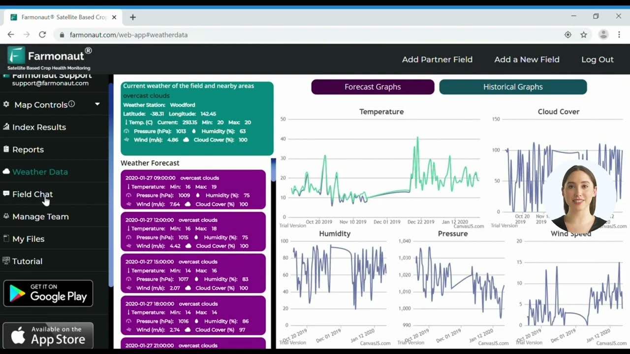
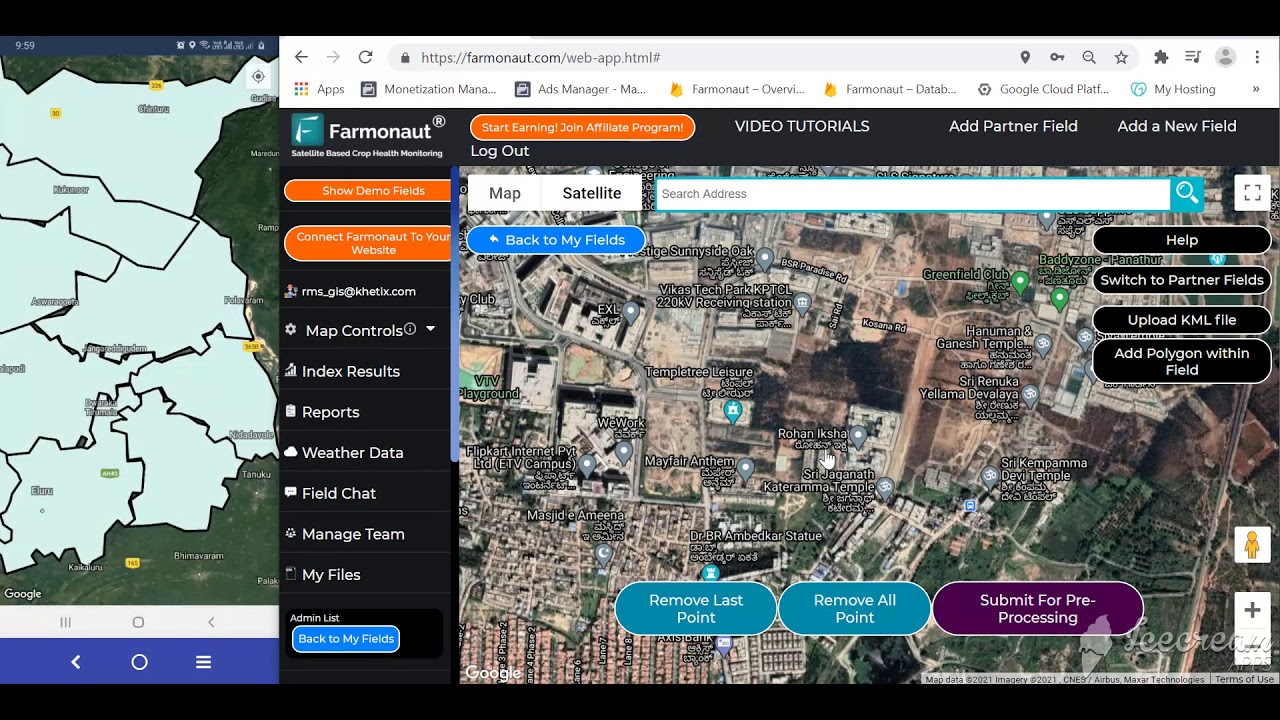
For optimal crop growth, Farmonaut’s satellite monitoring enables farmers to assess slope, aspect, and elevation digitally, generating actionable maps for site-specific farm management.

- 🌞 Sunlight Receipt: Slope direction influences photosynthesis rates and growing degree days.
- 💨 Wind Exposure: Elevated, exposed spots face more wind (greater evapotranspiration, lower moisture).
- 🌡 Temperature Variation: Bottom lands may be frost pockets; upper slopes warmer at night.
- 🌾 Crop Suitability: Gentle, well-drained slopes are ideal for cereals; terraces for rice or orchards; flat, deep soils for vegetables.
- 🌳 Agroforestry: Used on slopes to bind soil, shelter crops, and diversify incomes.
Understanding terrain, slope, and aspect underpins not only sustainable agriculture but also site fleet and resource management in mining, forestry, and infrastructure projects. Smart topography study reduces environmental risk and protects long-term investment.
Sediment, Erosion Risk & Topography Management
Erosion risk is tightly linked to the relief and shape of the land. When heavy rain falls or irrigation is mismanaged, water races down steeper slopes, stripping topsoil, decreasing soil structure, and transporting pollutants. This is why contour farming, strip cropping, buffer strips, and terracing are core practices of topography-informed management.
- ⚠ Critical Zones: Steep inclines, bare soils after harvest, and newly cleared land require extra vigilance to prevent sediment loss.
- ⛏ Restoration Needs: Post-mining or construction activities may demand land grading, cover crops, and hydrological restoration for soil stability.
- 🛡 Protective Measures: Buffer strips and vegetative cover at field edges minimize runoff, improve infiltration, and filter sediment.
Overlooking topography during farm expansion or field merging can increase surface runoff and soil loss. Always integrate erosion risk mapping when planning new agricultural land.
Topography’s Role in Pest and Disease Control
Pest and disease dynamics are not randomly distributed across a farm. The topography exerts powerful control over microhabitats, influencing where pests, insects, and pathogens are more likely to thrive or be suppressed. Here’s how:
- Definition of Pest in Agriculture: Any organism (insect, weed, pathogen, vertebrate) that causes harm to crops, livestock, or stored products.
- Disease Hotspots: Low-lying depressions with slow drainage often have higher risk of fungal/bacterial buildup. Humidity is naturally higher here.
- Insect Dynamics: Certain insect pests overwinter in undrained, sheltered sites and move upwards in the spring.
- Barrier Benefits: Physical features—windbreaks, upslope shelterbelts—can disrupt pest movement and create microclimates that slow disease spread.
- ⚡ Topography-informed scouting: Prioritizes critical risk zones for targeted control measures, reducing chemical and labor costs.
- 🌪 Reduced wind exposure: Protects crops from disease spores and pest influx on exposed ridges.
The best disease and pest management plans include zone-based monitoring, using real-time satellite assessment to spot emerging clusters before they spread.

Agricultural Land Definition and Integrated Land Planning
The agricultural land definition extends beyond simple usage rights—it covers arable land, pasture, orchard, and woodland components within productive systems. Suitability is determined by soil depth, structure, fertility, water availability, climate, and—crucially—topography.
- 📍 Field Layout: Place rows, beds, and blocks following natural contours for erosion prevention and efficient sunlight use.
- 🚜 Access & Roads: Design routes that avoid steep, erosive slopes. Use elevation data for minimal disturbance.
- 🛠 Infrastructure: Position irrigation systems, storage sites, and drainage networks in optimal terrain points.
In mining or infrastructure, topography guides site selection, erosion control measures, and post-extraction land restoration. In all contexts, the primary agricultural focus remains on maximizing productivity, sustainability, and resilience.
Combine blockchain traceability with digital topographic mapping to ensure authenticity, compliance, and transparent land management—key for forward-thinking agribusinesses and supply chains.
Techniques for Studying Topography in Agriculture
Modern technology has made topography study easier, more accurate, and scalable. Leading approaches include:
- 🛰 Satellite Imagery: Multispectral satellite monitoring gives field-scale elevation, slope, aspect, and vegetation maps—essential for precise interventions.
- 📱 Remote Sensing Apps: Mobile and desktop GIS tools let farmers overlay topographic maps on real-time management data, providing actionable, user-friendly insights.
- 🏞 Digital Elevation Models (DEMs): 3D representations of farm terrain allow for drainage modeling, contour design, and risk assessment.
- 🗺 Traditional Surveying: For smallholders, classic levels and chains can define terraces and irrigation points—though at lower resolution than satellite technologies.
Each method contributes to sustainable, data-driven agricultural land management and boosts farm resilience against climate and market shocks.
Digital topography assessment isn’t just for agriculture—it’s critical for environmental footprint tracking and satellite-based agricultural loan verification in banking and insurance as well.
How Farmonaut Empowers Topography-Based Agriculture
At Farmonaut, we offer advanced satellite-driven tools and AI-based advisory systems that help farmers harness the power of topography for precision agriculture. Our platform integrates:
- 🛰 Satellite-based crop and soil monitoring to map terrain, assess field variation, and enable rapid, data-driven interventions.
- 🤖 AI advisory (Jeevn AI) for personalized, real-time field management strategies—from erosion risk to irrigation scheduling.
- ⛓ Blockchain traceability for transparent, compliant land use from farm to supply chain.
- 🌳 Environmental impact tracking for sustainable, eco-friendly operations.
These services support everyone from smallholder farmers to enterprise operations, across agriculture, forestry, mining, and infrastructure. Explore our APIs for seamless integration: https://sat.farmonaut.com/api
(developer docs)



Our platform is web, Android, and iOS compatible—giving you round-the-clock, global coverage for every field, anywhere.
Farmonaut does not manufacture or sell inputs. Instead, we empower users with precision topography monitoring, environmental compliance, resource management, and AI advisories—ensuring effective, data-driven decision-making across the entire agricultural cycle.
Strategies for Efficient & Sustainable Farming Based on Topography
Aligning agricultural practices with the inherent geometry and topographical features of a farm unlocks multiple advantages across both the short and long term:
- ✔ Field Placement: Locate fields and arrange planting patterns to follow natural contours and minimize runoff.
- ✔ Soil Conservation Structures: Implement terracing, contour strips, windbreaks, and buffer vegetative belts to shield soils from erosion.
- ✔ Irrigation & Drainage Optimization: Use DEM data for efficient water application, preventing puddling in low spots and drought stress on exposed slopes.
- ✔ Pest Risk Zoning: Identify hotspots for targeted, reduced chemical interventions using surveillance of disease-prone low areas.
- ✔ Resilient Operations: Design flexible, modular management systems that adapt as land use or climate conditions change.
For large-scale plantation or forestry projects, use digital elevation models to prioritize planting of wind-resistant or deep-rooted crops on exposed, erosion-prone ridgelines—reducing risk and maximizing productivity.
FAQs on Topography Definition in Agriculture
-
What does topography mean in agriculture?
Topography in agriculture means the study of the physical features and relief of farmland—such as slopes, elevation, aspect, and drainage patterns—that affect how crops are grown, water is managed, soils are protected, and yields are maximized. -
How does topography influence soil health?
Steep slopes may erode more quickly, losing topsoil and fertility. Low areas may become waterlogged, leading to poor aeration and disease. Understanding topography helps farmers target soil conservation and maintain healthy, nutrient-rich soils. -
Why is drainage a vital consideration in topography study?
Proper drainage ensures that water moves efficiently off fields without pooling in depressions, preventing waterlogging and root disease, while also reducing erosion and nutrient runoff. -
How does slope direction (aspect) affect crop suitability?
Slope aspect controls sunlight and microclimates. South-facing slopes (Northern Hemisphere) are warmer and drier—good for heat-loving crops; north-facing slopes are cooler, holding moisture longer. -
Can digital tools improve topography-based farm management?
Yes! Satellite technologies (like those we offer at Farmonaut) provide high-resolution maps for digital terrain analysis, helping plan irrigation, field layout, soil conservation, and pest risk mitigation. -
What is the definition of pest in agriculture, and how does topography influence pest pressure?
A pest is any organism (insect, weed, pathogen, or vertebrate) harmful to crops. Topographic lows (wet spots), wind exposure zones, and shelterbelts create distinct pest/disease risk areas, which can be managed with informed scouting and interventions. -
How does topography influence land suitability ratings?
Topography is essential: flat to gentle slopes with good aspect and drainage rate highest for arable cropping; steep or irregular terrain is often suited for forestry or pasture, especially when integrated with erosion control structures.
Conclusion: The Foundation of Sustainable Agriculture is Topography
In summary, topography definition in agriculture is more than a set of surveyor’s lines; it is the living framework around which efficient, sustainable farming is designed. Topography dictates where fields are located, how land is shaped, how water and energy move, and sets both risks and opportunities for soil conservation, pest management, and yield optimization. All these directly affect the definition, suitability, and value of agricultural land.
By leveraging real-time monitoring, satellite mapping, and topography-based advisories, farmers today can design more resilient, productive, and environmentally responsible operations. Farmonaut’s mission is to provide the affordable, high-quality digital tools that make these insights accessible to every farmer, business, and land manager worldwide.
Whether you manage a few acres or an entire district, make topography your first step in every strategic decision.
Ready to experience data-driven, topography-based agriculture?
Discussion
Questions, corrections or field experience? Share them below. First-time comments are reviewed before they appear, and your email is never published.
No comments yet. Be the first to add a question or your experience.

 Bharat Krushi Seva
 Geno
Geno Hayleys Agriculture
 Linx Agritech
 Adinet
 Save Your Soils
 Grandstream Algérie
 XOS Realty
 Geospatial Lab Africa
 Agro La Gándara
 HIPSAC
 ZOL Zimbabwe
 Juligerm
 AdBio
AdBio MISE Maroc
 NWNS
NWNS
