

Gold exploration · Case studies
Advanced Exploration Techniques for Gold: 5 Case Studies
No single technique finds gold. Five documented projects show how imaging, geophysics, geochemistry and drilling each narrow the search, what drilling can cost and where each method stops working.
Key takeaways
- Geophysics maps rock, not gold: Barrick’s Pueblo Viejo report (February 2026) says gold is not directly detectable by these surveys.
- Fourmile’s Inferred resource rose from 6.4 to 13 million ounces in 2025 after 71.4 km of core drilling (Barrick, 2025).
- A 2026 Yukon report budgets drilling at C$400 per metre in summer and C$700 in winter, all-in.
- Gold reached 80 ppb in eucalyptus leaves over a deposit buried at 35 m (Nature Communications, 2013).
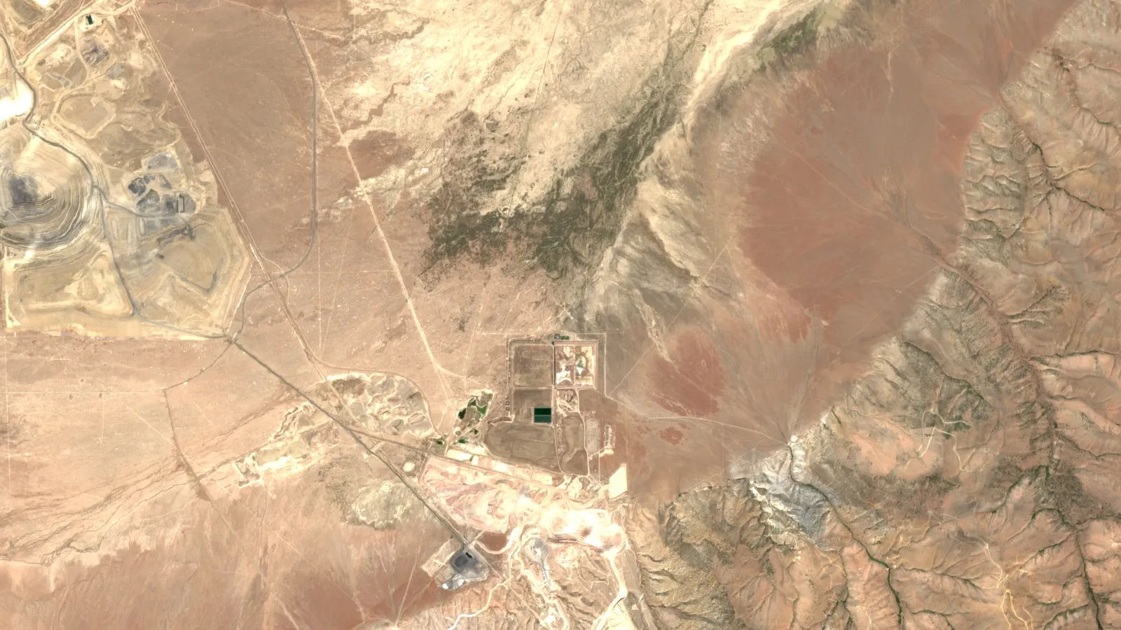
- Satellite imaging works best on dry, exposed ground, and every target still needs drilling (USGS).
In this article
- Which advanced exploration techniques suit which question
- Case study 1: Pueblo Viejo, integrating geochemistry, IP and magnetics
- Case study 2: Fourmile, deep diamond drilling beside a known deposit
- Case study 3: RC Gold, Yukon, and what a staged programme costs
- Exploration budget calculator for a gold programme
- Case study 4: Freddo, gold in eucalyptus leaves over buried ore
- Case study 5: Nevada epithermal districts, remote sensing and satellite imagery
- Deep targets: seismic and magnetotelluric surveys
- Machine learning in gold target identification: what to ask
- How to combine the methods in a gold exploration programme
- Environmental considerations in gold exploration
- Gold prices, budgets and the outlook for exploration
- Frequently asked questions
Advanced exploration techniques for gold are the survey, sampling, imaging and drilling methods used to find gold that is not visible at surface. No single one finds gold alone. The Pueblo Viejo technical report (February 2026) says it plainly: gold is not directly detectable by geophysics, so surveys map the rock properties that guide drilling. Only a drill hole and an assay confirm the metal.
This guide follows five real, documented projects, from a mine with 25 million ounces in its Measured and Indicated resource to a small buried deposit that was never economic. For each one you will see which method did what, what it could not do, and where the evidence comes from. All five were run by other companies and researchers. Use them to plan or to challenge an exploration programme, with real drilling costs and a budget calculator further down.
Which advanced exploration techniques suit which question
Choose a method by the question it answers. A consultant’s first step is to write down what is unknown (where is the alteration, what lies under cover, how deep does the zone run), then pick the cheapest method that can answer that question. The table sets out what each method measures and where it stops being useful. It uses no “success rate” figures, because a percentage for a method on its own means little: results depend on the deposit type, the cover and the quality of the targeting.
| Technique | What it measures | Best question | Main limit | Case below |
|---|---|---|---|---|
| Satellite and airborne spectral imaging | Light reflected by exposed minerals | Where is altered rock across a large area? | Sees the surface only; vegetation and cover hide it | Nevada epithermal districts |
| Magnetic surveys | Variation in the magnetic field caused by magnetic minerals | Where are structures, intrusions and demagnetized alteration? | Maps rock properties, not gold | Pueblo Viejo, RC Gold |
| Induced polarization (IP) | Chargeability, how strongly the ground holds an electrical charge | Where are sulphide zones at depth? | Pyrite responds whether or not gold is present | Pueblo Viejo |
| Soil and rock geochemistry | Gold and pathfinder elements in samples | Is there a metal signal at surface? | Weak or absent over thick transported cover | Pueblo Viejo, RC Gold |
| Plant sampling (biogeochemistry) | Gold taken up by deep-rooted plants | Is there a signal through cover? | Very low concentrations; not yet routine | Freddo |
| Machine-learning targeting | Patterns across combined datasets | Which targets should be ranked first? | Only as good as the training data | See the machine-learning section |
| Diamond core drilling | Rock and grade, directly from core | How much gold is there, and how is it shaped? | Highest cost per sampled point | Fourmile, RC Gold |
Pathfinder elements are metals such as arsenic and antimony that often travel with gold and are easier to detect. Grade is the amount of gold per tonne of rock, given in grams per tonne (g/t). For more on the survey side, see our earlier guide to innovations in gold exploration methods.
Case study 1: Pueblo Viejo, integrating geochemistry, IP and magnetics
Project: Pueblo Viejo mine, Dominican Republic, 60% owned by Barrick. Deposit type: high-sulfidation epithermal gold-silver, formed near surface by hot, acidic fluids. Best lesson: combining old and new data can extend the life of a known district.
The February 2026 technical report records how several methods built on one another. Early soil and rock sampling by Rosario and AMAX found the anomalies that led to the Monte Negro, Mejita and Cumba discoveries. Airborne magnetics and IP surveys followed, and were used mainly to map structure and alteration, not to spot gold.
From 2006, after Barrick acquired the property, the team compiled and reinterpreted all the historical data in one geological framework. That phase included more than 1,400 soil samples, 300 rock samples, close to 1,500 samples tested for gold and pathfinder elements, 41 km of IP lines, 132 km of ground magnetics (collected from 2006 to 2019), and more than 10 km of diamond drilling in 2006 alone.
The report sets out how each geophysical response was read. High chargeability in IP pointed to pyrite. Zones of demagnetization or high resistivity pointed to alteration. Strong magnetic highs pointed to intrusive rocks.
As of 31 December 2025, the report gives 410 million tonnes at 1.89 g/t gold in the Measured and Indicated categories, or 25 million ounces on a 100% basis, plus 0.77 million ounces Inferred. These figures use a long-term gold price of US$2,000 per ounce and include reserves. Exploration there has since become mainly a drilling programme, testing near-mine targets and stepping out along favourable corridors.
What a consultant can take from it: before paying for a new survey, compile and re-read what already exists. The report treats relogging of old core and reinterpretation as exploration work in their own right.
Case study 2: Fourmile, deep diamond drilling beside a known deposit
Project: Fourmile, Nevada, 100% owned by Barrick, next to the Goldrush project. Best lesson: drilling near a known system can change a project’s scale quickly, but it costs serious money and sits years ahead of a mine.
Chart
Fourmile resources after a year of drilling
Million ounces of gold, year-end 2024 and 2025
Diamond drilling uses a hollow, diamond-tipped bit to recover a solid cylinder of rock called core. It is slower and costlier than other drilling, but it preserves the structure and contacts that a geologist needs to read. Barrick’s 2025 annual report says a fleet of up to 16 deep core rigs drilled 71.4 km across Fourmile in 2025. The programme combined resource definition, step-out holes and exploration of nearby targets.
Indicated resources rose from 1.4 to 2.6 million ounces during the year, and Inferred resources from 6.4 to 13 million ounces. Hole FM25-321D returned 26.9 m at 33.71 g/t (about 12.2 m estimated true width), and deep holes confirmed mineralization more than 300 m further down dip than earlier intercepts. Barrick itself describes the project as one of the most significant discoveries this century.
Read those numbers with care. Inferred resources carry the lowest geological confidence and make up most of the ounces. Barrick expects a pre-feasibility study in 2028, with development of the access decline, a sloping tunnel, due to begin in late 2026. An intercept is one hole’s width and grade, not an average for the deposit.
Barrick also added drill pads at lower elevation so that work could continue through winter, where drilling had paused for snow in earlier years. That matters for planning, as the next case shows in dollars per metre.
Case study 3: RC Gold, Yukon, and what a staged programme costs
Project: RC Gold, Tintina gold belt, central Yukon, held by Sitka Gold. Deposit type: intrusion-related gold, in which gold forms around a granite-type intrusion. Best lesson: a public technical report gives rare, real numbers for budgeting.
Sitka’s NI 43-101 technical report, dated 10 July 2026, describes a property with decades of soil sampling behind it. Older work included a programme with 1,661 soil samples, a 138 line-km magnetometer survey and 8 line-km of IP. Since 2020, Sitka has completed 165 core holes totalling 59,765 m, along with selective LiDAR and helicopter magnetic surveys. LiDAR uses laser pulses to map the ground under trees, which helps in forested northern terrain.
The Blackjack Zone holds a pit-constrained Indicated resource of 39.9 million tonnes at 1.01 g/t gold, plus 34.6 million tonnes Inferred at 0.94 g/t. NI 43-101 is the Canadian disclosure standard for mineral projects.
The report’s proposed first phase is unusually useful because it prices the drilling. Its all-in rates include helicopter support, fuel, assays, camp, mobilization and equipment rental.
| Phase I programme | Metres | All-in cost per metre | Cost |
|---|---|---|---|
| Winter, 2 drills (Blackjack) | 6,000 | C$700 | C$4.2 million |
| Summer, 6 drills (all targets) | 54,000 | C$400 | C$21.6 million |
| Total | 60,000 | C$430 average | C$25.8 million |
The winter rate is 75% above the summer rate on this one project. These figures are for one remote Yukon helicopter-supported programme and will not transfer directly to a road-accessible site, so ask contractors for your own quotes. The calculator below lets you test them.
Exploration budget calculator for a gold programme
Enter your own holes, depths and rates to see the drilling share of a staged programme and the cost per hectare. The default all-in drilling rate matches the Yukon summer figure above, purely as a starting point. For contractor selection, read our guide to diamond drilling services.
Calculator
What will your gold exploration programme cost?
Enter your own programme and quotes. Use one currency throughout.
- Total drilling (m): 6,000
- Drilling cost: $2,400,000
- Cost per hole: $120,000
- Cost per hectare: $1,270
Example values only, not a benchmark or a forecast. The default rate equals the C$400 per metre summer figure in the RC Gold NI 43-101 report (2026), which is specific to that project. The $ sign shows your chosen currency (US$, C$ or A$).
Case study 4: Freddo, gold in eucalyptus leaves over buried ore
Project: Freddo prospect, 40 km north of Kalgoorlie, Western Australia. Studied by: CSIRO-led researchers. Best lesson: where soil and rock tell you little, deep roots may bring a signal up, but the method is still a research-backed supplement.
Chart
Peak gold found at Freddo, by sample type
Maximum gold, parts per billion, over the buried deposit
Freddo is a sub-economic supergene deposit, meaning gold that was concentrated by weathering. It measures 100 m by 200 m, at 35 m depth, and sits under about 30 m of barren sediment. It was found by drilling, and nothing crops out at surface. That made it a clean natural test.
In a 2013 paper in Nature Communications, the team reported gold highly anomalous in large eucalyptus trees directly over the deposit, and showed particles of gold inside living leaf tissue. Peak values in dried leaves reached 80 parts per billion (ppb), against a background of 0.1 ppb in plant material.
The paper also explains why plant sampling is not routine: concentrations are commonly very low and the way gold moves through the system has been poorly understood. So use it as a low-disturbance way to follow up covered ground, then confirm with drilling. Our guide to soil, stream and plant sampling covers survey design.
Case study 5: Nevada epithermal districts, remote sensing and satellite imagery
Project areas: Hasbrouck Mountain, Tonopah, Divide and Goldfield, Nevada, as mapped by the US Geological Survey. Best lesson: imagery narrows the search in dry, exposed terrain by mapping the alteration around a gold system, not the gold.
Chart
Shortwave infrared pixel size by satellite
Metres per pixel; smaller shows finer detail
Hot fluids that carry gold also change the surrounding rock, leaving clays, alunite, silica and iron oxides. Many of these minerals have recognizable signatures in reflected light. The USGS epithermal deposit model (report SIR 2010-5070-Q) reviews what each data type can do:
- Landsat can identify zones of altered rock at district and regional scale.
- ASTER adds bands that can separate alteration types, carbonate minerals and high quartz concentrations.
- Airborne hyperspectral sensors such as AVIRIS typically record more than one hundred bands and can identify specific minerals and mixtures.
- Field and core spectrometers give the most detailed readings, though mapping patterns with them is slow.
In the USGS examples, thermal ASTER data picked out quartz distribution at Hasbrouck Mountain, Tonopah, Divide and Goldfield. At Hasbrouck, an old sinter (a silica deposit from a hot spring) gave a strong quartz response that separated it from similar-looking outcrops nearby.
The limits are just as important. What can be seen depends on spectral and spatial resolution, deposit type, mining disturbance, terrain, vegetation and how far the deposit has been eroded. Many successful examples are from arid and semi-arid areas with little plant cover. Pixel size also matters when alteration halos are narrow, as the comparison above shows: ASTER has six shortwave infrared bands at 30 m, while Sentinel-2 has two at 20 m. ASTER’s shortwave detectors stopped giving usable data in April 2008, so its shortwave images are archive only; its visible and thermal bands were not affected by that failure.
For a licence holder or a consultant, the practical use is screening: rank ground before mobilizing a field crew, and record what the imagery cannot see. Farmonaut is one provider that does this from satellite data, and its output is an exploration target that sits ahead of any resource estimate.
▶ How satellites map the rock around gold, not the gold itself (4:25) · 4:25
Deep targets: seismic and magnetotelluric surveys
The methods above lose power with depth, which is where two other geophysical tools come in. Reflection seismic surveys send sound waves into the ground and record the echoes, which can image layers and faults. They suit layered settings such as the reef-hosted gold of the Witwatersrand Basin, but they are costly. Magnetotellurics (MT) uses natural electromagnetic signals to map how well rocks conduct electricity at depth.
As with magnetics and IP, both describe the rock and not the gold. Geoscience Australia describes the magnetic method as a non-invasive way to measure the field linked to magnetic minerals in crustal rocks. Each result still has to be turned into a geological idea and tested. Our guide to IP surveys goes further into cost and depth.
Machine learning in gold target identification: what to ask
Machine-learning models search combined datasets (geology, geochemistry, geophysics, imagery, old drill holes) for patterns that match known deposits. They then score new ground. They are ranking tools. Studies often compare models on one defined belt: SRK Peru, for example, tested four model types on public data for copper porphyry-skarn deposits in southern Peru. A strong test score on known deposits is not the same as a new discovery.
Treat any headline claim about a discovery uplift from AI with caution unless it comes with a published method and a control group. Before paying for AI targeting, ask these questions:
- How many known deposits of this type trained the model, and do they share your geological setting?
- Was it tested on an area it had not seen?
- Which input layers drive the score, and do they make geological sense?
- Does the output treat lack of data as lack of gold? Poorly sampled ground can score low for that reason alone.
- How many of its targets have been drilled, and what did the holes find?

▶ What AI does in mineral exploration, and how to check a claim (4:37) · 4:37
How to combine the methods in a gold exploration programme
Together, the five cases suggest a sequence. Cheap, wide methods shrink the area, and costly, narrow ones test what is left. Exploration targeting is the step in between, where evidence becomes a ranked list. Our guide to how drill targets get ranked covers that step.
Infographic
A staged gold exploration programme in 5 steps
- 1CompileGather old reports, maps and drill logs.
- 2ScreenMap alteration and structure from imagery and regional data.
- 3SampleCheck targets with mapping, soil and rock samples.
- 4SurveyUse IP or detailed magnetics on the best ground.
- 5DrillTest in stages and let results decide the next step.
- Compile. Gather old reports, maps, drill logs and survey data. Pueblo Viejo shows this can reshape a mature district.
- Screen. Use satellite imagery and regional magnetics to find alteration and structure.
- Sample and map. Test those areas on the ground with geology, soil and rock sampling. Use plant sampling where cover blocks a soil signal.
- Survey the priority ground. Use IP, detailed magnetics or other geophysics to shape a drill plan.
- Drill in stages. Scout holes come first, then step-outs (holes beyond the known zone) and resource drilling only if results justify them.
The same idea applies at small scale, as our piece on Parker Schnabel’s gold discovery method discusses for placer ground. Permits and landowner permission must be in place before any ground work, and no sampling should take place on someone else’s claim.
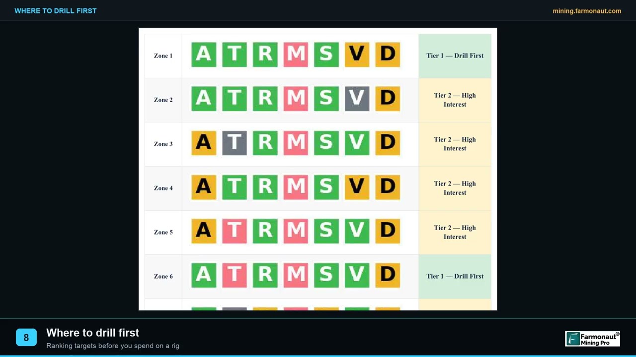
▶ How targets get ranked into a drill order (2:19) · 2:19
Environmental considerations in gold exploration
Satellite imagery causes no ground disturbance, and airborne surveys cause little. Drilling is where the footprint begins: pads, access tracks, water use and sumps all need permits and later rehabilitation. Fewer holes mean less disturbance, but only if targeting is sound. Barrick’s planned Fourmile facilities show another approach, placing the workshop and offices on previously disturbed land, which the company says simplifies permitting.
Imagery can also document land condition before and after a programme. A satellite screen is not an environmental or social clearance, though, and regulators will want their own assessments.
Gold prices, budgets and the outlook for exploration
Price shapes what is worth drilling. USGS figures put the annual average gold price at US$1,801 per troy ounce in 2021 and about US$3,300 in 2025 (estimate). Kitco showed a spot bid of US$4,103.20 at 12:44 New York time on 5 November 2026. Note that Pueblo Viejo’s resource uses US$2,000, so reported ounces and today’s spot price are not directly comparable.
Chart
Annual average gold price
US$ per troy ounce; 2025 is an estimate
Spending has held up in Western Australia. Western Australia’s statistics digest reports A$1.03 billion of gold exploration in 2024-25, the highest since 2022 though below record levels. The same state hosts Hemi, a project with 13.2 million ounces of resources and 5.5 million ounces of reserves in Northern Star’s 2026 update, after its May 2025 purchase of De Grey Mining.
Discovery is only the start. A study by S&P Global of 268 mines found US mines took an average of 29 years from discovery to production (reported July 2024). For context on where gold sits in the ground today, see our list of the countries with the most gold reserves.
Frequently asked questions
What are advanced exploration techniques for gold?
They include spectral imaging, magnetic, IP, seismic and MT surveys, multi-element soil and rock geochemistry, plant sampling, machine-learning targeting, and diamond drilling with 3D modelling. Most programmes combine several.
What does advanced exploration mean in mining?
The term is used in two ways. It can mean newer methods, as in this guide. In project language it often means a later stage in which a defined target is being drilled towards a resource estimate.
Can geophysics detect gold directly?
No. The Pueblo Viejo technical report says gold is not directly detectable by geophysical methods. Surveys map rock type, alteration, structure and sulphides that can guide drilling.
Can satellites find gold deposits?
Satellites do not see gold. They can map altered minerals and structures at surface. This works best in dry, exposed terrain, and any target still needs field checks and drilling.
What is the most accurate gold exploration method?
Drilling with laboratory assays is the direct measure, because it samples the rock itself. Other methods are indirect, and they are used to decide where drilling is justified.
How much does gold exploration drilling cost per metre?
It varies widely with access, depth and season. One 2026 Yukon technical report budgets C$400 per metre in summer and C$700 per metre in winter, all-in, with helicopter support. Get local contractor quotes for your own site.
What are pathfinder elements in gold exploration?
They are elements such as arsenic and antimony that often occur with gold and can be easier to detect. Multi-element assays use them to reveal patterns around a gold system.
Can trees show where gold is buried?
At the Freddo prospect in Western Australia, eucalyptus trees over a deposit at 35 m depth held anomalous gold, up to 80 ppb in dried leaves. The method is promising but not routine, because levels are very low.
Does AI improve gold discovery rates?
AI can rank large datasets quickly, but a claimed uplift means little without a published method and a comparison group. Ask how the model was trained and tested, and how many of its targets have been drilled.
Where should a junior explorer start on a new licence?
Start with what already exists: old reports, regional geophysics and imagery. Then add ground mapping and sampling, and only then commit to geophysics and drilling on the best-ranked targets.
More from Farmonaut: agro admin app, carbon footprinting, crop loan and insurance, farmonaut satellite weather api developer docs, fleet management, product traceability.
This page is for information only. It is not investment advice or legal advice. Company examples are not a view on any share. Get permits and landowner permission before any ground work.
Farmonaut mining
Map your own project area from space
Mapping a site for a client? Send the boundary and target mineral to screen the ground before you plan field work.

Mining Pro sample view, synthetic data
Keep reading
Sources
- Barrick, Pueblo Viejo NI 43-101 Technical Report (February 2026): s25.q4cdn.com
- Barrick, Annual Report 2025: s25.q4cdn.com
- Sitka Gold, RC Gold NI 43-101 Technical Report (July 2026): wp-sitkagold-2024.s3.ca-central-1.amazonaws.com
- Lintern et al., Natural gold particles in Eucalyptus leaves, Nature Communications (2013): nature.com
- USGS, Descriptive Models for Epithermal Gold-Silver Deposits, SIR 2010-5070-Q: pubs.usgs.gov
- NASA Earthdata, ASTER instrument: earthdata.nasa.gov
- Sentinel Hub, Sentinel-2 bands: custom-scripts.sentinel-hub.com
- USGS, Landsat 8: usgs.gov
- Geoscience Australia, Magnetics: ga.gov.au
- SRK, Porphyry-Skarn Copper Prospectivity Mapping with Machine Learning Models: srk.com
- USGS, Mineral Commodity Summaries 2026, Gold: pubs.usgs.gov
- Kitco, live gold price (read 5 November 2026): kitco.com
- Western Australia Department of Mines, Statistics Digest 2024-25: wa.gov.au
- Northern Star Resources, Resources and Reserves Update (2026): nsrltd.com
- Mining.com, S&P Global study of mine development timelines: mining.com
- stopped giving usable data in April 2008: asterweb.jpl.nasa.gov
Discussion
Questions, corrections or field experience? Share them below. First-time comments are reviewed before they appear, and your email is never published.
No comments yet. Be the first to add a question or your experience.

 WSP Investment Company
 Dalgety Minerals Pty Ltd
 Vortex Minerals Pty Ltd
 Faith At Work (Pty) Ltd
 Geotech Mining Solutions plc
 Vulcan International Limited
 Kidepo Associates
 GKY Mining
 Alkimy SARL
 Double A Trading
 GemSprout Metals Limited
 Qader Group
 Ileys General Trading
 SG Gold Mining LLC
 VRV Global Pte Ltd
 Omsri International FZE
 G.I.T.T.
 Jaunita Erss Ltd
 Almosi SARL
 SRK Consulting
 Berks Gold Limited
 Mwerezi Minerals Company Limited
 Mining SARL

 Exploration consultancy · South Africa · Gold










