

Uranium · Exploration guide
Uranium Exploration: Methods, Targets and First Drilling
Uranium exploration runs from deposit model to airborne survey to drilling with a gamma probe. Global exploration and development spending passed US$1.78 billion in 2023-2024 (Red Book). This guide covers methods, deposit types, permits, companies and prices.
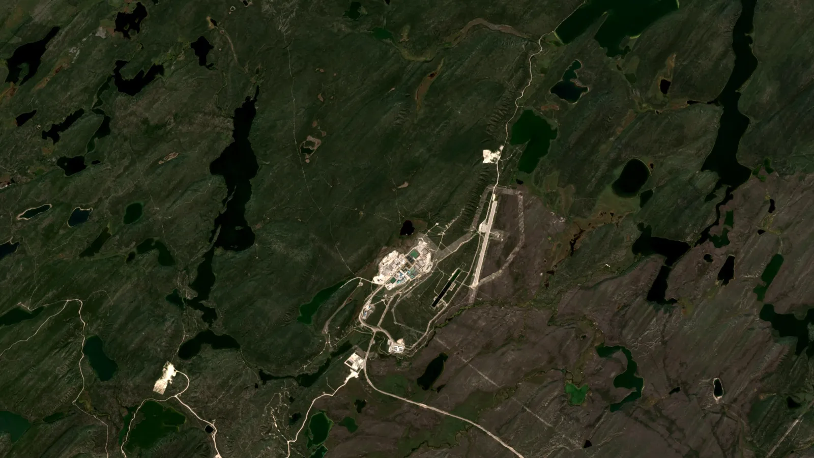
Key takeaways
- Global uranium exploration and development spending exceeded US$1.78 billion in 2023-2024, 46% above 2021-2022 (2026 Red Book, via ANS, September 2026).
- Airborne gamma rays come almost entirely from the top 35 cm of ground, so radiometrics find surface uranium; buried Athabasca deposits are searched with electromagnetics for graphitic conductors (IAEA; Shigeta, 1997).
- A downhole probe turns counts per second into eU3O8 with a calibrated K-factor, but disequilibrium and sample volume mean assays decide the grade (Cameco, ASEG 2015).
- In situ recovery supplied 56% of uranium mined in 2022; acid leach recovers 70-90% against 60-70% for alkaline leach (World Nuclear Association).
- Cameco’s month-end industry averages for 30 October 2026 were US$91.55/lb spot and US$98.00/lb long-term; TradeTech’s own long-term indicator reached US$99.00/lb on 31 October (Cameco, Crux Investor).
In this article
- What uranium exploration involves, stage by stage
- How to explore for uranium on a new licence: step by step
- Uranium deposit types that explorers target
- Unconformity uranium deposits: how explorers search the Athabasca Basin
- Sandstone-hosted uranium: roll-fronts and in situ recovery
- Radiometric survey for uranium: what the numbers mean
- Radon, soil and water geochemistry
- What satellite screening adds before the first hole
- Uranium exploration drilling and downhole gamma logging
- Uranium prospecting on foot: scintillometers and safety
- Permits and radiation safety in outline
- Uranium exploration companies and where they work
- Spot price and term price: what explorers watch
- Frequently asked questions
Uranium exploration is the search for rock that holds enough uranium, in a form that can be mined and processed, to justify a mine. It moves in a fixed order: pick a deposit model, measure natural radioactivity and rock properties over a wide area, narrow to a few targets, then drill and log the holes with a gamma probe. Spending is rising. The OECD Nuclear Energy Agency and the International Atomic Energy Agency report that global exploration and development spending passed US$1.78 billion in 2023-2024, 46% more than in 2021-2022 (American Nuclear Society summary of the 2026 Red Book).
This guide is written for licence holders, consultants and investors. It covers the deposit types, the survey methods in the order they are used, how drilling and downhole gamma logging work, what permits and radiation rules mean in outline, who is exploring where, and how to read a uranium price. A calculator turns a probe reading into a grade, a grade-thickness figure and a pound count. Prices and company facts carry their dates.
What uranium exploration involves, stage by stage
Uranium is easier to detect than most metals because it gives off gamma rays, which a detector can read through air and a few tens of centimetres of rock. It is harder to size, because the gamma signal does not always match the uranium actually present. Most of the skill lies in that gap. The five stages below are the usual sequence.
| Stage | What you do | What you measure | Decision it supports |
|---|---|---|---|
| 1. Desk study | Pick the deposit model that fits the geology; collect old drilling and surveys | Rock type, age, structure, past results | Which model to explore for, and where |
| 2. Regional survey | Fly airborne radiometrics, magnetics and, in some basins, electromagnetics | Potassium, uranium and thorium; conductors; faults | Which areas get ground work |
| 3. Ground follow-up | Sample soil, water and outcrop; run ground geophysics | Radioactivity, geochemistry, resistivity | Where to site the first holes |
| 4. First drilling | Drill, log each hole with a gamma probe, core the best intervals | Counts per second, then assays | Whether there is a mineralised zone |
| 5. Delineation | Step out on a pattern, assay, test the metallurgy | Grade, thickness, continuity, recovery | Whether to estimate a resource |
A satellite screen of the licence can sit in front of stage 2; the section on satellite screening below says what it can and cannot do.
How to explore for uranium on a new licence: step by step
- Choose the deposit model first. The method follows the model. A basin with buried graphitic rock beneath sandstone points to an unconformity search; a permeable sandstone with organic matter points to roll-fronts; a dry valley with weathered granite upstream points to calcrete.
- Gather what already exists. National geological surveys publish airborne radiometric grids. Geoscience Australia, for example, has merged more than 600 gamma-ray surveys into continent-wide potassium, uranium and thorium grids at 100 metre resolution, available to download.
- Buy or commission a survey only where the model needs one. Radiometrics suit exposed or thinly covered ground. Electromagnetics suit deep-basin targets.
- Rank targets before you drill. Score each by how many independent signals agree: a radiometric anomaly, a conductor, an alteration zone, a structure. Agreement is cheaper than a hole.
- Plan the first holes to test the model, not to prove a resource. Log every hole with a calibrated gamma probe, and sample cores for assay.
- Record everything in one place. Probe logs, core photos, assays and survey grids lose value when they sit in separate folders.
Infographic
Uranium exploration in 5 steps
- 1Pick the modelMatch geology to unconformity, sandstone or calcrete.
- 2Gather dataCollect surveys and old drilling.
- 3SurveyRun radiometrics or electromagnetics as the model needs.
- 4Rank targetsDrill where several signals agree.
- 5Drill and logProbe every hole, then assay.
Uranium deposit types that explorers target
The International Atomic Energy Agency groups world uranium deposits into 15 types by geological setting, and the World Nuclear Association summarises them (Geology of Uranium Deposits, updated 23 October 2026). Five matter most to a working explorer.
Chart
Identified uranium resources by country
thousand tonnes U, resources to US$130/kgU, as of January 2025 (reasonably assured plus inferred)
| Type | Typical grade | Where | How it is searched for |
|---|---|---|---|
| Proterozoic unconformity | Ore up to about 20% U in Canada; Australian deposits generally lower | Athabasca Basin (Saskatchewan), Thelon Basin, Alligator Rivers (Northern Territory) | Airborne and ground electromagnetics for graphitic conductors, then deep drilling |
| Sandstone (roll-front, tabular, basal channel) | 0.05-0.35% U; bodies up to 50,000 t U | Kazakhstan, Uzbekistan, USA, Niger | Wide-spaced drilling with gamma, resistivity and self-potential logs |
| Iron-oxide breccia complex | 0.035-0.07% U at Olympic Dam, recovered with copper | Gawler Craton, South Australia | Drilling through cover; at Olympic Dam the breccia lies under about 300 m of sedimentary rock |
| Surficial (calcrete) | Low grade; carnotite in carbonate-cemented sand and clay | Yeelirrie (Western Australia), Langer Heinrich (Namibia) | Mapping of drainage channels and playas, then shallow drilling |
| Intrusive and granite-related | Low grade | Rossing and Husab (Namibia) | Mapping of the intrusive units, with radiometrics |
The same page notes that sandstone deposits make up about 28% of reasonably assured resources and 40% of inferred resources, and that unconformity deposits hold about one-third of the western world’s resources. Three types – sandstone, iron-oxide breccia and unconformity – make up most of the 5.9 million tonnes of identified recoverable resources listed in the 2024 Red Book. Lignite, black shale and phosphate hold far more uranium but at grades so low that very little is recovered.
For deposit lists and rankings, see our guides to the map of uranium deposits and the largest uranium deposits by country. For a wider view of deposit data sources, see our world mineral deposits map.
Unconformity uranium deposits: how explorers search the Athabasca Basin
An unconformity is a buried surface where young rock sits on much older rock. In the Athabasca Basin of northern Saskatchewan, flat sandstone lies over folded basement that contains graphite-rich rock. The deposits sit at, just above or just below that contact. Cigar Lake and McArthur River are the best-known mines. The World Nuclear Association gives the average McArthur River reserve grade as 6.48% U3O8 at the end of 2025, at about 600 metres depth, and notes that Cigar Lake’s orebody lies in soft sandstone and is mined with ground freezing (Uranium in Canada). U3O8 is the oxide form in which uranium is sold; grade is the share of the rock that is uranium oxide.
Chart
Reported grades at four Athabasca projects
% U3O8; different categories: Phoenix Zone A high-grade domain (Measured and Indicated), Hurricane (Indicated), Arrow (Measured), Triple R (Probable reserve)
Electromagnetics: look for the graphite, not the uranium
The deposits are buried too deep for radiometrics to see. A Japanese research paper describes the standard Athabasca flow: airborne magnetic and electromagnetic surveys first, because uranium deposits are associated with non-magnetic graphitic basement rocks; then ground electromagnetics to outline the graphitic horizons before drilling (Shigeta, Shigen-Chishitsu, 1997). Graphite conducts electricity well, so an electromagnetic survey that sends a pulse into the ground and listens for the return shows it as a conductor. The same paper reports that three-component time-domain measurements locate the conductor axes more accurately than two-component ones, and that resistivity mapping helps pick shallow alteration zones.
Alteration and structure as the second filter
The rock below the unconformity is usually faulted and brecciated, and the World Nuclear Association notes strong quartz dissolution around the deposits. Explorers therefore pair conductors with alteration and faults, and a conductor that has neither is a weaker target than one that has both.
Recent deposits and what their grades look like
Company disclosures show how the targets differ. Denison’s Phoenix deposit at Wheeler River, in the eastern Athabasca, has a Zone A high-grade domain estimated at 56.3 million pounds of U3O8 in Measured and Indicated resources at an average 46.0% U3O8 (Denison, Wheeler River). NexGen’s Arrow deposit in the south-west has Measured resources of 209.6 million pounds at 4.35% and is hosted entirely in basement rock (NexGen, Rook I). Paladin’s Triple R deposit at Patterson Lake South has a Probable reserve of 93.7 million pounds at 1.41%, starting about 50 metres from surface (Paladin, PLS). IsoEnergy reports a 48.6 million pound Indicated resource at 34.5% U3O8 at its Hurricane deposit, about 325 metres deep (IsoEnergy news release, 8 September 2026). These figures are not directly comparable, because each is a different resource or reserve category.
For the basin as a whole, see our Athabasca Basin guide and uranium deposits in Canada.
Sandstone-hosted uranium: roll-fronts and in situ recovery
Sandstone-hosted deposits form where groundwater carrying dissolved uranium meets a chemically reducing zone, such as organic matter or pyrite, and drops the uranium out of solution. In a roll-front the result is a crescent-shaped body that cuts across the bedding at the boundary between oxidised and reduced ground. The USGS descriptive model lists the ore controls as permeability and a regional redox boundary, and gives the geochemical signature as uranium, vanadium, molybdenum and selenium, with radioactivity from uranium’s daughter products (USGS Bulletin 1693, Model 30c). The Powder River Basin in Wyoming, the Colorado Plateau and the Gulf Coast plain of south Texas are the main US sandstone provinces.
Chart
In situ leach uranium recovery by method
% of uranium recovered, range reported by the World Nuclear Association
How the drilling differs
A USGS report on roll-front work states that exploration depends on extensive drilling, that cuttings are checked for oxidation that shows where oxidising fluid has passed, and that holes are routinely logged for gamma count, resistivity and self-potential (USGS Open-File Report 76-861). Self-potential is a natural voltage the tool records as it moves through the hole. The key exploration question is which side of the roll-front a hole is on, and how far away the ore lies.
Why the leach chemistry matters at the exploration stage
Many sandstone deposits are mined by in situ leaching, also called in situ recovery: a leach solution is pumped through the orebody underground and the dissolved uranium is brought to the surface. The World Nuclear Association reports that 56% of world uranium mined in 2022 came from this method (In-Situ Leach Mining of Uranium). The host rock decides the chemistry. More than about 2% calcium, as limestone or gypsum, forces an alkaline leach; otherwise acid is generally better, with 70-90% recovery against 60-70% for alkaline and operating costs about half. That is why a sandstone programme assays for carbonate, not only uranium. Permeability, thickness and position below the water table also decide whether a body can be leached at all.
Not every project fits one box. Denison’s Phoenix deposit lies at the Athabasca unconformity but is planned for in situ recovery with freeze-wall confinement (World Nuclear Association, above), and Denison reported full-scale construction 24% complete after its third-quarter 2026 results (Denison).
Radiometric survey for uranium: what the numbers mean
A radiometric survey, also called gamma-ray spectrometry, counts gamma rays and splits them by energy into potassium, uranium and thorium. Geoscience Australia explains that rocks and soils all contain these radioactive isotopes, that gamma rays can travel about 35 centimetres through rock and several hundred metres through air, and that the method maps lithology and also finds uranium and thorium directly (Geoscience Australia, Radiometrics). Surveys are flown from a low-flying aircraft or helicopter, or run on foot or from a vehicle.
The limits you must know
- It sees only the surface. The IAEA’s guidelines state that over 98% of the radiation reaching an airborne detector comes from the top 35 centimetres of ground, so deeply buried deposits give no direct signal (IAEA-TECDOC-1363).
- The uranium figure is an equivalent. The detector reads gamma rays from bismuth-214 and lead-214, which sit far down the uranium decay chain. Uranium is therefore reported as eU, equivalent uranium, assuming the chain is in balance. The IAEA calls disequilibrium, where that balance is broken, a serious source of error, and notes that radon gas can escape from soil and rock.
- Thorium and potassium confuse the picture. Many rocks are radioactive because of thorium or potassium. A map of uranium alone can mislead.
Reading eU, eTh and ratios
Explorers map eU on its own, the ratio of eU to eTh, and potassium. Uranium that is high relative to thorium stands out against granite and shale that are radioactive for other reasons. Potassium increases can mark alteration from hot fluids. Treat every ratio as a lead to check on the ground. Geoscience Australia notes that surveys have been combined into Australia-wide grids, and national surveys elsewhere give a cheap first look before any new flying.
Airborne radiometric surveys began with intensive uranium exploration in the USA, Canada and the former USSR in 1947 and in Australia in 1951 (IAEA-TECDOC-1363), so the method has a long record. It works best for surficial, calcrete, granite-hosted and exposed sandstone targets. It does not replace electromagnetics in the Athabasca.
Radon, soil and water geochemistry
Radon is a gas formed from radium in the uranium chain. It has a half-life of 3.82 days, so it cannot travel far before it decays. A University of Ottawa study over the McArthur River and Millennium deposits, buried about 500 and 750 metres deep under up to 100 metres of glacial sediment, found radon in soil gas at background levels of less than 10 kBq per cubic metre above both, so it did not indicate the ore there (Devine, University of Ottawa, 2016). Radon in groundwater was high, but the study traced it mainly to radium on fracture surfaces.
A second study at the Phoenix deposits, about 400 metres deep, estimated that radon would need more than 4,000 years to diffuse that far, far longer than its half-life. The authors conclude that high radon in groundwater probably reflects uranium-rich sandstone above the deposit, and suggest that radon could be an easy tool for finding concealed deposits (Dudek and Hattori, University of Ottawa, 2015). In practice, treat radon and helium as supporting evidence, run them with soil, lake-sediment and water samples, and never drill on a radon reading alone.
What satellite screening adds before the first hole
Satellites do not read uranium underground. They map the surface: alteration minerals, clay and iron-oxide zones, faults and lineaments, drainage and cover. That helps choose where to spend an airborne survey or a field programme. Our guide to how satellite mineral exploration works explains the method, and our satellite-based mineral detection page covers the service. Uranium is among the minerals Farmonaut covers; a Farmonaut satellite mineral report accepts a KML, KMZ or polygon boundary and is delivered in 5-20 business days.
Satellites map surface and near-surface signatures; sampling and drilling confirm them, and any result is an exploration target, not a JORC or NI 43-101 resource.

▶ Mineral exploration from space: how satellite data helps decide where to drill. · 4:26
Uranium exploration drilling and downhole gamma logging
Drilling is the main cost and the main test. Diamond core is typical in hard rock, while sandstone programmes often work from drill cuttings. What sets uranium apart is that each hole can be measured immediately after drilling. A gamma probe lowered down the hole records radiation along its full length, and the geologist sees where the hole hit mineralisation before the core reaches the lab.
From counts per second to eU3O8
A Cameco presentation to the Australian Society of Exploration Geophysicists describes the basic conversion: counts per second multiplied by a K-factor gives equivalent U3O8 in parts per million. The K-factor comes from calibration in test pits of known grade, with corrections for water, steel casing, dead time and, at high grades, the Z-effect, which makes a probe read low as uranium itself absorbs gamma rays (Fitzpatrick, Cameco, 2015). Geiger-Muller tubes suit high-grade ore; spectrometer probes give a better eU estimate because they allow for thorium and potassium.
Why eU3O8 and the assay differ
The same presentation lists the reasons a probe grade does not match the assay grade. A probe senses a sphere of rock up to about 1 metre across, while a drill core is 8-10 centimetres across. The probe peak can be offset in depth from the assay peak. Logging fast shifts and smears thin zones: the deck shows peak shifts at 27, 9 and 3 metres per minute. And disequilibrium, where the decay chain is out of balance, makes gamma proportional to uranium only if the chain has had about a million years to settle. Radon adds a trap. It is a gas and soluble in water, and its daughters can stick to the hole wall, so probes should be run soon after drilling.
Chemical assays settle the question. Many companies therefore report both: the probe result at the drill site, then the laboratory assay, with the ratio between them.
How companies report first results
IsoEnergy’s Larocque East programme shows the usual reporting. Summer drilling in 2026 totalled 10,159 metres in 26 holes. Intervals were counted at or above a cut-off of 350 counts per second over 0.5 metres, measured on drill core with three readings averaged. Eighteen holes met that threshold, 13 returned 1,000 cps or more, and three returned over 35,000 cps. The company states that samples were sent to SRC Geoanalytical Laboratories and that assay results would follow. A cps figure shows where to look. It is not a grade, and it is not a resource.
What to expect in a first programme
- Hole spacing follows the model and the size of the target.
- Every hole gets a probe log, even those with no visible mineralisation.
- Core is split and sampled by length, with standards and blanks inserted for the laboratory.
- A good first programme ends with a decision: step out, drill a new target, or stop.
A drill plan is easier to defend if it follows a ranked list of targets. For method, see the Farmonaut explainer on drilling programmes in the video below.
Calculator
What grade does my probe reading imply?
Enter your probe’s count rate and calibration, then see the grade, grade-thickness and pounds in a block of ore.
- Grade after disequilibrium factor (% U3O8): 0.40
- Grade x thickness (% x m): 1.00
- Contained U3O8 in the ore (lb): 881,848
- Recovered U3O8 (lb): 749,571
- Gross value of recovered U3O8 (US$): $59,965,664
Example values only, not a benchmark. The K-factor (ppm eU3O8 per count per second) comes from your probe’s test-pit calibration; the default is an example. Enter the count rate after your corrections for dead time, water, casing and, at high grades, the Z-effect. Disequilibrium factor is chemical grade divided by eU3O8 grade (1 means in balance). Pounds = tonnes x grade % x 22.0462 (1 tonne = 2,204.62 lb). Price is an input: example, use today’s price. Gross value is before costs, royalties and recovery losses beyond the recovery you enter.
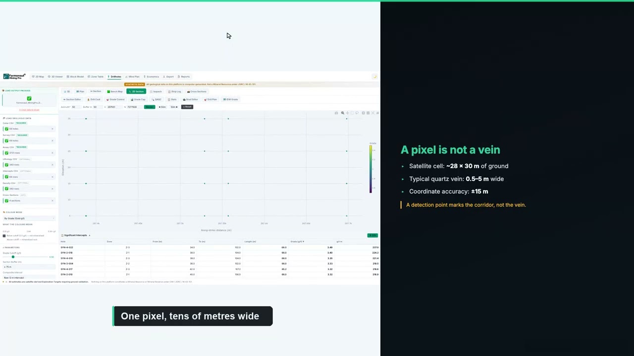
▶ How to plan a drilling programme from satellite data, shown in Farmonaut Mining Pro. · 5:49
Uranium prospecting on foot: scintillometers and safety
Prospecting is the cheapest first step on open ground. A hand-held scintillometer or gamma spectrometer, walked across outcrop and float, flags radioactive rock. Portable gamma spectrometry has been used for uranium work since the 1960s (IAEA-TECDOC-1363). A reading is relative: it depends on the instrument, the rock and the survey height, so record the instrument model and the background reading at the start of each day.
Rules to follow:
- Get permission from the landowner or the mineral rights holder before you enter, and check the claim, licence or permit position.
- Check local rules on radioactive material before you collect or move samples.
- Wash hands before eating, avoid dust, and do not take samples into living areas.
- Do not use mercury, and do not dig where you have no right to.
Permits and radiation safety in outline
Rules differ by country and by stage. In Canada, the Canadian Nuclear Safety Commission states that surface uranium exploration is exempt from the Nuclear Safety and Control Act because it poses low risk, that each province or territory regulates exploration in its jurisdiction, and that advanced exploration such as ramps through mineralised zones may need a federal licence (CNSC, Uranium mines and mills). In the United States, the Nuclear Regulatory Commission explains that under a section 274b agreement a state takes over part of the NRC’s authority to license and regulate certain nuclear materials, including source material such as uranium (NRC, Agreement States). Land access can also be restricted: the proclamation of 8 August 2023 that created the Baaj Nwaavjo I’tah Kukveni monument near the Grand Canyon withdrew about 917,618 acres of federal land from location, entry and patent under the mining laws, subject to valid existing rights (Federal Register, 15 August 2023).
For a working programme: keep a radiation-safety plan for core handling and storage, record background and dose for staff who handle high-grade core, and involve local communities early. Check with the ministry or regulator before you apply, because fees, notice periods and permit conditions change.
Uranium exploration companies and where they work
The table lists companies with advanced uranium projects or large exploration positions, from their own pages and from the World Nuclear Association. It is a list of facts, not a recommendation, and nothing here is investment advice.
Chart
Cameco exploration and evaluation spending
C$ million a year; 2026 is the planned figure
| Company | Main exploration or development focus | Fact from a company or WNA page |
|---|---|---|
| Cameco | Athabasca Basin; also Australia, Kazakhstan and the US | Land position of 755,000 hectares; interests in 41 Athabasca projects (2025 annual information form) |
| Denison Mines (TSX: DML; NYSE American: DNN) | Wheeler River, Waterbury Lake and other eastern Athabasca ground | About 457,000 hectares of prospective ground; Phoenix in construction |
| NexGen Energy | Rook I, with Arrow, south-west Athabasca | Site preparation and construction licence from the CNSC in March 2026; designed for up to 30 million pounds U3O8 a year |
| Paladin Energy | Patterson Lake South, Triple R deposit | Saskatchewan Ministerial approval of the Environmental Impact Statement in February 2026 |
| IsoEnergy (TSX: ISO; NYSE American: ISOU) | Larocque East and Hurricane, Athabasca | 10,159 m drilled in 26 holes in summer 2026 |
| Uranium Energy Corp | In situ projects in Wyoming and Texas | Described by the WNA as the largest US uranium mining company; first dried concentrate at Irigaray in February 2025 |
| Energy Fuels | White Mesa mill and projects in the US West | White Mesa produced 1,015,000 lb U3O8 in 2025 |
Cameco’s annual information form says it has raised exploration spending in response to a stronger nuclear fuel market, and shows Canadian-dollar spending on exploration and evaluation rising each year from about C$8 million in 2021 to a planned C$30 million in 2026 (Cameco 2025 Annual Information Form). The World Nuclear Association adds that exploration in the US is carried out by many companies, often over ground mined in the 1950s to the 1980s.
Where do explorers work? The World Nuclear Association’s country table of identified resources puts Australia first, then Kazakhstan, Canada, Russia, Namibia, Niger, China and South Africa. Tanzania’s resources are 57,700 tonnes of uranium in the same table. For the African picture, see our African uranium mines guide. For mapping the surface cover and valley-fill sediments that host calcrete uranium, see our guide to surficial geology maps.

▶ Uranium in Africa explained, using Zimbabwe’s Kanyemba deposit as the example. · 4:27
Spot price and term price: what explorers watch
Uranium does not trade on an open exchange. Buyers and sellers deal directly, and reporters such as UxC and TradeTech publish price indicators from those deals. Two numbers matter. The spot price is for delivery within a short time. The term, or long-term, price is the benchmark for multi-year contracts, and it is what a mine’s revenue depends on.
Chart
Three uranium prices, late 2026
US$ per pound U3O8; different measures and dates
Cameco publishes industry average prices calculated from the month-end prices of UxC and TradeTech. For 30 October 2026 the spot price was US$91.55 per pound of U3O8 and the long-term price was US$98.00 (Cameco, Uranium Price). The TradeTech Long-Term Uranium Price Indicator reached US$99.00 per pound on 31 October 2026, the highest since the series began in 1996, and Cameco’s average realised price in the third quarter was US$65.78 per pound, because it was delivering under older contracts (Crux Investor, 3 November 2026). Futures commentary in early November put US uranium futures above US$91 (Trading Economics, 10 November 2026).
The gap between a project’s cost and the term price decides which targets are worth drilling. The 2026 Red Book finds that identified resources recoverable below US$260 per kilogram of uranium total more than 8.1 million tonnes as of 1 January 2025, enough for the highest demand case to 2050, but that the typical lead time for a new mine is 15-20 years (World Nuclear News, 14 September 2026; ANS). Global production in 2024 was 61,924 tonnes of uranium, the highest since 2006.
Frequently asked questions
What is uranium exploration?
It is the process of finding and testing rock that may hold mineable uranium, from desk study and airborne surveys to drilling and gamma logging. The goal is a defined, drillable target and then a resource estimate.
What are the main uranium exploration methods?
Airborne radiometrics for surface uranium, electromagnetics for graphitic conductors in basins such as the Athabasca, radon and geochemical sampling as supporting evidence, satellite mapping of alteration and structure, and drilling with downhole gamma probes.
How do you explore for uranium on a new licence?
Choose the deposit model, collect existing survey data, run the survey that fits the model, rank targets where several signals agree, drill a few holes to test the model, and log each with a calibrated probe.
What is a radiometric survey for uranium?
It is a gamma-ray spectrometry survey that estimates potassium, uranium and thorium at the surface. Geoscience Australia notes gamma rays travel about 35 centimetres through rock, so the survey maps near-surface ground only.
What are unconformity-related uranium deposits?
They form near a major Proterozoic unconformity, where sandstone overlies faulted basement. They hold about one-third of the western world’s uranium resources. The richest known deposits are in the Athabasca Basin; the Australian examples, in the Northern Territory, are generally lower grade.
What are sandstone-hosted uranium deposits?
They are uranium bodies in permeable sandstone, often roll-fronts at the boundary between oxidised and reduced ground. Grades are generally 0.05-0.35% U, and they are often mined by in situ recovery.
Why does a probe grade differ from an assay?
The probe infers uranium from daughter-product gamma rays, which only match if the decay chain is in balance. It also reads a much larger volume of rock than a core sample does. Assays are the final word.
How much does uranium exploration drilling cost?
Costs depend on depth, rock, location and access. Deep unconformity targets in remote basins cost far more per hole than shallow sandstone drilling. Get quotes from drilling contractors for your own site, and use the calculator on this page to value what a hole might find.
Can I prospect for uranium myself?
Yes, with permission and the right claim or licence, using a scintillometer. Follow the safety rules above, and check local radioactive-material rules before taking samples.
Which companies are exploring in the Athabasca Basin?
Cameco, Denison Mines, NexGen Energy, Paladin Energy and IsoEnergy all report work there. The table above lists facts from their pages; none of it is advice to buy or sell.
What is the difference between spot and term uranium prices?
Spot is for near-term delivery. Term is the benchmark for multi-year contracts and sets a mine’s revenue over time. In late 2026 the long-term price sat above spot (US$98.00 and US$91.55 in Cameco’s 30 October averages).
Can satellites find uranium?
Not directly. They can map alteration, structure and surface geology that help rank targets before airborne work and drilling.
This page is for information only. It is not investment advice and not legal advice. Confirm permit and licence rules with the regulator. Prospect only with permission, follow radiation-safety rules and never use mercury.
Farmonaut mining
Screen your licence area from space
Send your licence boundary to request a quote for a Farmonaut satellite mineral report, delivered in 5-20 business days.
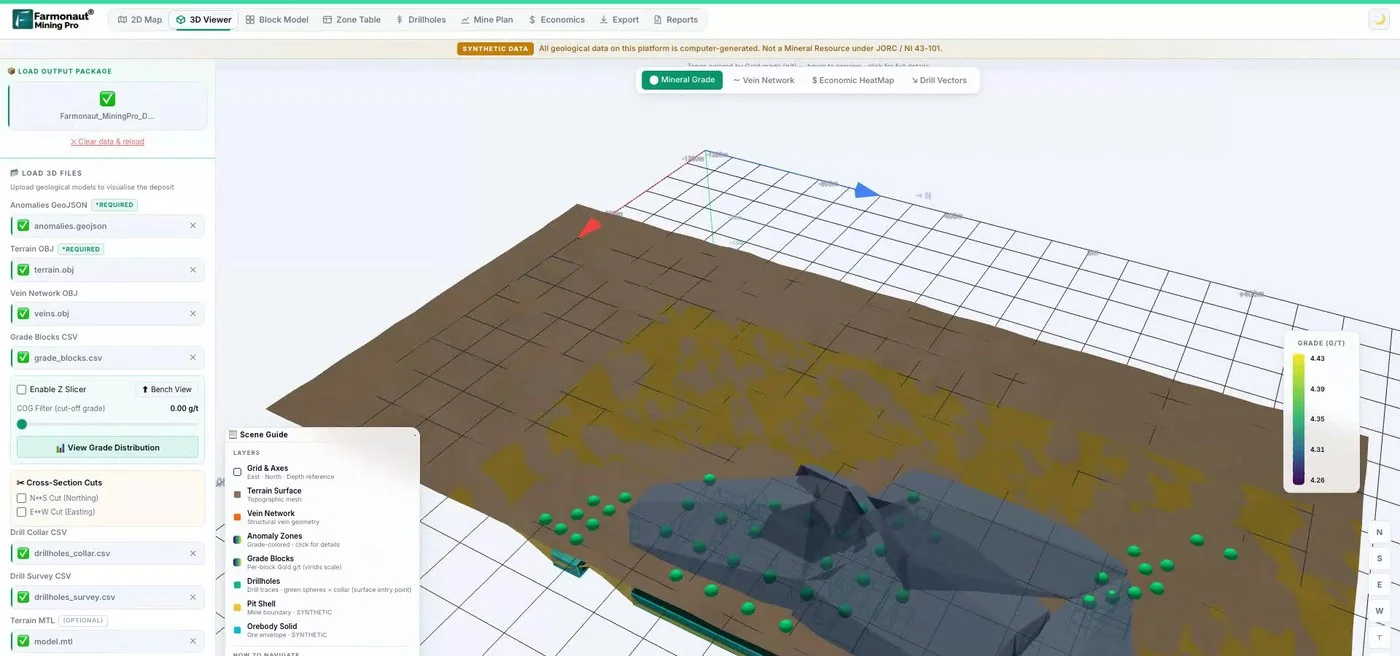
Mining Pro sample view, synthetic data
Sources
- World Nuclear Association, Geology of Uranium Deposits (updated 23 Oct 2026): world-nuclear.org
- World Nuclear Association, Supply of Uranium: world-nuclear.org
- World Nuclear Association, In-Situ Leach Mining of Uranium (updated 20 Jan 2026): world-nuclear.org
- World Nuclear Association, Uranium in Canada: world-nuclear.org
- Geoscience Australia, Radiometrics: ga.gov.au
- IAEA, Guidelines for radioelement mapping using gamma ray spectrometry data (IAEA-TECDOC-1363): www-pub.iaea.org
- Fitzpatrick (Cameco), Using downhole probing for real-time grade estimation, ASEG (2015): aseg.org.au
- Cameco, 2025 Annual Information Form: cameco.com
- USGS, Bulletin 1693, Descriptive model of sandstone U (Model 30c): pubs.usgs.gov
- USGS, Open-File Report 76-861, uranium-bearing sandstones: pubs.usgs.gov
- Shigeta, Geophysical surveys for unconformity-related uranium deposits, Shigen-Chishitsu (1997): jstage.jst.go.jp
- Canadian Nuclear Safety Commission, Uranium mines and mills: cnsc-ccsn.gc.ca
- Devine, University of Ottawa thesis on radiogenic elements above Millennium and McArthur River (2016): ruor.uottawa.ca
- Dudek and Hattori, University of Ottawa, radon at the Phoenix deposits (2015): cmic-footprints.laurentian.ca
- Denison Mines, Wheeler River Project: denisonmines.com
- Denison Mines, company home page (Q3 2026 results headline): denisonmines.com
- NexGen Energy, Rook I Project: nexgenenergy.ca
- Paladin Energy, Patterson Lake South: paladinenergy.com.au
- IsoEnergy, summer drilling at Larocque East (8 Sep 2026): isoenergy.ca
- American Nuclear Society, Newest Red Book notes the need for more U investment (15 Sep 2026): ans.org
- World Nuclear News, Red Book confident on uranium resources to meet future growth (14 Sep 2026): world-nuclear-news.org
- Cameco, Uranium Price (month-end averages of UxC and TradeTech): cameco.com
- Crux Investor, Record US$99 uranium contract price (3 Nov 2026): cruxinvestor.com
- Trading Economics, Uranium hovers near 9-month high (10 Nov 2026): tradingeconomics.com
- NRC, Agreement States: nrc.gov
- Federal Register, Establishment of the Baaj Nwaavjo I’tah Kukveni Ancestral Footprints of the Grand Canyon National Monument (15 Aug 2023): govinfo.gov
- Canadian Nuclear Safety Commission, Rook I project: cnsc-ccsn.gc.ca
Discussion
Questions, corrections or field experience? Share them below. First-time comments are reviewed before they appear, and your email is never published.
No comments yet. Be the first to add a question or your experience.

 Sahara Mining
 Sean Mining Limited
 NTS Group (Pty) Ltd
 Mine4Africa
 Lithspo Minerals Limited
 Tintina Mining Group
 Dalgety Minerals Pty Ltd
 Faith At Work (Pty) Ltd
 Geotech Mining Solutions plc
 Vulcan International Limited
 Kidepo Associates
 GKY Mining
 Alkimy SARL
 Double A Trading
 GemSprout Metals Limited
 Qader Group
 Ileys General Trading
 SG Gold Mining LLC
 VRV Global Pte Ltd
 Omsri International FZE
 G.I.T.T.
 Jaunita Erss Ltd
 SRK Consulting
 Berks Gold Limited

 Client · Tanzania · Gold










