

Pix4D Supported Drones: Boost Precision Agriculture in 2026
“By 2026, over 75% of precision agriculture projects are projected to incorporate Pix4D-supported drones for data collection.”
Table of Contents
- Introduction: The Evolution of Precision Agriculture
- The Future of Precision Agriculture: Pix4D Supported Drones in 2026
- How Pix4D Supported Drones Work
- Key Benefits of Pix4D Supported Drones in Agriculture
- Advancing Mapping, Crop Monitoring, & Actionable Insights
- Comparison Table of Pix4D Supported Drones for Precision Agriculture (2026)
- Revolutionizing Irrigation Planning and Water Resource Management
- Land Surveying, Field Mapping & Planning Made Efficient
- Technology Pipeline: AI, Machine Learning & IoT Integration
- Beyond Agriculture: Pix4D Drones in Mining, Forestry, and Infrastructure
- Satellite-Based Advances & Farmonaut’s Role in Data-Driven Agriculture
- Expert Callouts, Bullet Points & Visual Lists
- FAQs: Your Pix4D Drone & Precision Agriculture Questions Answered
- Conclusion: The Cornerstone of Modern Farming
Introduction: The Evolution of Precision Agriculture
The agricultural landscape is experiencing a radical transformation powered by modern technology, Pix4D supported drones, and advanced mapping solutions. Data-driven precision agriculture is now at the forefront, supplying farmers and managers with actionable insights at an unparalleled scale and accuracy. In 2026, the integration of drones and cutting-edge software like Pix4D is redefining how crops are monitored, resources managed, and long-term sustainability achieved in food production worldwide.
Why Is This Shift Critical?
- ✔ Global population growth increases food demand
- ✔ Climate variability creates new agricultural challenges
- ✔ Resource constraints require higher efficiency
- ✔ Sustainability standards drive innovation
- ✔ Data accuracy enables smarter, real-time decisions

The Future of Precision Agriculture: Pix4D Supported Drones in 2026
In 2026, Pix4D supported drones have revolutionized agriculture by pairing robust mapping and photogrammetry software with high-performance drones. The integration of multispectral sensors, RGB cameras, and real-time data processing tools now ensures unparalleled accuracy in field operations. As a result, the cornerstone of modern farming is built on data—collected, analyzed, and transformed into actionable insights faster than ever before.
Main Attributes of 2026 Pix4D Supported Drones:
- ✔ High-resolution RGB/multispectral imagery for detailed crop monitoring
- 📊 Advanced photogrammetry algorithms for precise mapping and modeling
- ✔ Real-time NDVI/vegetation indices for plant health and stress assessment
- ✔ Seamless software-hardware integration for efficient mission planning and resource management
- ⚠ Minimized response time—image acquisition and insight generation within minutes
Fast Fact
“Pix4D mapping software can generate detailed crop health maps from drone imagery 10 times faster than traditional manual field scouting.”
How This Transformation Impacts You:
With rising climate variability and stricter regulations, today’s farmers, managers, and business owners require more than intuition—they need accurate, real-time data delivered by solutions like Pix4D supported drones to optimize yields, conserve resources, and lead the path toward a sustainable agricultural future.

How Pix4D Supported Drones Work
At the core, Pix4D supported drones blend advanced drone hardware—equipped with multispectral, RGB, and sometimes thermal sensors—and the highly specialized Pix4D photogrammetry software. Here’s a step-by-step breakdown:
-
Aerial Data Capture:
Drones, equipped with high-resolution RGB and multispectral sensors, are deployed across vast agricultural fields. In minutes (not days or weeks), they capture aerial imagery and raw data spanning the entire crop lifecycle. -
Automated Flight & Mapping:
Drones fly predetermined routes using advanced waypoints and altitudes, ensuring full-field coverage and uniform data collection with geotagging accuracy. -
Advanced Data Processing:
Pix4D’s cloud-based software ingests this imagery using robust algorithms, stitching together thousands of images to generate:- Precise orthomosaic maps
- 3D surface models & digital terrain models
- Vegetation indices (NDVI, NDRE, GNDVI, etc.)
-
Insight Delivery:
Within hours—or in some setups, near real time—the software delivers actionable insights for immediate use. Detecting crop health, stress, moisture variability, and more becomes a streamlined task.
Common Mistake
Real-World Example Tasks Automated by Pix4D Drones:
- ✔ Early-season crop stress detection across 100+ hectares
- ✔ Timely disease and pest monitoring
- ✔ Rapid nutrient deficiency assessments
- ✔ Irrigation and resource-use mapping for water conservation
- ✔ Verification of land boundaries and field changes

Key Benefits of Pix4D Supported Drones in Agriculture
- ✔ Faster Data Acquisition: High-resolution imagery of entire fields within minutes
- ✔ Data-Driven Decisions: Actionable insights based on accurate crop and soil data
- ✔ Resource Optimization: Targeted interventions mean less waste, higher productivity, and cost savings
- 📊 Sustainability: Improved environmental and economic outcomes by reducing fertilizer, pesticide, and water use
- ✔ Compliance and Documentation: Geospatially accurate maps for record-keeping, traceability, and regulatory needs
Visual List: How Pix4D Drones Boost Crop Yields
- 🌱 NDVI Mapping — Tracks vegetation vigor and plant health continuously
- 🛰️ 3D Surface Modeling — Identifies topographic variations influencing irrigation
- ⚙️ Automated Flight Plans — Ensures full-field coverage with minimal manual effort
- 💧 Soil Moisture Assessment — Guides smart irrigation and water use
- 🔎 High-Resolution Crop Analysis — Detects micro-patterns invisible to the naked eye

Advancing Mapping, Crop Monitoring, & Actionable Insights with Pix4D Drones
Pix4D supported drones stand out as a cornerstone of modern farming because they enable rapid and accurate digital mapping, monitor crops continuously, and generate actionable insights specific to each field and crop type. By leveraging multispectral and RGB sensors, advanced algorithms, and real-time data transfer, the value to the agricultural sector has never been higher.
Orthomosaic maps—graphic representations of aerial drone data—bring a new level of detail for field mapping and resource management. These maps can accurately indicate:
- ✔ Zones of nutrient deficiency or pest infestation
- ✔ Surface waterlogging or drought-affected areas
- ✔ Changes in plant health and stress levels throughout the growing season
- ✔ Erosion or soil movement patterns for better land planning
Actionable Insights with Pix4D Mapping
- 📊 Normalized Difference Vegetation Index (NDVI): Identifies plant stress before it’s visible
- 🟢 Soil Reflectance Analysis: Highlights compaction and fertility variation
- 📈 Temporal Comparisons: Track field changes between seasons or years

Comparison Table of Pix4D Supported Drones for Precision Agriculture (2026)
Choosing the right Pix4D supported drone is critical for maximizing mapping accuracy, planning efficiency, and crop monitoring at scale. Below is a Pix4D drone comparison table for 2026 highlighting top models:
| Drone Model | Camera Resolution (MP) | Flight Time (minutes) | Mapping Accuracy (cm/pixel, est.) | Coverage Area per Flight (hectares) | Compatible Pix4D Version | Notable Agri-Tech Features |
|---|---|---|---|---|---|---|
| AgriFlyer X6 Pro | 48 (RGB) / Multispectral 10-band | 65 | 0.8 | 110 | Pix4Dfields, Pix4Dmapper | Multispectral, AI-assisted planning, thermal sensing |
| GreenVision H20 | 20 (RGB) / Multispectral 6-band | 55 | 1.2 | 63 | Pix4Dfields | 3D modeling, RTK GPS, terrain following |
| SkyAgri Mapper II | 42 (RGB) / Multispectral 8-band | 69 | 0.6 | 125 | Pix4Dreact, Pix4Dmapper | Thermal camera integration, live NDVI streaming |
| FieldEagle Ultra A | 24 (RGB), Multispectral 5-band | 75 | 1.0 | 140 | Pix4Dfields, Pix4Dengine | Surface/terrain modeling, automated deployment |
| AgroDrone Spectra4 | 32 (RGB) / Multispectral 12-band | 62 | 0.7 | 120 | Pix4Dfields, Pix4Dcloud | Advanced orthomosaic, AI health/stress analytics |
| TerraSurveyor G5 | 16 (RGB)/ Multispectral 6-band | 52 | 1.3 | 70 | Pix4Dfields | Topography mapping, environmental sensors |
*Pix4D drone comparison based on 2026 model estimates. Mapping accuracy and area depend on field conditions, altitude, and weather.
Revolutionizing Irrigation Planning and Water Resource Management
One of the most substantial benefits of Pix4D supported drones is the precision planning and execution of irrigation strategies. With climate variability making water a precious and critical resource, efficient irrigation is no longer a luxury—it’s a necessity.
- ✔ Moisture distribution mapping: Drones equipped with multispectral and soil moisture sensors deliver spatially detailed maps highlighting dry and over-irrigated zones.
- ✔ Topographic data: Helps managers devise gravity-fed or drip irrigation layouts tailored to actual field slopes.
- ✔ Savings: Targeted irrigation reduces water usage by up to 30-60% in arid regions.
- ✔ Yield boost: Crops receive optimal hydration zones, minimizing stress and maximizing productivity.
As land and water resources become increasingly stressed in many global agricultural regions, the case for data-driven irrigation management using drone mapping and Pix4D grows even stronger.

Visual List: Resource Management with Pix4D Drones
- 💧 Water Conservation: Pinpoint distribution, prevent wastage
- 🌱 Fertilizer Application: Apply only where deficiency detected
- 🌾 Pesticide Use: Minimized by mapping pest hot-spots
- ⏱️ Time Efficiency: Complete field surveys in hours, not weeks
- 🌍 Environmental Impact: Reduced input runoff and pollution
Land Surveying, Field Mapping & Planning Made Efficient
Modern field planning and land surveying are essential for large-scale agricultural management. Traditional methods are labor-intensive and prone to human error; however, Pix4D supported drones combined with photogrammetry enable:
- ✔ Re-mapping of boundaries and field conditions within hours
- ✔ Rapid assessment of erosion, land movement, and soil compaction
- ✔ Scalable integration with digital farm management systems (for compliance and operational planning)
- ✔ Accurate input for blockchain-based traceability of crop origin and production practices.
Learn about blockchain-based traceability here
Standardized digital records—generated by drones and Pix4D software—are now a fundamental business asset for compliance, crop insurance, and supply chain verification.
Explore crop loan and insurance solutions where satellite/digital verification ensures financial security.

Technology Pipeline: AI, Machine Learning & IoT Integration
By 2026, Pix4D supported drones are being further enhanced through the integration of AI, machine learning, and IoT devices. This convergence brings real-time analytics, autonomous mission planning, and predictive modeling to the heart of farming.
- ✔ AI-enabled detection: Instantly recognize patterns associated with disease outbreaks, water stress, or nutrient deficiency
- ✔ Machine learning: Predict yield, optimize planting schedules, and model pest spread risks using historic and live drone data
- ✔ IoT integration: Combine drone insights with on-ground soil sensors, weather stations, and automated systems for holistic management
- ✔ Automated drone fleets: Swarm missions minimize the need for manual deployment and data interpretation
The combination of Pix4D software pipelines with in-field smart devices is the next quantum leap, enabling a truly responsive and adaptive agricultural sector.
Beyond Agriculture: Pix4D Supported Drones in Mining, Forestry & Infrastructure
While agriculture is the primary domain for Pix4D supported drones, the same mapping, monitoring, and modeling principles are applied in forestry, mining, and infrastructure sectors.
- 🌳 Forestry: Biomass estimation, forest health monitoring, and tracking regeneration using multispectral data
- ⛏️ Mining: Volume calculations for extraction sites, monitoring environmental impacts, and ensuring carbon footprint monitoring
- 🏗️ Infrastructure: Mapping construction progress, assessing structural integrity, and supporting fleet/resource management
Digital mapping and 3D modeling reduce costs, enhance compliance, and drive sustainability across all these fields.
Satellite-Based Advances & Farmonaut’s Role in Data-Driven Agriculture
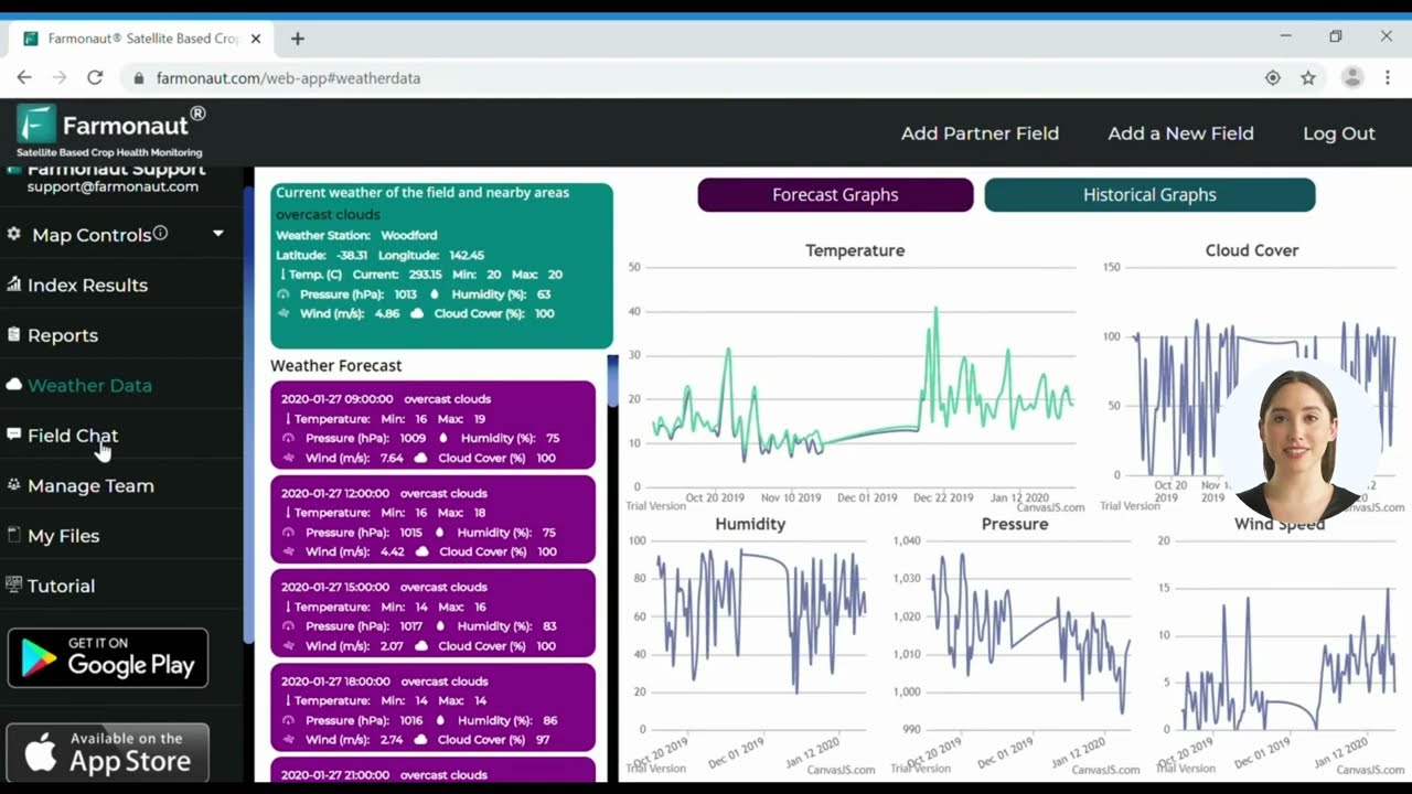
While Pix4D supported drones revolutionize field-level mapping and monitoring, satellite intelligence is essential for scaling these benefits to regional, national, and global levels. At Farmonaut, we offer a full suite of satellite-based solutions for agriculture, mining, and infrastructure management via web, mobile apps, and API. All our solutions are accessible, affordable, and scalable to users worldwide.
- ✔ Satellite Crop Monitoring: Real-time NDVI, soil health, and moisture analytics for better resource management and yield optimization
- ✔ AI Advisory (Jeevn AI): Automated agronomic insights, weather forecasts, and strategic recommendations based on live data
- ✔ Blockchain Traceability: Unmatched product provenance for supply chain trust and authenticity
- ✔ Fleet and Resource Management: Optimal vehicle use, logistics, and efficiency in mining/infrastructure projects.
Read about fleet management - ✔ Environmental Monitoring: Carbon footprint tracking and climate impact analysis for all major industries
Explore more about carbon footprinting
We support large-scale farm management with tools that empower managers to plan, monitor, and execute from anywhere.
Learn more on our large-scale farm management product page.



Want to build automation with real-time satellite data APIs? Check our API for integration: Farmonaut Satellite Monitoring API
API docs here.
Expert Callouts, Bullet Points & Visual Lists
- 📊 Actionable analytics guide effective resource management
- ✔ Field-to-fleet digitalization makes remote management a reality
- ⚠ Integration with farm management systems for seamless planning
- 🌍 Sustainable production meets global food security targets
- 🔄 Continuous evolution of drone and software tech ensures the future-readiness of the agricultural sector
FAQs: Your Pix4D Drone & Precision Agriculture Questions Answered
1. What are Pix4D supported drones?
Pix4D supported drones are UAVs (unmanned aerial vehicles) equipped to capture aerial imagery and data that is processed using Pix4D’s photogrammetry software. This pairing enables high-precision mapping, monitoring, and analysis of crops, soil, and field conditions.
2. How do Pix4D drones improve precision agriculture?
They dramatically increase data collection speed, accuracy, and insight delivery for farm management—enabling early crop stress detection, efficient fertilizer use, targeted irrigation, and higher yields, all while optimizing environmental impact.
3. Is Pix4D software compatible with all drones?
Most major professional drones designed for agriculture and mapping are compatible with Pix4D, provided they capture high-quality geotagged imagery. Always check software and hardware specifications to ensure compatibility.
4. Are drone and satellite data redundant?
No—drone data excels at high-resolution, field-specific analysis, while satellite data provides wide-area monitoring and trend tracking across larger scales. Combining both delivers the most robust management insights.
5. How can I integrate Farmonaut’s satellite solutions with my drone mapping efforts?
Our satellite data and real-time monitoring tools can be layered with drone-generated orthomosaics. This synergy enhances decision support, traceability, and resource optimization. Explore our app or APIs to learn how.
Conclusion: The Cornerstone of Modern Farming
As we move into 2026 and beyond, Pix4D supported drones have solidified their place as the cornerstone of modern, sustainable, and data-driven farming. Their ability to deliver precise, rapid, and actionable mapping, monitoring, and resource management insights will continue to address the demands of feeding a growing global population under increasing climate pressure.
Whether used alone or in conjunction with satellite-driven platforms like our own at Farmonaut, drones and Pix4D software empower managers to move from reactive responses to proactive planning—optimizing yields, conserving natural resources, and leading the global transition toward agricultural sustainability.
Get started with satellite-powered, AI-boosted agricultural solutions today—explore our platform and see how you can integrate next-generation tech into your own workflow.

 Godrej Agrovet
 Hayleys Agriculture
 Linx Agritech
 Adinet
 Save Your Soils
 GalaxEye Space
 Grandstream Algérie
 XOS Realty
 Geospatial Lab Africa
 Agro La Gándara
 HIPSAC
 ZOL Zimbabwe
 Juligerm
 AdBio
AdBio MISE Maroc
 NWNS
NWNS Red August Group
 Farm Inc
 WeMe Global
 Agrotoken
 Blue BearX
 Insignito
 DnCubed
 Indosistim Teknologi
 Liquify Digital
 CU Foods
 BeyondTech Global
 Rouge VC
 AgroRisk
 Oath Inc
 Esri North East Africa
 MDCV UK
 Etech Consulting Madagascar
 Vestlandsforsking
 WB Dev
 Sama Premium
 Tres Valles
 Blickwinkel
 Agricultural Credit Policy Council
 eKGIS
eKGIS Mostas Tech
 Andex
Andex Deluxe Conseil
 WICO
WICO Chimera Innovation
 SkyHarvest
 Teledarbas
 Exurbia Geospatial
 FieldZero
