

Farm drones · Buyer guide
LiDAR Spray Drones vs LiDAR Mapping Drones for Farms
LiDAR on a spray drone is a safety sensor; LiDAR on a mapping drone is a survey tool. Drone spray service averaged $13 per acre in the US in 2025 (ASDC), and Missouri Extension models about $12.27 per acre for a farm that owns one and sprays 1,000 acres a year.
Key takeaways
- The DJI Agras T100 lists a 100 L tank, a 5-13 m spray width and a laser radar (LiDAR) for obstacle sensing up to 60 m (DJI spec page).
- The Zenmuse L2 mapping LiDAR lists 4 cm vertical and 5 cm horizontal accuracy at 150 m with optimized processing (DJI spec page).
- US spray drones treated more than 16.4 million acres in 2025, and approved Part 137 drone operators rose to 1,710 (ASDC 2025 Impact Survey).
- Average US drone spray service fell from $21 to $13 per acre between 2024 and 2025 (ASDC); Missouri Extension models $12.27 per acre for an owner spraying 1,000 acres a year.
- Bestway Ag is a Kentucky-based sprayer company that distributes agricultural drones; it does not make its own drones.
In this article
- LiDAR spray drones vs LiDAR mapping drones at a glance
- How LiDAR works on a farm drone
- Best LiDAR drones for agriculture by job
- Bestway Ag drones: who Bestway Ag is and what it sells
- How we checked the numbers
- How fast LiDAR spray drones are spreading in the US
- What drone spraying costs per acre
- Should you own a spray drone or hire one?
- Rules for flying a LiDAR spray drone
- Where LiDAR spray drones help, and where they do not
- How LiDAR mapping helps farm businesses
- LiDAR drones and satellite monitoring together
- How to choose a LiDAR drone for your farm business
- FAQ
A LiDAR spray drone uses a laser scanner to see wires, poles, trees and the ground below it, so it can hold height and avoid obstacles while it sprays. A LiDAR mapping drone carries a survey-grade laser to build 3D models of fields, slopes and tree canopies. They solve different jobs, cost different amounts and fall under different rules, so a farm business should decide which job it needs before it picks a model.
This guide compares the two types with figures from the makers’ spec sheets, US extension economics and FAA rules. It explains where Bestway Ag fits as a US drone dealer, shows what spray drone service costs per acre, and gives a calculator to test whether owning a spray drone beats hiring one.
LiDAR spray drones vs LiDAR mapping drones at a glance
The word “LiDAR” covers two very different tools on farm drones. On a spray drone, LiDAR is part of the safety system. On a mapping drone, LiDAR is the payload you pay for.
| Feature | LiDAR spray drone | LiDAR mapping drone |
|---|---|---|
| Example model | DJI Agras T100 | DJI Matrice 350 RTK with Zenmuse L2 |
| What the LiDAR does | Sees obstacles and terrain for safe, low flight | Measures ground and canopy in 3D |
| Main output | Product applied to the crop | Point cloud, elevation model, canopy height |
| Payload | 100 L spray tank | 905 g LiDAR sensor |
| Max takeoff weight | 175 kg (spraying, 2 nozzles) | 9.2 kg |
| US rules | Part 107 plus Part 137 and an exemption | Part 107 |
| Who buys it | Applicators, large row-crop farms, retailers | Surveyors, drainage contractors, foresters, researchers |
Figures come from the DJI spec pages for the Agras T100, the Matrice 350 RTK and the Zenmuse L2, checked in October 2026. Rules come from the FAA and are explained below.
How LiDAR works on a farm drone
LiDAR stands for Light Detection and Ranging. The sensor sends out laser pulses and times how long each one takes to bounce back. Each return becomes a point with a position in 3D. Millions of points make a point cloud.
Because the sensor makes its own light, it does not depend on sunlight in the way a camera does. A pulse can also return more than once: part of it bounces off the top of a leaf, part off a lower branch, and part off the ground. That is why LiDAR can measure both canopy height and the bare ground under trees, which a normal photo cannot do.
Two points matter for buyers:
- Obstacle LiDAR on a spray drone is tuned to detect wires, poles and trees in time for the drone to brake or climb. It is not built to produce survey maps.
- Survey LiDAR on a mapping drone is tuned for accuracy and point density. It needs RTK positioning and processing software to turn raw points into maps.
Spray drones also use radar and cameras. LiDAR is one sensor in the safety stack, not the whole stack. Wind, dust and very thin wires remain hazards, so pilots still survey the field before each flight.
What LiDAR adds that cameras and satellites do not
Multispectral cameras and satellites measure how plants reflect light, which shows crop vigor. They do not measure height well. LiDAR measures shape and height. Use LiDAR when the question is about terrain, drainage, slope, tree height or canopy volume. Use multispectral imagery when the question is about plant health across the season.
Best LiDAR drones for agriculture by job
We do not rank drones by brand. We group them by job, because a spray drone and a mapping drone are not substitutes. Each entry lists what the maker states, and what that means on a farm.
1. DJI Agras T100: best for large-acre spraying with LiDAR obstacle sensing
Best for: custom applicators and large row-crop or orchard farms that spray many thousands of acres.
The spec page lists a 100 L spray tank, a 100 kg operating payload, a 5 to 13 m effective spray width and a maximum flow of 30 L/min with two nozzles or 40 L/min with four. Droplet size runs from 50 to 500 μm. Its safety system lists a “laser radar” (LiDAR) with a 272° vertical and 60° horizontal field of view, plus millimeter-wave radar and a quad vision system. The listed obstacle sensing range is up to 60 m. A 150 L spreading tank is also offered for granular products.
Watch for: a maximum takeoff weight of 175 kg when spraying, which puts it far above the 55 lb line in US rules. Plan for a generator or several batteries, a trailer and a trained crew. The spec page also lists an effective safe obstacle avoidance speed of up to 13.8 m/s; the sensors need time to react, so flying faster than that cuts the safety margin near trees, poles and wires.
2. DJI Matrice 350 RTK with Zenmuse L2: best for farm 3D mapping
Best for: drainage design, land leveling, tree and vine canopy surveys, and erosion checks.
The Matrice 350 RTK lists a flight time of up to 55 minutes without payload and a maximum takeoff weight of 9.2 kg. The Zenmuse L2 weighs about 905 g. DJI lists a ranging accuracy of 2 cm at 150 m, up to 5 returns, and up to 1.2 million points per second with multiple returns. Its system accuracy is listed as 5 cm horizontal and 4 cm vertical at 150 m when the point cloud is optimized in DJI Terra.
Watch for: flight time drops once the sensor is fitted, and accuracy depends on RTK, ground control and processing. Most farms hire a survey firm for this job rather than buy the kit.
3. Higher-end survey LiDAR from specialist makers: best for forestry and research
Best for: forestry plots, research trials and large estates where dense canopy needs many returns per pulse.
Specialist sensor makers such as RIEGL sell UAV laser scanners for this work. Prices are set by quote, so we do not list them. The old version of this page gave price ranges and coverage figures for several models that we could not match to any maker’s page, so we removed them.
4. Camera-only mapping drones: best for crop health scouting on a budget
Best for: farms that want plant-health maps rather than 3D terrain.
A drone with an RGB or multispectral camera is lighter and cheaper to run than a LiDAR drone. It suits scouting and stand counts. It cannot see the ground under a dense canopy. For whole-farm health maps every few days, satellite imagery is another option, discussed below.
Chart
Zenmuse L2 accuracy at 150 m
cm, system accuracy as stated by the maker, by processing setting
Bestway Ag drones: who Bestway Ag is and what it sells
People who search for “Bestway Ag drones” are usually looking for a dealer, not a drone brand. Bestway Ag is a US agricultural sprayer company and drone distributor based in Hopkinsville, Kentucky. Trade reports describe locations in Alabama, Mississippi, North Carolina and Kansas, and a model where it works with farm equipment dealers to sell and support agricultural drones. Kentucky Living describes it as a company known for agricultural sprayers that also distributes drones.
A 2023 Precision Farming Dealer report described how Birkey’s Farm Store, a Case IH dealer group in Illinois, became a drone dealer after Bestway approached it. Birkey’s staff took sales training at Bestway Ag.
What this means for a buyer:
- Bestway Ag does not make its own drone line. The old version of this page described a “Bestway Ag Drones Pro S1” model, which we could not find on any maker or dealer page, so we removed it.
- Ask any dealer, including Bestway, about parts stock, repair turnaround, battery supply and training before you buy. Downtime in the spray window costs more than the price gap between dealers.
- Product lines can change with US import rules. The American Spray Drone Coalition reported that import holds on DJI shipments limited supply in 2025, so check what a dealer can deliver for your season.
How we checked the numbers
We used maker spec pages for hardware figures, the FAA and Transport Canada for rules, and extension services and industry surveys for costs and adoption. Where a figure comes from an industry group rather than a government count, we say so. We did not use list prices from the old page, because we could not trace them to a dated source. Dealer prices change often, so ask for a written quote with the date on it.
How fast LiDAR spray drones are spreading in the US
Spray drone use has grown quickly. The American Spray Drone Coalition’s 2025 Impact Survey reported that US spray drones treated more than 16.4 million acres in 2025, up 58.7% on the year before. The same figures were presented to state pesticide regulators in an AAPCO presentation in March 2026, which also gave 3.7 million acres sprayed by drone in 2023, across 41 states and 50 crops.
Chart
US cropland sprayed by drone
Million acres per year, industry survey estimates
The survey says the growth came mainly from more operators, not more acres per operator. The FAA count of approved Part 137 drone operators rose 58.3% to 1,710, while acres per operator stayed flat at about 9,584 a year. The AAPCO slides note that the FAA reported 40 approved Part 137 waivers for ag drones in 2021.
Survey figures are self-reported by an industry group and are not a federal statistic. Federal data lag behind: a USDA Economic Research Service report on precision agriculture adoption tracks tools such as yield maps, soil maps and guidance, and found yield maps, soil maps and variable-rate technology on only 5 to 25 percent of US planted acres of winter wheat, cotton, sorghum and rice.
What drone spraying costs per acre
The price of hiring a drone applicator has fallen. The ASDC survey reported that the average US price per acre sprayed fell 38%, from $21 in 2024 to $13 in 2025, and linked the drop to more competition. These are average service prices reported by operators, not list prices.
For owning a drone, the University of Missouri Extension guide G1274 on the economics of spray drone ownership modeled a total cost of about $12.27 per acre for a farm owner spraying 1,000 acres a year and about $7.39 per acre for a custom operator spraying 4,000 acres a year, using a DJI Agras T40. It put break-even for owning at about 980 acres a year against a $16 custom rate. Coverage of the guide also gives about $8.32 per acre at 2,000 acres a year, and a typical custom hire rate of about $16 per acre. These are modeled estimates under the guide’s assumptions, not quotes.
Those three scenarios show the shape of the curve. Doubling acres from 1,000 to 2,000 cuts the modeled cost by about a third. Doubling again to 4,000 acres saves less, because running costs such as labor, fuel and chemicals handling do not shrink with scale. A farm sprays a set number of acres, so most farms sit near the left end of that curve. A custom operator who sells spraying to neighbors can reach the right end.
Supply also matters. The ASDC survey estimated that new spray drone sales fell about 59%, from about 8,950 units in 2024 to about 3,711 in 2025, after US Customs and Border Protection held DJI imports under the Uyghur Forced Labor Prevention Act. It said XAG and EAVision, both Chinese makers, gained most from the gap, and that the share of US-made drones rose from about 6% to about 24% of sales. Fewer new drones on the market can mean longer waits and firmer prices for buyers, even while service prices fall.
The biggest part of the owner’s cost is ownership itself: depreciation, interest and battery replacement. That is why the number of acres you spray each year decides whether owning pays.
Chart
Drone spraying cost per acre: survey prices vs modeled costs
US dollars per acre; survey averages and extension model estimates
Should you own a spray drone or hire one?
Hiring makes sense when you spray fewer than about 1,000 acres a year (Missouri Extension put break-even near 980 acres against a $16 custom rate), when your spray windows are short and you cannot spare a trained crew, or when you need a product applied that you do not want to handle yourself. Owning makes sense when you spray enough acres to spread the fixed cost and you have staff who can fly, mix and maintain safely.
Other points to weigh:
- Timing: in a wet spring, an owned drone can fly when a hired one is booked elsewhere.
- Labor: a spray drone needs a pilot and usually a second person to mix and swap batteries.
- Paperwork: owners carry the FAA certificates, records and pesticide licensing themselves.
- Resale: drone models and import rules change fast, so plan on a short life.
What do operators value when they buy? In the ASDC survey, operators rated productivity and efficiency the single most important buying factor, and features and software scored highest overall. Country of origin had little weight: 49% said they would not pay any premium for a US-made drone, and 41% would pay up to 25% more. The survey also found that 69% of Part 137 operators run a fleet of two drones or fewer.
Use the calculator below to test your own numbers. Its defaults are illustrative examples, not the Missouri guide’s assumptions, so the result will not match the guide’s figures exactly. This is not financial advice; get dealer quotes and talk to your lender or adviser before you buy.
Try the numbers for your own farm below.
Calculator
Does owning a spray drone beat hiring one?
Enter your own acres, costs and the custom rate you are quoted.
- Yearly ownership cost: $9,200
- Saving per acre from owning (negative = hiring is cheaper): $3
- Acres per year to break even: 767 acres
Example values only, not a benchmark, a quote or the Missouri guide’s assumptions. Change every field to your own quotes. Yearly ownership cost is the kit cost spread over its life plus interest on the average investment (half the kit cost). Running cost covers labor, maintenance, fuel and batteries per acre. Product cost is not included. Not financial advice.
Rules for flying a LiDAR spray drone
In the US, spraying from a drone is an agricultural aircraft operation. The FAA page on dispensing chemicals with drones says operators need an exemption, a Part 137 certificate and an air traffic authorization (COA), and must follow all relevant parts of 14 CFR. Basic steps include a Remote Pilot Certificate and registering the drone with the FAA. The FAA says it has found exemption holders operating outside their conditions and has started operational checks.
A LiDAR mapping drone that only collects data flies under the normal commercial drone rules (Part 107) in the US.
Buyers in the US should also watch equipment rules, not only flight rules. The ASDC survey noted that DJI has been added to the FCC covered list, and that the FCC has since added foreign-made drones and critical drone parts to that list. The coalition expects supply of new spray drones to stay tight in 2026 as a result. Before you buy, ask the dealer in writing which models it can deliver, how it will source spare parts and batteries, and how long it expects to support the model. Check the current FCC and customs position yourself, because it has changed several times.
In Canada, Transport Canada’s drone safety pages cover pilot certificates, registration, safety assurance declarations for advanced operations and special permission for operations outside the standard rules. In the UK, the EU, Australia and New Zealand, the national aviation authority sets its own rules for spraying from drones, and pesticide law sets who may apply which product.
Safety note: follow the product label and your local rules. Not every pesticide label allows aerial or drone application. Check with your state or provincial pesticide regulator and get professional advice before you start spraying.
Where LiDAR spray drones help, and where they do not
Drone spraying fits jobs where ground rigs struggle:
- wet fields where a sprayer would rut or get stuck;
- tall crops late in the season, such as corn fungicide passes;
- rice and flooded fields;
- steep slopes, terraces, orchards and vineyards;
- spot spraying of weed patches or field edges.
Spot spraying can save product. In an Iowa State University trial of precision spraying technology near Ames in 2024, targeted herbicide application covered on average 76% less field area, with a range of 43.9% to 90.6%. That trial tested ground-based precision spray technology, with drone imagery used to check weed pressure, so the result does not transfer directly to drones. The 415-acre soybean demonstration saved nearly $6,500 in herbicide, about $15.70 per acre. Savings were highest in fields where pre-emergence herbicides had held weeds back and lowest in a field with heavy weed pressure after a wet spring, so results depend on the field and the season.
Drones are less suited to very large, flat, dry fields where a ground sprayer can cover ground faster and at lower cost, and to windy days. Wind was the top concern of Iowa farmers in the 2025 Iowa Farm and Rural Life Poll, which found that about 22% of surveyed farmers had used a drone or hired a drone service.
How LiDAR mapping helps farm businesses
A LiDAR survey gives you a detailed elevation model. Farm businesses use it for:
- Drainage and tile design: finding low spots and flow paths before you lay tile or cut ditches.
- Land leveling: planning cut and fill for irrigated fields.
- Erosion checks: comparing surveys over time to see where soil moves.
- Orchards and vineyards: measuring tree height and canopy volume to plan pruning and spray volumes.
- Woodlots and shelterbelts: estimating tree height and biomass.
One survey often lasts years for terrain work, because the ground changes slowly. Crop health changes every week, which is where frequent imagery is more useful than repeat LiDAR flights. If you want a comparison of mapping software for the data these drones collect, see our separate guide on agricultural mapping software.
LiDAR drones and satellite monitoring together
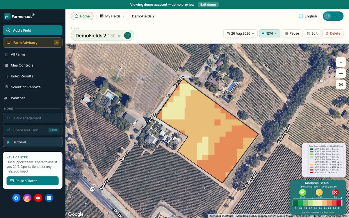
Drones and satellites answer different questions. A drone gives very fine detail over one field on the day you fly. Satellites cover every field on a fixed revisit schedule, with less detail. Many farm businesses use satellite crop-health maps to decide where to scout or spray, then send a drone to that block.
▶ How satellite NDVI maps show crop stress across a whole farm before you can see it from the ground. · 4:09
Farmonaut, a US-based company, provides satellite crop-health maps and an agriculture API that farm software and agtech teams can build into their own tools. It does not sell or make drones. Drone data and satellite layers can sit side by side in the same farm records.
Related pages on our site: farm analytics web app, mobile apps, large-scale farm management, API developer docs, fleet management, crop loan and insurance verification, product traceability and carbon footprinting.

▶ How radar satellites see fields through cloud, which helps when drone flights and optical images are not possible. · 2:37
How to choose a LiDAR drone for your farm business
- Name the job. Spraying, 3D mapping or crop scouting. Each needs a different drone.
- Count your acres. Use the calculator to see if owning a spray drone beats hiring at your scale.
- Check the rules. In the US, plan for Part 107, Part 137, an exemption and pesticide licensing before the drone arrives.
- Check the dealer. Ask about parts, repairs, batteries, training and delivery dates in writing.
- Plan the data. For mapping, decide who processes point clouds and which software you will use.
- Budget for the whole kit. Batteries, chargers or a generator, a trailer and insurance often cost as much as the drone.

▶ Six plain steps to start precision farming without buying expensive hardware first. · 4:18
FAQ
What is a LiDAR spray drone?
It is a spray drone that uses a laser scanner as part of its obstacle and terrain sensing. The DJI Agras T100 spec page, for example, lists a laser radar alongside millimeter-wave radar and cameras. The LiDAR helps the drone avoid wires and trees; it does not map the field for survey use.
Does Bestway Ag make its own drones?
No. Bestway Ag is a US distributor based in Hopkinsville, Kentucky, that sells and supports agricultural drones through its own sites and partner farm equipment dealers. Check with them for current models and stock.
How much does drone spraying cost per acre?
The American Spray Drone Coalition reported an average US service price of $13 per acre in 2025, down from $21 in 2024. The University of Missouri Extension modeled about $12.27 per acre for a farm that owns its drone and sprays 1,000 acres a year. Your price depends on crop, product, field size and region.
Do I need a license to spray with a drone in the US?
Yes. The FAA requires a Remote Pilot Certificate, drone registration, an exemption, a Part 137 certificate and an air traffic authorization for drone spraying. Pesticide licensing is set by your state. Follow the product label and get professional advice.
Is LiDAR better than a multispectral camera for crops?
They measure different things. LiDAR measures height and shape, which suits terrain, drainage and canopy volume. Multispectral cameras measure plant reflectance, which suits crop health. Many farms use both, or pair LiDAR terrain data with satellite crop-health maps.
Farmonaut agriculture API
Add satellite crop data to your drone workflow
Agtech teams can pull satellite crop-health layers into their own software through the Farmonaut agriculture API.



Keep reading
Sources
- DJI, Agras T100 specifications (checked October 2026): ag.dji.com
- DJI, Matrice 350 RTK specifications (checked October 2026): enterprise.dji.com
- DJI, Zenmuse L2 specifications (checked October 2026): enterprise.dji.com
- American Spray Drone Coalition, 2025 Impact Survey Results (January 2026): americanspraydronecoalition.com
- AAPCO, UAPASTF presentation on drone pesticide application (March 2026): aapco.org
- University of Missouri Extension, G1274 Economics of Drone Ownership for Agricultural Spray Applications: extension.missouri.edu
- FAA, Dispensing Chemicals and Agricultural Products (Part 137) with UAS: faa.gov
- FAA, How to Register Your Drone: faa.gov
- Transport Canada, Drone safety: tc.canada.ca
- USDA ERS, Precision Agriculture in the Digital Era: Recent Adoption on U.S. Farms: ers.usda.gov
- Iowa State University Extension, Precision Spraying Technology (August 2024): crops.extension.iastate.edu
- Iowa State University Extension Sociology, Iowa Farm and Rural Life Poll 2025 highlights: ext.soc.iastate.edu
- Farm Progress, Despite growth, Iowa farmers remain uncertain about drones (April 2026): farmprogress.com
- Precision Farming Dealer, Birkey’s drone dealership story (2023): precisionfarmingdealer.com
- Kentucky Living, Service and innovation drive Bestway Ag: kentuckyliving.com
Discussion
Questions, corrections or field experience? Share them below. First-time comments are reviewed before they appear, and your email is never published.
No comments yet. Be the first to add a question or your experience.

 Vizexec Transformation
 GalaxEye Space
 Sun Palm Australia
 Grandstream Algérie
 XOS Realty
 Geospatial Lab Africa
 Agro La Gándara
 HIPSAC
 ZOL Zimbabwe
 Juligerm
 AdBio
 MISE Maroc
 NWNS
 Red August Group
 Farm Inc
 WeMe Global
 Agrotoken
 Blue BearX
 Insignito
 DnCubed

 Licence holder · Niger · Gold
 Licence holder · Nigeria · Gold + lithium










